<< Text Pages >> Le Tombeau du General - Burial Chamber or Dolmen in France in Rhone:Isère (38)
Submitted by TheCaptain on Wednesday, 08 September 2010 Page Views: 1952
Neolithic and Bronze AgeSite Name: Le Tombeau du GeneralCountry: France
NOTE: This site is 16.243 km away from the location you searched for.
Département: Rhone:Isère (38) Type: Burial Chamber or Dolmen
Nearest Town: Lyon Nearest Village: Vernas
Latitude: 45.776000N Longitude: 5.281000E
Condition:
| 5 | Perfect |
| 4 | Almost Perfect |
| 3 | Reasonable but with some damage |
| 2 | Ruined but still recognisable as an ancient site |
| 1 | Pretty much destroyed, possibly visible as crop marks |
| 0 | No data. |
| -1 | Completely destroyed |
| 5 | Superb |
| 4 | Good |
| 3 | Ordinary |
| 2 | Not Good |
| 1 | Awful |
| 0 | No data. |
| 5 | Can be driven to, probably with disabled access |
| 4 | Short walk on a footpath |
| 3 | Requiring a bit more of a walk |
| 2 | A long walk |
| 1 | In the middle of nowhere, a nightmare to find |
| 0 | No data. |
| 5 | co-ordinates taken by GPS or official recorded co-ordinates |
| 4 | co-ordinates scaled from a detailed map |
| 3 | co-ordinates scaled from a bad map |
| 2 | co-ordinates of the nearest village |
| 1 | co-ordinates of the nearest town |
| 0 | no data |
Be the first person to rate this site - see the 'Contribute!' box in the right hand menu.
Internal Links:
External Links:
burial chamber in Rhone:Isère (38)
Le Tombeau du General is a burial chamber in the community of Vernas, Departement of Isère, Region of Rhône-Alps
You may be viewing yesterday's version of this page. To see the most up to date information please register for a free account.
Do not use the above information on other web sites or publications without permission of the contributor.
Nearby Images from Flickr
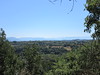
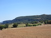
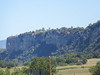
The above images may not be of the site on this page, but were taken nearby. They are loaded from Flickr so please click on them for image credits.
Click here to see more info for this site
Nearby sites
Click here to view sites on an interactive map of the areaKey: Red: member's photo, Blue: 3rd party photo, Yellow: other image, Green: no photo - please go there and take one, Grey: site destroyed
Download sites to:
KML (Google Earth)
GPX (GPS waypoints)
CSV (Garmin/Navman)
CSV (Excel)
To unlock full downloads you need to sign up as a Contributory Member. Otherwise downloads are limited to 50 sites.
Turn off the page maps and other distractions
Nearby sites listing. In the following links * = Image available
1.8km ENE 59° Pierre à Cupule de Chatelans Rock Art
2.5km NE 37° Camp de Larina* Ancient Village or Settlement
9.7km NNE 28° Grottes de la Balme* Cave or Rock Shelter
26.6km W 268° Montaberlet Menhir* Standing Stone (Menhir)
29.8km SSW 192° Ciste de Meyrieu-les-Étangs Burial Chamber or Dolmen
32.8km W 272° Monument des Droits de l'Homme* Modern Stone Circle etc
34.6km W 270° Gros Caillou (Lyon)* Natural Stone / Erratic / Other Natural Feature
35.4km NNE 15° Grotte de la Colombiere* Cave or Rock Shelter
35.8km W 267° Musée Gallo-Romain* Museum
35.8km W 267° Lugdunum* Ancient Village or Settlement
40.9km E 99° Pierre à Cupules de la Roche Rock Art
41.4km E 97° Blocs Cupulaires des Follioules Rock Art
42.4km E 97° Pierre à Cupules de Santourin Rock Art
48.0km SE 138° Dolmen dit la Pierre à Mata Burial Chamber or Dolmen
51.4km W 262° Dolmen dit la Roche aux Fées Burial Chamber or Dolmen
51.9km NNE 12° Pierrefiche Menhir* Standing Stone (Menhir)
52.9km W 265° Oppidum du Châtelar Ancient Village or Settlement
53.8km SE 132° Grottes des Echelles Cave or Rock Shelter
58.8km ESE 109° Mont Peney Rock Art
61.0km ESE 113° Grotte des Fées (Curienne) Cave or Rock Shelter
61.1km SSW 199° Palais idéal* Modern Stone Circle etc
61.9km WSW 254° Dolmen de Vaudragon Burial Chamber or Dolmen
62.7km E 83° Dolmen de Quintal* Burial Chamber or Dolmen
64.1km ESE 117° Chignin Menhir* Standing Stone (Menhir)
67.3km SSE 162° Grotte De La Ture Cave or Rock Shelter
View more nearby sites and additional images


 We would like to know more about this location. Please feel free to add a brief description and any relevant information in your own language.
 Wir möchten mehr über diese Stätte erfahren. Bitte zögern Sie nicht, eine kurze Beschreibung und relevante Informationen in Deutsch hinzuzufügen.
 Nous aimerions en savoir encore un peu sur les lieux. S'il vous plaît n'hesitez pas à ajouter une courte description et tous les renseignements pertinents dans votre propre langue.
 Quisieramos informarnos un poco más de las lugares. No dude en añadir una breve descripción y otros datos relevantes en su propio idioma.