<< Text Pages >> Modern Stonehenge on the beach at Popovka - Modern Stone Circle etc in Ukraine
Submitted by Aluta on Thursday, 16 January 2020 Page Views: 864
Modern SitesSite Name: Modern Stonehenge on the beach at Popovka Alternative Name: Kazantip StonehengeCountry: Ukraine
NOTE: This site is 47.162 km away from the location you searched for.
Type: Modern Stone Circle etc
Nearest Town: Popovka
Latitude: 45.295319N Longitude: 33.036858E
Condition:
| 5 | Perfect |
| 4 | Almost Perfect |
| 3 | Reasonable but with some damage |
| 2 | Ruined but still recognisable as an ancient site |
| 1 | Pretty much destroyed, possibly visible as crop marks |
| 0 | No data. |
| -1 | Completely destroyed |
| 5 | Superb |
| 4 | Good |
| 3 | Ordinary |
| 2 | Not Good |
| 1 | Awful |
| 0 | No data. |
| 5 | Can be driven to, probably with disabled access |
| 4 | Short walk on a footpath |
| 3 | Requiring a bit more of a walk |
| 2 | A long walk |
| 1 | In the middle of nowhere, a nightmare to find |
| 0 | No data. |
| 5 | co-ordinates taken by GPS or official recorded co-ordinates |
| 4 | co-ordinates scaled from a detailed map |
| 3 | co-ordinates scaled from a bad map |
| 2 | co-ordinates of the nearest village |
| 1 | co-ordinates of the nearest town |
| 0 | no data |
Internal Links:
External Links:
This is a large set of stone trilithons on a beach at Popovka on the Crimean peninsula. It may also have a short stretch of uprights with shared lintels. The area is used for raves and an exclusive electronica festival in the summer and this feature was presumably created for that experience.
I don't know much more about it.
The entry for this site on Clonehenge is here.
Here is one of a number of Instagram posts.
You may be viewing yesterday's version of this page. To see the most up to date information please register for a free account.
Do not use the above information on other web sites or publications without permission of the contributor.
Nearby Images from Flickr
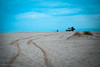
The above images may not be of the site on this page, but were taken nearby. They are loaded from Flickr so please click on them for image credits.
Click here to see more info for this site
Nearby sites
Click here to view sites on an interactive map of the areaKey: Red: member's photo, Blue: 3rd party photo, Yellow: other image, Green: no photo - please go there and take one, Grey: site destroyed
Download sites to:
KML (Google Earth)
GPX (GPS waypoints)
CSV (Garmin/Navman)
CSV (Excel)
To unlock full downloads you need to sign up as a Contributory Member. Otherwise downloads are limited to 50 sites.
Turn off the page maps and other distractions
Nearby sites listing. In the following links * = Image available
84.1km SSE 155° Chersonesus* Ancient Village or Settlement
91.3km SE 145° Dolmens Inkerman 2nd Cardon* Burial Chamber or Dolmen
94.3km SE 135° Megaliths in the Alima* Ancient Palace
94.3km SE 144° Eski Kermen* Promontory Fort / Cliff Castle
94.4km SE 144° Eski-Kermen* Promontory Fort / Cliff Castle
109.7km ESE 119° Dolmens Of Roman-Kosh* Burial Chamber or Dolmen
126.5km ESE 123° Cromlech Alushta* Stone Circle
127.0km SE 137° Dolmens Of Oreanda* Burial Chamber or Dolmen
131.7km ESE 108° Dolmens Of Krasnosyolovka* Burial Chamber or Dolmen
160.3km NNW 334° Kherson Cliffs* Natural Stone / Erratic / Other Natural Feature
177.9km NNW 331° Olbia Ancient Village or Settlement
206.1km NNE 31° Oguz Burial Mound Round Barrow(s)
212.7km NNE 29° Kozel Burial Mound Round Barrow(s)
228.8km NW 309° Kuyalnik Temple Ancient Temple
231.4km WNW 297° Tira (Ukraine) Ancient Village or Settlement
247.0km NNE 23° Znamenskoye Round Barrow(s)
249.8km NE 46° Melitopol Museum of Local History* Museum
255.9km NNE 21° Mamay-Hora* Round Barrow(s)
262.7km NE 45° Kamyana Mohyla Rock Cut Tomb
266.8km E 88° Pantikapaion* Ancient Village or Settlement
268.3km E 88° Kul-Oba* Round Barrow(s)
272.9km E 87° Tsarsky Kurgan* Chambered Cairn
277.3km NNE 17° Tolstaja Mogila Burial Mound Round Barrow(s)
286.2km NNE 19° Chertomlyk Kurgan Round Barrow(s)
315.6km N 8° Mohyla Baba* Round Barrow(s)
View more nearby sites and additional images


 We would like to know more about this location. Please feel free to add a brief description and any relevant information in your own language.
 Wir möchten mehr über diese Stätte erfahren. Bitte zögern Sie nicht, eine kurze Beschreibung und relevante Informationen in Deutsch hinzuzufügen.
 Nous aimerions en savoir encore un peu sur les lieux. S'il vous plaît n'hesitez pas à ajouter une courte description et tous les renseignements pertinents dans votre propre langue.
 Quisieramos informarnos un poco más de las lugares. No dude en añadir una breve descripción y otros datos relevantes en su propio idioma.