<< Text Pages >> Myrmekion - Ancient Village or Settlement in Ukraine
Submitted by Shwabb1 on Friday, 06 September 2024 Page Views: 1046
Multi-periodSite Name: Myrmekion Alternative Name: MyrmeciumCountry: Ukraine
NOTE: This site is 36.746 km away from the location you searched for.
Type: Ancient Village or Settlement
Nearest Town: Kerch
Latitude: 45.353442N Longitude: 36.522422E
Condition:
| 5 | Perfect |
| 4 | Almost Perfect |
| 3 | Reasonable but with some damage |
| 2 | Ruined but still recognisable as an ancient site |
| 1 | Pretty much destroyed, possibly visible as crop marks |
| 0 | No data. |
| -1 | Completely destroyed |
| 5 | Superb |
| 4 | Good |
| 3 | Ordinary |
| 2 | Not Good |
| 1 | Awful |
| 0 | No data. |
| 5 | Can be driven to, probably with disabled access |
| 4 | Short walk on a footpath |
| 3 | Requiring a bit more of a walk |
| 2 | A long walk |
| 1 | In the middle of nowhere, a nightmare to find |
| 0 | No data. |
| 5 | co-ordinates taken by GPS or official recorded co-ordinates |
| 4 | co-ordinates scaled from a detailed map |
| 3 | co-ordinates scaled from a bad map |
| 2 | co-ordinates of the nearest village |
| 1 | co-ordinates of the nearest town |
| 0 | no data |
Internal Links:
External Links:
Ancient Village or Settlement in Ukraine
Myrmekion was an ancient Greek settlement founded in 6th century BC near Pantikapaion. It was specialized in winemaking and minting coins. It was eventually abandoned during the Bosporan period as it lost significance.
Source: Wikipedia
You may be viewing yesterday's version of this page. To see the most up to date information please register for a free account.
Do not use the above information on other web sites or publications without permission of the contributor.
Nearby Images from Flickr
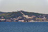
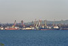
The above images may not be of the site on this page, but were taken nearby. They are loaded from Flickr so please click on them for image credits.
Click here to see more info for this site
Nearby sites
Click here to view sites on an interactive map of the areaKey: Red: member's photo, Blue: 3rd party photo, Yellow: other image, Green: no photo - please go there and take one, Grey: site destroyed
Download sites to:
KML (Google Earth)
GPX (GPS waypoints)
CSV (Garmin/Navman)
CSV (Excel)
To unlock full downloads you need to sign up as a Contributory Member. Otherwise downloads are limited to 50 sites.
Turn off the page maps and other distractions
Nearby sites listing. In the following links * = Image available
2.3km N 7° Tsarsky Kurgan* Chambered Cairn
4.6km WSW 249° Kul-Oba* Round Barrow(s)
6.0km WSW 256° Pantikapaion* Ancient Village or Settlement
12.4km SW 227° Tyritake Ancient Village or Settlement
15.4km SSW 212° Nymphaion Ancient Village or Settlement
41.3km SSW 214° Kimmerikon NOT SET
80.0km SE 129° Gorgippia* Ancient Village or Settlement
111.0km SE 127° Vasilyevka 1* Burial Chamber or Dolmen
111.5km SE 127° Vasilyevka 2* Burial Chamber or Dolmen
139.0km ESE 119° Shapsugskiy mogil'nik* Barrow Cemetery
140.2km ESE 119° Shapsugskiy Dolmen* Burial Chamber or Dolmen
140.5km ESE 119° Shapsuga Dolmen* Burial Chamber or Dolmen
141.9km ESE 119° Kazachiy Brod Dolmen* Burial Chamber or Dolmen
147.8km ESE 116° Erivanskaya Dolmen Burial Chamber or Dolmen
148.2km ESE 122° Dolmen river Mezyb* Burial Chamber or Dolmen
148.3km ESE 122° Dolmens Verbova gap* Burial Chamber or Dolmen
150.6km SE 125° Gelendzhik Local History Museum* Museum
152.4km ESE 119° Dolmen city of the river Abin* Burial Chamber or Dolmen
153.5km ESE 120° Kruchenaya Schel' Burial Chamber or Dolmen
155.7km SE 124° Mount Nexis Dolmens 2* Burial Chamber or Dolmen
155.7km SE 124° Mount Nexis Dolmens 1* Burial Chamber or Dolmen
155.7km WSW 253° Dolmens Of Krasnosyolovka* Burial Chamber or Dolmen
156.9km ESE 123° Shirokaya Schel Dolmen* Burial Chamber or Dolmen
157.2km N 8° Stone Babas on Tsentralna Street* Carving
157.6km ESE 123° Shirokaya Schel North East 1* Burial Chamber or Dolmen
View more nearby sites and additional images


 We would like to know more about this location. Please feel free to add a brief description and any relevant information in your own language.
 Wir möchten mehr über diese Stätte erfahren. Bitte zögern Sie nicht, eine kurze Beschreibung und relevante Informationen in Deutsch hinzuzufügen.
 Nous aimerions en savoir encore un peu sur les lieux. S'il vous plaît n'hesitez pas à ajouter une courte description et tous les renseignements pertinents dans votre propre langue.
 Quisieramos informarnos un poco más de las lugares. No dude en añadir una breve descripción y otros datos relevantes en su propio idioma.