<< Other Photo Pages >> Chivasso Menhir - Standing Stone (Menhir) in Italy in Piemonte
Submitted by davidmorgan on Tuesday, 26 August 2014 Page Views: 3263
Neolithic and Bronze AgeSite Name: Chivasso MenhirCountry: Italy
NOTE: This site is 30.759 km away from the location you searched for.
Region: Piemonte Type: Standing Stone (Menhir)
Nearest Town: Chivasso
Latitude: 45.189727N Longitude: 7.884999E
Condition:
| 5 | Perfect |
| 4 | Almost Perfect |
| 3 | Reasonable but with some damage |
| 2 | Ruined but still recognisable as an ancient site |
| 1 | Pretty much destroyed, possibly visible as crop marks |
| 0 | No data. |
| -1 | Completely destroyed |
| 5 | Superb |
| 4 | Good |
| 3 | Ordinary |
| 2 | Not Good |
| 1 | Awful |
| 0 | No data. |
| 5 | Can be driven to, probably with disabled access |
| 4 | Short walk on a footpath |
| 3 | Requiring a bit more of a walk |
| 2 | A long walk |
| 1 | In the middle of nowhere, a nightmare to find |
| 0 | No data. |
| 5 | co-ordinates taken by GPS or official recorded co-ordinates |
| 4 | co-ordinates scaled from a detailed map |
| 3 | co-ordinates scaled from a bad map |
| 2 | co-ordinates of the nearest village |
| 1 | co-ordinates of the nearest town |
| 0 | no data |
Internal Links:
External Links:
Standing Stone (Menhir) in Piemonte
A 4 metre tall Iron Age menhir now in a protective glass case in the Piazza della Repubblica, Chivasso.
You may be viewing yesterday's version of this page. To see the most up to date information please register for a free account.
Do not use the above information on other web sites or publications without permission of the contributor.
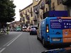
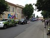
davidmorgan has found this location on Google Street View:
Nearby Images from Flickr


The above images may not be of the site on this page, but were taken nearby. They are loaded from Flickr so please click on them for image credits.
Click here to see more info for this site
Nearby sites
Click here to view sites on an interactive map of the areaKey: Red: member's photo, Blue: 3rd party photo, Yellow: other image, Green: no photo - please go there and take one, Grey: site destroyed
Download sites to:
KML (Google Earth)
GPX (GPS waypoints)
CSV (Garmin/Navman)
CSV (Excel)
To unlock full downloads you need to sign up as a Contributory Member. Otherwise downloads are limited to 50 sites.
Turn off the page maps and other distractions
Nearby sites listing. In the following links * = Image available
12.8km NNE 18° Mazzè Menhir* Standing Stone (Menhir)
20.7km SW 229° Museo Egizio* Museum
28.5km W 276° Dreamland* Modern Stone Circle etc
29.4km NE 34° Menhirs di Cavaglià* Stone Circle
29.5km NNW 344° Lugnacco Menhir* Standing Stone (Menhir)
37.2km NNW 343° The Path of the Souls Rock Art
41.1km WSW 243° Bosco de Celti* Henge
49.2km N 0° Plan de Sorcières* Rock Art
60.7km ESE 123° Pietra Guaritrice di Villa del Foro* Standing Stone (Menhir)
63.7km WSW 241° Rocio Clapier* Rock Art
68.1km WSW 241° Roccia del Mago* Rock Art
69.4km WNW 285° Les Peintures du Rocher du Château* Rock Art
70.8km W 265° Necropolis la Maddalena* Barrow Cemetery
70.8km W 265° Museo e Area Archeologica della Maddalena di Chiomonte Museum
71.9km NNW 329° Vollein Necropolis Barrow Cemetery
73.5km W 279° La Pierre des Saints Rock Art
74.0km W 278° Pierre Gravée (Crosats) Rock Art
74.6km NNE 32° Preja Batizà* Rock Art
76.0km NW 323° Saint Martin de Corleans Dolmen* Burial Chamber or Dolmen
76.2km W 278° Pierre Gravée (St Pierre) Rock Art
77.0km NNE 30° Masso coppellato Pella Rock Art
77.9km W 281° La Pierre aux Pieds Rock Art
77.9km W 281° Pierre à Cupules dite Le Rocher aux Pieds Rock Art
79.4km NE 40° Necropoli Golasecchiana di Motto Lagone Long Barrow
83.9km NE 46° Golasecca's Necropolis* Long Barrow
View more nearby sites and additional images

")
 We would like to know more about this location. Please feel free to add a brief description and any relevant information in your own language.
 Wir möchten mehr über diese Stätte erfahren. Bitte zögern Sie nicht, eine kurze Beschreibung und relevante Informationen in Deutsch hinzuzufügen.
 Nous aimerions en savoir encore un peu sur les lieux. S'il vous plaît n'hesitez pas à ajouter une courte description et tous les renseignements pertinents dans votre propre langue.
 Quisieramos informarnos un poco más de las lugares. No dude en añadir una breve descripción y otros datos relevantes en su propio idioma.