<< Other Photo Pages >> Cybele Temple - Ancient Temple in Bulgaria
Submitted by DrewParsons on Sunday, 23 May 2010 Page Views: 4689
Multi-periodSite Name: Cybele TempleCountry: Bulgaria
NOTE: This site is 16.947 km away from the location you searched for.
Type: Ancient Temple
Nearest Town: Balchik Nearest Village: Balchik
Latitude: 43.405753N Longitude: 28.167794E
Condition:
| 5 | Perfect |
| 4 | Almost Perfect |
| 3 | Reasonable but with some damage |
| 2 | Ruined but still recognisable as an ancient site |
| 1 | Pretty much destroyed, possibly visible as crop marks |
| 0 | No data. |
| -1 | Completely destroyed |
| 5 | Superb |
| 4 | Good |
| 3 | Ordinary |
| 2 | Not Good |
| 1 | Awful |
| 0 | No data. |
| 5 | Can be driven to, probably with disabled access |
| 4 | Short walk on a footpath |
| 3 | Requiring a bit more of a walk |
| 2 | A long walk |
| 1 | In the middle of nowhere, a nightmare to find |
| 0 | No data. |
| 5 | co-ordinates taken by GPS or official recorded co-ordinates |
| 4 | co-ordinates scaled from a detailed map |
| 3 | co-ordinates scaled from a bad map |
| 2 | co-ordinates of the nearest village |
| 1 | co-ordinates of the nearest town |
| 0 | no data |
Internal Links:
External Links:
Ancient temple to the Greek goddess Cybele in Balchek, Bulgaria.
The unique temple of the Greek goddess Cybele in Balchek, north eastern Bulgaria was uncovered by accident in April 2007 during the building of an hotel. The extremely rich temple dates back to the 4th century AD. It did suffer some damage thought to be either from the effects of an earthquake or perhaps by actions of barbarian invaders during the reign of Emperor Valens (364-378 AD), but is still relatively well preserved. A dispute regarding its status on the construction site looks as if it will be settled by it being declared a National Monument.
You may be viewing yesterday's version of this page. To see the most up to date information please register for a free account.
Do not use the above information on other web sites or publications without permission of the contributor.
davidmorgan has found this location on Google Street View:
Nearby Images from Flickr
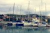

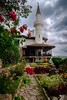

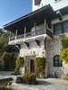
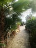
The above images may not be of the site on this page, but were taken nearby. They are loaded from Flickr so please click on them for image credits.
Click here to see more info for this site
Nearby sites
Click here to view sites on an interactive map of the areaKey: Red: member's photo, Blue: 3rd party photo, Yellow: other image, Green: no photo - please go there and take one, Grey: site destroyed
Download sites to:
KML (Google Earth)
GPX (GPS waypoints)
CSV (Garmin/Navman)
CSV (Excel)
To unlock full downloads you need to sign up as a Contributory Member. Otherwise downloads are limited to 50 sites.
Turn off the page maps and other distractions
Nearby sites listing. In the following links * = Image available
30.1km SW 223° Varna Museum of Archaeology Museum
42.3km WSW 242° Pobiti Kamani* Natural Stone / Erratic / Other Natural Feature
56.6km NE 36° Callatis Museum of Archaeology Museum
56.7km NE 36° Callatis* Ancient Village or Settlement
64.2km WSW 242° Solnitsata* Ancient Village or Settlement
77.5km NNW 347° Adamclisi Museum of Antiquities* Museum
79.3km NNW 348° Tropaeum Traiani* Sculptured Stone
83.8km W 269° Pliska Mound Artificial Mound
85.2km W 267° Pliska Menhirs* Standing Stones
90.5km SSW 204° Nesebar Necropolis* Burial Chamber or Dolmen
94.1km NNE 25° Constanta Museum of National History and Archaeology* Museum
119.0km WNW 289° Sveshtari Thracian Tomb* Chambered Cairn
121.1km N 357° Capidava* Ancient Village or Settlement
126.0km SSW 195° Beglik Tash* Natural Stone / Erratic / Other Natural Feature
126.6km SSW 196° Perla Dolmen 1* Burial Chamber or Dolmen
135.7km NNE 21° Histria Museum of History* Museum
135.9km NNE 21° Histria* Ancient Village or Settlement
138.2km NNE 20° Istria burial site* Barrow Cemetery
139.6km NNE 21° Fertility menhir* Standing Stone (Menhir)
139.8km S 191° Ancient Tsarevo Ancient Village or Settlement
153.0km SSW 209° Dolmen Ashlamata* Passage Grave
162.6km NNE 22° Argamum* Ancient Village or Settlement
164.9km SSW 211° The Big Stone Natural Stone / Erratic / Other Natural Feature
165.4km SSW 210° Dolmen Belevren 4* Burial Chamber or Dolmen
166.0km SSW 209° Dolmen Belevren 1* Burial Chamber or Dolmen
View more nearby sites and additional images


 We would like to know more about this location. Please feel free to add a brief description and any relevant information in your own language.
 Wir möchten mehr über diese Stätte erfahren. Bitte zögern Sie nicht, eine kurze Beschreibung und relevante Informationen in Deutsch hinzuzufügen.
 Nous aimerions en savoir encore un peu sur les lieux. S'il vous plaît n'hesitez pas à ajouter une courte description et tous les renseignements pertinents dans votre propre langue.
 Quisieramos informarnos un poco más de las lugares. No dude en añadir una breve descripción y otros datos relevantes en su propio idioma.