<< Our Photo Pages >> San Miguel de Arrechinaga - Natural Stone / Erratic / Other Natural Feature in Spain in Pais Vasco
Submitted by Sunny100 on Saturday, 08 January 2011 Page Views: 6642
Natural PlacesSite Name: San Miguel de Arrechinaga Alternative Name: Hermitage of St Michael the Archangel, ArretxinagaCountry: Spain Region: Pais Vasco Type: Natural Stone / Erratic / Other Natural Feature
Nearest Town: Bilbao Nearest Village: Markina-Xemein
Latitude: 43.271478N Longitude: 2.495099W
Condition:
| 5 | Perfect |
| 4 | Almost Perfect |
| 3 | Reasonable but with some damage |
| 2 | Ruined but still recognisable as an ancient site |
| 1 | Pretty much destroyed, possibly visible as crop marks |
| 0 | No data. |
| -1 | Completely destroyed |
| 5 | Superb |
| 4 | Good |
| 3 | Ordinary |
| 2 | Not Good |
| 1 | Awful |
| 0 | No data. |
| 5 | Can be driven to, probably with disabled access |
| 4 | Short walk on a footpath |
| 3 | Requiring a bit more of a walk |
| 2 | A long walk |
| 1 | In the middle of nowhere, a nightmare to find |
| 0 | No data. |
| 5 | co-ordinates taken by GPS or official recorded co-ordinates |
| 4 | co-ordinates scaled from a detailed map |
| 3 | co-ordinates scaled from a bad map |
| 2 | co-ordinates of the nearest village |
| 1 | co-ordinates of the nearest town |
| 0 | no data |
Internal Links:
External Links:
")
Two gigantic boulders with a third hidden behind support each other. They are said to be millions of years old (some say 40 million) which rules out them being part of a prehistoric burial site. They are probably natural boulders which may have been shaped at some point in the past and in the last century or two gained some sort of religious association, possibly with a hermit living here. A medieval chapel was built around the stones but that fell into ruin; then in the 18th century the present chapel was built over that, again surrounding the giant boulders.
In between the boulders stands a shrine dedicated to St Michael the Archangel and St Pollonia, a local saint. On the altar a figure of St Michael watches over the chapel. The chapel has an hexagonal floor. The roof is pyramid-shaped and made of unworked stone. In the middle the cupola comes together in the centre with a large radiating key-lock boss. The chapel entrance has an upper axis upon which stands a belltower.
According to local legend/folklore a man wishing to marry within the year must pass beneath the boulders three times. Another legend says that St Michael buried the devil beneath the three boulders - so in a way it is a burial site of sorts. Perhaps this is one of those cases where a prehistoric monument has been adapted to suit Christianity, but not completely push the pagan beliefs aside.
For more information and reference sources see the Journal of Antiquities entry for San Miguel de Arrechinaga, Markina-Xemein, Biscay, Northern Spain.
You may be viewing yesterday's version of this page. To see the most up to date information please register for a free account.
Do not use the above information on other web sites or publications without permission of the contributor.
Nearby Images from Flickr
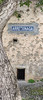
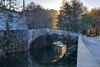
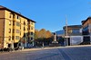

The above images may not be of the site on this page, but were taken nearby. They are loaded from Flickr so please click on them for image credits.
Click here to see more info for this site
Nearby sites
Click here to view sites on an interactive map of the areaKey: Red: member's photo, Blue: 3rd party photo, Yellow: other image, Green: no photo - please go there and take one, Grey: site destroyed
Download sites to:
KML (Google Earth)
GPX (GPS waypoints)
CSV (Garmin/Navman)
CSV (Excel)
To unlock full downloads you need to sign up as a Contributory Member. Otherwise downloads are limited to 50 sites.
Turn off the page maps and other distractions
Nearby sites listing. In the following links * = Image available
2.9km SSW 199° Baldako Tumulua Round Barrow(s)
3.4km SSW 206° Estrakinburu Barrutia Trikuharria Burial Chamber or Dolmen
5.0km SSE 156° Kalamua 1 Tumulua Round Barrow(s)
5.7km SE 140° Kanpaizulo Tumulua Round Barrow(s)
5.8km SSE 154° Diruzulo Trikuharria Burial Chamber or Dolmen
5.8km SSE 147° Olaburu Trikuharria Burial Chamber or Dolmen
5.9km SSE 151° Kalamua 2 Trikuharria Burial Chamber or Dolmen
8.7km SW 219° Zengotitagañe Trikuharria Burial Chamber or Dolmen
9.0km SW 223° Probazelaiburua 2 Tumulua Round Barrow(s)
9.1km SW 223° Probazelaiburua 1 Trikuharria Burial Chamber or Dolmen
9.3km SW 223° Iturzurigaña Trikuharria* Burial Chamber or Dolmen
10.1km N 354° Armintxe Cave Cave or Rock Shelter
10.6km NW 319° Munjozuri Tumulua Round Barrow(s)
10.6km SW 234° Amabirjinen Baso Tumulua Round Barrow(s)
10.7km SW 234° Amabirjinen Baso Trikuharria Burial Chamber or Dolmen
10.8km WSW 240° Ipinarrieta Tumulua Round Barrow(s)
12.5km SE 140° Gizaburua Tumulua* Round Barrow(s)
12.7km SE 139° Iruiya Trikuharria* Burial Chamber or Dolmen
13.0km SE 138° Sabua Tumulua Round Barrow(s)
13.3km SE 138° Atxolin Trikuharria* Burial Chamber or Dolmen
13.4km SE 138° Atxolin Txiki Tumulua* Round Barrow(s)
13.5km SE 138° Aizkoin Tumulua Round Barrow(s)
13.7km SE 138° Pagobedeinkatu Tumulua* Round Barrow(s)
14.0km SE 137° Naasiko Goena Tumulua* Round Barrow(s)
14.5km SE 137° Kutzebakaar Tumulua Round Barrow(s)
View more nearby sites and additional images


 We would like to know more about this location. Please feel free to add a brief description and any relevant information in your own language.
 Wir möchten mehr über diese Stätte erfahren. Bitte zögern Sie nicht, eine kurze Beschreibung und relevante Informationen in Deutsch hinzuzufügen.
 Nous aimerions en savoir encore un peu sur les lieux. S'il vous plaît n'hesitez pas à ajouter une courte description et tous les renseignements pertinents dans votre propre langue.
 Quisieramos informarnos un poco más de las lugares. No dude en añadir una breve descripción y otros datos relevantes en su propio idioma.