<< Text Pages >> Auntz-Etxea Dolmen - Burial Chamber or Dolmen in Spain in Navarra
Submitted by Klingon on Monday, 22 September 2008 Page Views: 1285
Neolithic and Bronze AgeSite Name: Auntz-Etxea DolmenCountry: Spain
NOTE: This site is 2.313 km away from the location you searched for.
Region: Navarra Type: Burial Chamber or Dolmen
Nearest Town: Baztan Nearest Village: Olazti
Latitude: 42.893002N Longitude: 2.196189W
Condition:
| 5 | Perfect |
| 4 | Almost Perfect |
| 3 | Reasonable but with some damage |
| 2 | Ruined but still recognisable as an ancient site |
| 1 | Pretty much destroyed, possibly visible as crop marks |
| 0 | No data. |
| -1 | Completely destroyed |
| 5 | Superb |
| 4 | Good |
| 3 | Ordinary |
| 2 | Not Good |
| 1 | Awful |
| 0 | No data. |
| 5 | Can be driven to, probably with disabled access |
| 4 | Short walk on a footpath |
| 3 | Requiring a bit more of a walk |
| 2 | A long walk |
| 1 | In the middle of nowhere, a nightmare to find |
| 0 | No data. |
| 5 | co-ordinates taken by GPS or official recorded co-ordinates |
| 4 | co-ordinates scaled from a detailed map |
| 3 | co-ordinates scaled from a bad map |
| 2 | co-ordinates of the nearest village |
| 1 | co-ordinates of the nearest town |
| 0 | no data |
Be the first person to rate this site - see the 'Contribute!' box in the right hand menu.
Internal Links:
External Links:
Burial Chamber (Dolmen) in Community of Seingaitz
Have you visited this site? Please add a comment below.
You may be viewing yesterday's version of this page. To see the most up to date information please register for a free account.
Do not use the above information on other web sites or publications without permission of the contributor.
Nearby Images from Flickr
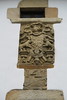
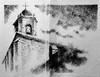

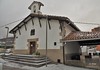

The above images may not be of the site on this page, but were taken nearby. They are loaded from Flickr so please click on them for image credits.
Click here to see more info for this site
Nearby sites
Click here to view sites on an interactive map of the areaKey: Red: member's photo, Blue: 3rd party photo, Yellow: other image, Green: no photo - please go there and take one, Grey: site destroyed
Download sites to:
KML (Google Earth)
GPX (GPS waypoints)
CSV (Garmin/Navman)
CSV (Excel)
To unlock full downloads you need to sign up as a Contributory Member. Otherwise downloads are limited to 50 sites.
Turn off the page maps and other distractions
Nearby sites listing. In the following links * = Image available
2.3km W 273° Saratxakolegi Dolmen* Burial Chamber or Dolmen
3.3km W 277° Ibirigain Dolmen* Burial Chamber or Dolmen
3.5km S 173° Morterutxo Campo Tumular Barrow Cemetery
3.5km SSE 157° Zelaiaundi Menhir Standing Stone (Menhir)
3.9km SSE 160° Sorosgain Dolmen* Burial Chamber or Dolmen
3.9km S 169° Gansoil Menhir Standing Stone (Menhir)
4.0km SSE 167° Ergibel Menhir Standing Stone (Menhir)
4.1km SSE 161° Juakosoro Túmulo* Round Barrow(s)
4.2km SSE 153° Gazbide Túmulo Round Barrow(s)
4.2km SSE 151° Morterutxo Túmulo Round Barrow(s)
4.3km SSE 153° Otsaportilloko Bidegurutzea Túmulo Round Barrow(s)
4.6km SE 137° Larrakarte Túmulo Round Barrow(s)
4.7km SE 141° Bentakeita Menhir Standing Stone (Menhir)
4.7km SSE 158° Guardetxeko Bidea Fondo Cabaña Ancient Village or Settlement
4.7km SSE 158° Guardetxeko Bidea Túmulo Round Barrow(s)
4.9km W 264° La Piedra Trikuharria Burial Chamber or Dolmen
5.0km SSE 155° Bioitza Campo Tumular Barrow Cemetery
5.1km NNE 22° Igartza Oeste Dolmen Burial Chamber or Dolmen
5.2km W 273° Aginaran Txulo Trikuharria Burial Chamber or Dolmen
5.2km W 263° Olano Zutarria Standing Stone (Menhir)
5.2km NNE 25° Igartza Este Túmulo Round Barrow(s)
5.4km NE 43° Intxuspe Dolmen 2 Burial Chamber or Dolmen
5.5km W 261° Olano Etxola Hondoa Ancient Village or Settlement
5.7km NE 43° Intxuspe Dolmen 1 Burial Chamber or Dolmen
5.7km NNE 29° Beotegiko Murkoa Dolmen Burial Chamber or Dolmen
View more nearby sites and additional images


 We would like to know more about this location. Please feel free to add a brief description and any relevant information in your own language.
 Wir möchten mehr über diese Stätte erfahren. Bitte zögern Sie nicht, eine kurze Beschreibung und relevante Informationen in Deutsch hinzuzufügen.
 Nous aimerions en savoir encore un peu sur les lieux. S'il vous plaît n'hesitez pas à ajouter une courte description et tous les renseignements pertinents dans votre propre langue.
 Quisieramos informarnos un poco más de las lugares. No dude en añadir una breve descripción y otros datos relevantes en su propio idioma.