<< Other Photo Pages >> Giant's Thumb and mound - Standing Stone (Menhir) in United States in New England
Submitted by Anonymous on Friday, 27 January 2017 Page Views: 5141
Neolithic and Bronze AgeSite Name: Giant's Thumb and mound Alternative Name: Hobbamock's Thumb, Raccoon's ThumbCountry: United States Region: New England Type: Standing Stone (Menhir)
Nearest Town: Salisbury, CT Nearest Village: Salisbury, CT
Latitude: 41.975700N Longitude: 73.3959W
Condition:
| 5 | Perfect |
| 4 | Almost Perfect |
| 3 | Reasonable but with some damage |
| 2 | Ruined but still recognisable as an ancient site |
| 1 | Pretty much destroyed, possibly visible as crop marks |
| 0 | No data. |
| -1 | Completely destroyed |
| 5 | Superb |
| 4 | Good |
| 3 | Ordinary |
| 2 | Not Good |
| 1 | Awful |
| 0 | No data. |
| 5 | Can be driven to, probably with disabled access |
| 4 | Short walk on a footpath |
| 3 | Requiring a bit more of a walk |
| 2 | A long walk |
| 1 | In the middle of nowhere, a nightmare to find |
| 0 | No data. |
| 5 | co-ordinates taken by GPS or official recorded co-ordinates |
| 4 | co-ordinates scaled from a detailed map |
| 3 | co-ordinates scaled from a bad map |
| 2 | co-ordinates of the nearest village |
| 1 | co-ordinates of the nearest town |
| 0 | no data |
Internal Links:
External Links:
")
On the Appalachian Trail just north of the town of Salisbury. Site is approx 2 miles southeast of entry right on the trail. The standing stone is appx 9-10 feet high and uncarved (a rude stone). A low mound, cut in half by the trail is 20-30 feet beyond in the same direction. No excavations have been carried out that I know of, but the AT is an ancient Native American throughway in northwestern CT, connecting what is now NY, MA and CT.
If you follow the trail a little to the right of the stone, the mound is visible between the trees with the trail cutting through the lower left quadrant (satellite view). This is also visible on the ground, perfectly round, obviously man made. I was surprised this earthen feature is never mentioned in any books or websites
Sent in by Tom Morganti
You may be viewing yesterday's version of this page. To see the most up to date information please register for a free account.
")
")
Do not use the above information on other web sites or publications without permission of the contributor.
Nearby Images from Flickr

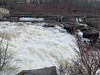
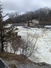
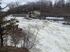
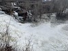
The above images may not be of the site on this page, but were taken nearby. They are loaded from Flickr so please click on them for image credits.
Click here to see more info for this site
Nearby sites
Click here to view sites on an interactive map of the areaKey: Red: member's photo, Blue: 3rd party photo, Yellow: other image, Green: no photo - please go there and take one, Grey: site destroyed
Download sites to:
KML (Google Earth)
GPX (GPS waypoints)
CSV (Garmin/Navman)
CSV (Excel)
To unlock full downloads you need to sign up as a Contributory Member. Otherwise downloads are limited to 50 sites.
Turn off the page maps and other distractions
Nearby sites listing. In the following links * = Image available
48.9km W 269° The King Stones Stone Circle
53.1km N 7° EarthGate Circle Modern Stone Circle etc
57.5km SSW 203° Ludingtonville stones* Modern Stone Circle etc
59.2km SSW 211° Stormville Structure* Modern Stone Circle etc
60.1km N 10° Balance Stone Lanesborough Natural Stone / Erratic / Other Natural Feature
63.7km SSW 210° Forest ct Stones* Modern Stone Circle etc
71.2km NE 42° Balanced rock Goshen* Natural Stone / Erratic / Other Natural Feature
72.7km SSW 192° North Salem Dolmen* Natural Stone / Erratic / Other Natural Feature
74.4km NE 56° Potential Grinding Stone at Northampton Site Polissoir
74.4km NE 56° Early Archaic Settlement Site on North King Street* Ancient Village or Settlement
83.2km SSE 152° Connecticut Seid* Natural Stone / Erratic / Other Natural Feature
90.6km NNE 32° Burnt Hill Heath* Stone Circle
96.5km E 101° Connecticut Archaeology Center* Museum
99.2km NE 46° Turner's Falls Standing Stones
103.3km SSW 201° Glacial Erratic, Rockefeller State Park Preserve* Natural Stone / Erratic / Other Natural Feature
115.3km NE 36° Humming Stone Guilford (Summstein) Modern Stone Circle etc
117.4km ESE 116° Montville Chamber* Souterrain (Fogou, Earth House)
120.7km NE 35° Brattleboro Petroglyphs Rock Art
127.5km ESE 119° Gungywamp* Standing Stones
131.7km ESE 116° Mashantucket Pit Houses Ancient Village or Settlement
132.1km ESE 117° Ledyard Stone Enclosures Cairn
136.9km ENE 64° Wachusett Stone* Natural Stone / Erratic / Other Natural Feature
140.6km SW 216° Tripod Rock* Natural Stone / Erratic / Other Natural Feature
141.2km SSW 200° Metropolitan Museum of Art* Museum
141.2km SSW 200° New York Cleopatra's Needle* Standing Stone (Menhir)
View more nearby sites and additional images


 We would like to know more about this location. Please feel free to add a brief description and any relevant information in your own language.
 Wir möchten mehr über diese Stätte erfahren. Bitte zögern Sie nicht, eine kurze Beschreibung und relevante Informationen in Deutsch hinzuzufügen.
 Nous aimerions en savoir encore un peu sur les lieux. S'il vous plaît n'hesitez pas à ajouter une courte description et tous les renseignements pertinents dans votre propre langue.
 Quisieramos informarnos un poco más de las lugares. No dude en añadir una breve descripción y otros datos relevantes en su propio idioma.