<< Other Photo Pages >> Briscoe Mounds - Artificial Mound in United States in Great Lakes Midwest
Submitted by AKFisher on Friday, 18 August 2023 Page Views: 506
Pre-ColumbianSite Name: Briscoe MoundsCountry: United States
NOTE: This site is 6.827 km away from the location you searched for.
Region: Great Lakes Midwest Type: Artificial Mound
Nearest Town: Channahon, IL
Latitude: 41.420260N Longitude: 88.22035W
Condition:
| 5 | Perfect |
| 4 | Almost Perfect |
| 3 | Reasonable but with some damage |
| 2 | Ruined but still recognisable as an ancient site |
| 1 | Pretty much destroyed, possibly visible as crop marks |
| 0 | No data. |
| -1 | Completely destroyed |
| 5 | Superb |
| 4 | Good |
| 3 | Ordinary |
| 2 | Not Good |
| 1 | Awful |
| 0 | No data. |
| 5 | Can be driven to, probably with disabled access |
| 4 | Short walk on a footpath |
| 3 | Requiring a bit more of a walk |
| 2 | A long walk |
| 1 | In the middle of nowhere, a nightmare to find |
| 0 | No data. |
| 5 | co-ordinates taken by GPS or official recorded co-ordinates |
| 4 | co-ordinates scaled from a detailed map |
| 3 | co-ordinates scaled from a bad map |
| 2 | co-ordinates of the nearest village |
| 1 | co-ordinates of the nearest town |
| 0 | no data |
Internal Links:
External Links:
")
The site takes its name from the Briscoe family, who owned the property until selling it to the state. Briscoe Mounds is now owned by the Illinois State Museum, who plan on building a visitor center in the future.
The two mounds on the site were built between 1200 and 1500 AD in the Mississippian Period. The first survey of the mounds was in 1938; a later survey in 1940 revealed nine distinctive pieces of pottery. The mounds were excavated in 1964, revealing sixteen bodies. The mounds were added to the National Register of Historic Places in 1978. Source: Wikipedia.
Further reading and information:
Wikipedia
IL DNR (via Wayback Machine)
Directions: From downtown Channahon, IL via S Canal St., 1 mi.
You may be viewing yesterday's version of this page. To see the most up to date information please register for a free account.
Do not use the above information on other web sites or publications without permission of the contributor.
Nearby Images from Flickr
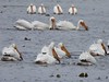
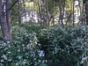
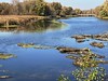

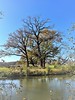
The above images may not be of the site on this page, but were taken nearby. They are loaded from Flickr so please click on them for image credits.
Click here to see more info for this site
Nearby sites
Click here to view sites on an interactive map of the areaKey: Red: member's photo, Blue: 3rd party photo, Yellow: other image, Green: no photo - please go there and take one, Grey: site destroyed
Download sites to:
KML (Google Earth)
GPX (GPS waypoints)
CSV (Garmin/Navman)
CSV (Excel)
To unlock full downloads you need to sign up as a Contributory Member. Otherwise downloads are limited to 50 sites.
Turn off the page maps and other distractions
Nearby sites listing. In the following links * = Image available
66.0km NE 51° University of Chicago Institute* Museum
70.5km NE 45° The Field Museum* Museum
119.2km NW 323° Beattie Park Mound Group* Misc. Earthwork
126.7km E 80° Goodall Site* Barrow Cemetery
126.8km WNW 290° Sinnissippi Mounds* Artificial Mound
137.8km NNW 331° Beloit College Mounds* Artificial Mound
140.3km SSE 163° Collins Site* Ancient Village or Settlement
148.5km NNE 13° Mound Cemetery (Racine) Barrow Cemetery
170.6km NNW 342° The Finch Site Ancient Village or Settlement
171.4km NNW 341° Lake Koshkonong Mounds* Artificial Mound
171.8km WNW 284° Albany Mounds* Barrow Cemetery
176.7km N 360° Cutler Mound Group* Artificial Mound
190.4km NNW 344° Aztalan State Park* Ancient Village or Settlement
198.5km SW 232° Rockwell* Artificial Mound
198.9km SW 234° Dickson Mounds* Barrow Cemetery
208.2km NNW 332° Forest Hill Cemetery* Artificial Mound
217.4km SW 214° Illinois State Museum* Museum
227.4km N 2° Lizard Mound State Park* Artificial Mound
228.3km NW 324° Circle Sanctuary Nature Preserve* Modern Stone Circle etc
229.4km NW 324° Brighid's Spring at Circle Sanctuary* Holy Well or Sacred Spring
231.6km N 350° Nitschke Mounds State Park Artificial Mound
233.3km WNW 302° Dunleith Mounds* Artificial Mound
238.3km W 264° Toolesboro Mound Group* Artificial Mound
239.0km SE 126° Castor Farm Ancient Village or Settlement
239.1km SE 126° Strawtown Enclosure* Ancient Village or Settlement
View more nearby sites and additional images


 We would like to know more about this location. Please feel free to add a brief description and any relevant information in your own language.
 Wir möchten mehr über diese Stätte erfahren. Bitte zögern Sie nicht, eine kurze Beschreibung und relevante Informationen in Deutsch hinzuzufügen.
 Nous aimerions en savoir encore un peu sur les lieux. S'il vous plaît n'hesitez pas à ajouter une courte description et tous les renseignements pertinents dans votre propre langue.
 Quisieramos informarnos un poco más de las lugares. No dude en añadir una breve descripción y otros datos relevantes en su propio idioma.