<< Our Photo Pages >> Amasya Museum - Museum in Turkey
Submitted by h_fenton on Saturday, 05 May 2012 Page Views: 3799
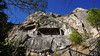
MuseumsSite Name: Amasya Museum Alternative Name: Archaeological Museum of AmasyaCountry: Turkey
NOTE: This site is 0.716 km away from the location you searched for.
Type: Museum
Nearest Town: Amasya
Latitude: 40.649500N Longitude: 35.824600E
Condition:
| 5 | Perfect |
| 4 | Almost Perfect |
| 3 | Reasonable but with some damage |
| 2 | Ruined but still recognisable as an ancient site |
| 1 | Pretty much destroyed, possibly visible as crop marks |
| 0 | No data. |
| -1 | Completely destroyed |
| 5 | Superb |
| 4 | Good |
| 3 | Ordinary |
| 2 | Not Good |
| 1 | Awful |
| 0 | No data. |
| 5 | Can be driven to, probably with disabled access |
| 4 | Short walk on a footpath |
| 3 | Requiring a bit more of a walk |
| 2 | A long walk |
| 1 | In the middle of nowhere, a nightmare to find |
| 0 | No data. |
| 5 | co-ordinates taken by GPS or official recorded co-ordinates |
| 4 | co-ordinates scaled from a detailed map |
| 3 | co-ordinates scaled from a bad map |
| 2 | co-ordinates of the nearest village |
| 1 | co-ordinates of the nearest town |
| 0 | no data |
Internal Links:
External Links:
I have visited· I would like to visit
DrewParsons would like to visit
")
Hall of Archaeological Artifacts, where items from 13 civilizations are on display.
Hall of Ethnographical Artifacts, Displays of regional handicrafts, culture and traditional farming.
The Museum Yard, Architectural stonework and sarcophagi.
Hall of Mummies (located inside the Sultan Mesud I Tomb) in the museum yard, mummified remains of people including babies from the Ilkhanate period 13th-14th Century AD
Amasya Museum
Atatürk Cad. AMASYA
Telephone: +90 0358 218 45 13
Open everyday except Mondays, from 08:00 to 17:00 (The Museum is closed from 12:00 to 13:00)
Official Web Site
You may be viewing yesterday's version of this page. To see the most up to date information please register for a free account.
Do not use the above information on other web sites or publications without permission of the contributor.
Nearby Images from Flickr
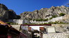
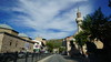
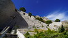
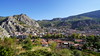

The above images may not be of the site on this page, but were taken nearby. They are loaded from Flickr so please click on them for image credits.
Click here to see more info for this site
Nearby sites
Click here to view sites on an interactive map of the areaKey: Red: member's photo, Blue: 3rd party photo, Yellow: other image, Green: no photo - please go there and take one, Grey: site destroyed
Download sites to:
KML (Google Earth)
GPX (GPS waypoints)
CSV (Garmin/Navman)
CSV (Excel)
To unlock full downloads you need to sign up as a Contributory Member. Otherwise downloads are limited to 50 sites.
Turn off the page maps and other distractions
Nearby sites listing. In the following links * = Image available
20.2km SW 235° Oluz Mound* Ancient Village or Settlement
56.0km S 185° Masat Hoyuk Ancient Village or Settlement
64.2km E 88° Horoztepe Ancient Village or Settlement
66.4km SW 229° Shapinuwa Ancient Village or Settlement
70.4km NNW 332° Oymaagac Mound Artificial Mound
74.7km W 261° Çorum Archaeological Museum Museum
81.7km NE 41° Tekkekoy Caves Cave or Rock Shelter
82.2km WSW 244° Pazarli Ancient Village or Settlement
85.4km SE 137° Bolus Ancient Village or Settlement
98.7km SW 233° Örükaya Roman Dam Ancient Mine, Quarry or other Industry
101.7km SSW 203° Karakiz* Carving
104.4km WSW 239° Eskiyapar Ancient Village or Settlement
105.7km WSW 244° Alacahöyük Hittite Dam* Misc. Earthwork
106.1km WSW 245° Alacahöyük* Ancient Village or Settlement
107.4km N 2° Ikiztepe Ancient Village or Settlement
113.8km SW 215° Usakli Mound* Ancient Village or Settlement
119.3km SSW 213° Kerkenes Ancient Village or Settlement
122.6km SW 236° Yazilikaya* Carving
122.7km SSW 208° Cadir Hoyuk* Ancient Village or Settlement
124.1km SW 236° Hattuşa* Ancient Village or Settlement
125.5km SSW 203° Alisar Hoyuk* Ancient Village or Settlement
126.2km SW 224° Yozgat Ethnographic Museum Museum
129.2km SSE 152° Kayalipinar Ancient Village or Settlement
133.9km SSW 197° Sarikaya Roman Bath* Ancient Village or Settlement
134.6km WSW 255° Boyali Hoyuk Ancient Village or Settlement
View more nearby sites and additional images


 We would like to know more about this location. Please feel free to add a brief description and any relevant information in your own language.
 Wir möchten mehr über diese Stätte erfahren. Bitte zögern Sie nicht, eine kurze Beschreibung und relevante Informationen in Deutsch hinzuzufügen.
 Nous aimerions en savoir encore un peu sur les lieux. S'il vous plaît n'hesitez pas à ajouter une courte description et tous les renseignements pertinents dans votre propre langue.
 Quisieramos informarnos un poco más de las lugares. No dude en añadir una breve descripción y otros datos relevantes en su propio idioma.