<< Other Photo Pages >> Pa Lungan - Standing Stone (Menhir) in Malaysia
Submitted by Runemage on Sunday, 02 March 2014 Page Views: 5027
Neolithic and Bronze AgeSite Name: Pa LunganCountry: Malaysia
NOTE: This site is 213.548 km away from the location you searched for.
Type: Standing Stone (Menhir)
Nearest Town: Sarawak
Latitude: 3.800000N Longitude: 115.533333E
Condition:
| 5 | Perfect |
| 4 | Almost Perfect |
| 3 | Reasonable but with some damage |
| 2 | Ruined but still recognisable as an ancient site |
| 1 | Pretty much destroyed, possibly visible as crop marks |
| 0 | No data. |
| -1 | Completely destroyed |
| 5 | Superb |
| 4 | Good |
| 3 | Ordinary |
| 2 | Not Good |
| 1 | Awful |
| 0 | No data. |
| 5 | Can be driven to, probably with disabled access |
| 4 | Short walk on a footpath |
| 3 | Requiring a bit more of a walk |
| 2 | A long walk |
| 1 | In the middle of nowhere, a nightmare to find |
| 0 | No data. |
| 5 | co-ordinates taken by GPS or official recorded co-ordinates |
| 4 | co-ordinates scaled from a detailed map |
| 3 | co-ordinates scaled from a bad map |
| 2 | co-ordinates of the nearest village |
| 1 | co-ordinates of the nearest town |
| 0 | no data |
Be the first person to rate this site - see the 'Contribute!' box in the right hand menu.
Internal Links:
External Links:
")
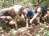
"The first megalith we came across, half way thru Pa'Lungan. Carvings hardly visible due to erosion." - info from Flickr
You may be viewing yesterday's version of this page. To see the most up to date information please register for a free account.
")
")
Do not use the above information on other web sites or publications without permission of the contributor.
Nearby Images from Flickr
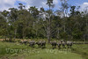
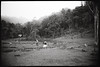
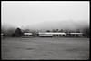
The above images may not be of the site on this page, but were taken nearby. They are loaded from Flickr so please click on them for image credits.
Click here to see more info for this site
Nearby sites
Click here to view sites on an interactive map of the areaKey: Red: member's photo, Blue: 3rd party photo, Yellow: other image, Green: no photo - please go there and take one, Grey: site destroyed
Download sites to:
KML (Google Earth)
GPX (GPS waypoints)
CSV (Garmin/Navman)
CSV (Excel)
To unlock full downloads you need to sign up as a Contributory Member. Otherwise downloads are limited to 50 sites.
Turn off the page maps and other distractions
Nearby sites listing. In the following links * = Image available
nankm 0° Batu Ritong* Burial Chamber or Dolmen
196.5km W 271° Niah Caves* Cave or Rock Shelter
323.7km SE 143° Cagar Budaya Ceruk Senen* Rock Art
375.8km SSE 165° Lubang Jeriji Saléh Cave* Rock Art
503.3km N 353° Pura Batur Gangsian* Natural Stone / Erratic / Other Natural Feature
798.5km SE 137° Situs Pekasele* Sculptured Stone
818.7km SE 140° Bada Valley Megaliths* Sculptured Stone
881.8km SSE 148° Pali Standing Stones* Standing Stones
892.2km SSE 147° Bori Kalimbuang* Stone Circle
892.3km SSE 147° Batu-Batu Standing Stones Standing Stones
898.7km SSE 147° Ke´te Kesu´ Standing Stones* Stone Circle
900.2km SSE 147° Londa Tana Toraja Rock Cut Tomb
1079.2km SSE 155° Leang Leang Rock Art
1085.1km SSE 156° Maros (Sulawesi) Rock Art
1230.1km NE 48° San Remigio Misc. Earthwork
1233.3km NW 307° Rach Nui* Artificial Mound
1319.1km NE 35° Limestone tombs of Kamhantik* Cist
1336.9km S 185° Museum Manusia Purba Gilimanuk* Museum
1344.7km NNE 27° Angono Petroglyphs* Rock Art
1353.7km S 180° Pura Besakih Ancient Temple
1359.4km S 181° Gunung Kawi* Ancient Temple
1361.3km SSW 201° Sukuh Temple Ancient Temple
1370.0km S 181° Goa Garba* Cave or Rock Shelter
1370.2km S 181° Archaelogical Museum Gedong Arca* Museum
1371.5km S 181° Yeh Pulu* Carving
View more nearby sites and additional images


 We would like to know more about this location. Please feel free to add a brief description and any relevant information in your own language.
 Wir möchten mehr über diese Stätte erfahren. Bitte zögern Sie nicht, eine kurze Beschreibung und relevante Informationen in Deutsch hinzuzufügen.
 Nous aimerions en savoir encore un peu sur les lieux. S'il vous plaît n'hesitez pas à ajouter une courte description et tous les renseignements pertinents dans votre propre langue.
 Quisieramos informarnos un poco más de las lugares. No dude en añadir una breve descripción y otros datos relevantes en su propio idioma.