<< Text Pages >> Pig Point - Ancient Village or Settlement in United States in Mid Atlantic
Submitted by bat400 on Sunday, 05 July 2009 Page Views: 25886
DigsSite Name: Pig PointCountry: United States
NOTE: This site is 37.11 km away from the location you searched for.
Region: Mid Atlantic Type: Ancient Village or Settlement
Nearest Town: Washington, DC Nearest Village: Upper Marlboro, MD
Latitude: 38.793300N Longitude: 76.704W
Condition:
| 5 | Perfect |
| 4 | Almost Perfect |
| 3 | Reasonable but with some damage |
| 2 | Ruined but still recognisable as an ancient site |
| 1 | Pretty much destroyed, possibly visible as crop marks |
| 0 | No data. |
| -1 | Completely destroyed |
| 5 | Superb |
| 4 | Good |
| 3 | Ordinary |
| 2 | Not Good |
| 1 | Awful |
| 0 | No data. |
| 5 | Can be driven to, probably with disabled access |
| 4 | Short walk on a footpath |
| 3 | Requiring a bit more of a walk |
| 2 | A long walk |
| 1 | In the middle of nowhere, a nightmare to find |
| 0 | No data. |
| 5 | co-ordinates taken by GPS or official recorded co-ordinates |
| 4 | co-ordinates scaled from a detailed map |
| 3 | co-ordinates scaled from a bad map |
| 2 | co-ordinates of the nearest village |
| 1 | co-ordinates of the nearest town |
| 0 | no data |
Be the first person to rate this site - see the 'Contribute!' box in the right hand menu.
Internal Links:
External Links:
Ancient Settlement Anne Arundel Co., Maryland.
An excavation and C14 dating shows a village site dating to 1290 to 1300 AD, although artifacts indicate at least periodic occupation over a much longer time period - thousands of years.
The outlines of multiple oval Algonquian-style wigwams dwellings have been found, along with numerous whole and worn tools, jewelry items, pottery, and food debris.
The excavation has been sponsored by the Maryland Historical Trust. See the attached comments for news stories.
Note: The site given is only approximate.
Note: “This casts all the things we discovered in the first three years in a completely different light. It is a hell of a mystery.” See attached news stories.
You may be viewing yesterday's version of this page. To see the most up to date information please register for a free account.
Do not use the above information on other web sites or publications without permission of the contributor.
Nearby Images from Flickr

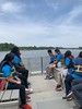


The above images may not be of the site on this page, but were taken nearby. They are loaded from Flickr so please click on them for image credits.
Click here to see more info for this site
Nearby sites
Click here to view sites on an interactive map of the areaKey: Red: member's photo, Blue: 3rd party photo, Yellow: other image, Green: no photo - please go there and take one, Grey: site destroyed
Download sites to:
KML (Google Earth)
GPX (GPS waypoints)
CSV (Garmin/Navman)
CSV (Excel)
To unlock full downloads you need to sign up as a Contributory Member. Otherwise downloads are limited to 50 sites.
Turn off the page maps and other distractions
Nearby sites listing. In the following links * = Image available
32.7km WNW 294° Embassy of Costa Rica, Washington DC Carving
33.0km ESE 109° Paw Paw Cove Natural Stone / Erratic / Other Natural Feature
69.0km W 278° Foamhenge (Cox Farms) Modern Stone Circle etc
106.7km WNW 289° Spout Run* Not Known (by us)
125.2km NNE 13° Safe Harbor Petroglyphs* Rock Art
136.1km W 274° Thunderbird Archaeological District* Ancient Mine, Quarry or other Industry
155.7km N 10° Bring Rocks Manheim* Modern Stone Circle etc
170.0km SW 226° Elk Hill Petroglyphs Rock Art
182.9km NE 45° Penn Museum* Museum
195.7km N 4° Boxcar Rocks* Natural Stone / Erratic / Other Natural Feature
204.7km SSW 197° Cactus Hill Ancient Village or Settlement
209.5km NNE 25° Oley Hills* Cairn
216.0km NE 38° Bucks County PA Sacred Ceremonial Stone Landscape* Standing Stones
216.8km NNE 28° Vera Cruz Quarry Pits* Ancient Mine, Quarry or other Industry
221.8km NNE 27° Museum of Indian Culture* Museum
238.4km NE 34° Ringing Rocks* Natural Stone / Erratic / Other Natural Feature
246.8km NNE 31° Lenape Nation Cultural Center and Trading Post Museum
248.2km NE 37° Quakertown Bedrock Mortar Museum
252.1km NNE 28° Jacobsburg Stone Skull* Rock Art
269.7km NNE 28° Columcille Megalith Park* Modern Stone Circle etc
277.7km NNE 25° Scotrun* Round Cairn
279.0km WSW 244° Foamhenge (Natural Bridge)* Modern Stone Circle etc
279.5km NE 34° Hackettstown Ceremonial Stone Landscape* Cairn
311.0km NE 39° Tripod Rock* Natural Stone / Erratic / Other Natural Feature
313.1km NE 46° National Museum of the American Indian* Museum
View more nearby sites and additional images


 We would like to know more about this location. Please feel free to add a brief description and any relevant information in your own language.
 Wir möchten mehr über diese Stätte erfahren. Bitte zögern Sie nicht, eine kurze Beschreibung und relevante Informationen in Deutsch hinzuzufügen.
 Nous aimerions en savoir encore un peu sur les lieux. S'il vous plaît n'hesitez pas à ajouter une courte description et tous les renseignements pertinents dans votre propre langue.
 Quisieramos informarnos un poco más de las lugares. No dude en añadir una breve descripción y otros datos relevantes en su propio idioma.