<< Text Pages >> La Guardia de Jaén Catacumbas - Ancient Village or Settlement in Spain in Andalucía
Submitted by holger_rix on Saturday, 05 December 2015 Page Views: 1057
Multi-periodSite Name: La Guardia de Jaén CatacumbasCountry: Spain
NOTE: This site is 9.116 km away from the location you searched for.
Region: Andalucía Type: Ancient Village or Settlement
Latitude: 37.743140N Longitude: 3.69544W
Condition:
| 5 | Perfect |
| 4 | Almost Perfect |
| 3 | Reasonable but with some damage |
| 2 | Ruined but still recognisable as an ancient site |
| 1 | Pretty much destroyed, possibly visible as crop marks |
| 0 | No data. |
| -1 | Completely destroyed |
| 5 | Superb |
| 4 | Good |
| 3 | Ordinary |
| 2 | Not Good |
| 1 | Awful |
| 0 | No data. |
| 5 | Can be driven to, probably with disabled access |
| 4 | Short walk on a footpath |
| 3 | Requiring a bit more of a walk |
| 2 | A long walk |
| 1 | In the middle of nowhere, a nightmare to find |
| 0 | No data. |
| 5 | co-ordinates taken by GPS or official recorded co-ordinates |
| 4 | co-ordinates scaled from a detailed map |
| 3 | co-ordinates scaled from a bad map |
| 2 | co-ordinates of the nearest village |
| 1 | co-ordinates of the nearest town |
| 0 | no data |
Be the first person to rate this site - see the 'Contribute!' box in the right hand menu.
Internal Links:
External Links:
Ancient Village or Settlement in Andalucía
You may be viewing yesterday's version of this page. To see the most up to date information please register for a free account.
Do not use the above information on other web sites or publications without permission of the contributor.
Nearby Images from Flickr
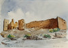
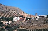


The above images may not be of the site on this page, but were taken nearby. They are loaded from Flickr so please click on them for image credits.
Click here to see more info for this site
Nearby sites
Click here to view sites on an interactive map of the areaKey: Red: member's photo, Blue: 3rd party photo, Yellow: other image, Green: no photo - please go there and take one, Grey: site destroyed
Download sites to:
KML (Google Earth)
GPX (GPS waypoints)
CSV (Garmin/Navman)
CSV (Excel)
To unlock full downloads you need to sign up as a Contributory Member. Otherwise downloads are limited to 50 sites.
Turn off the page maps and other distractions
Nearby sites listing. In the following links * = Image available
8.5km SW 227° Dólmen del Collado de los Bastianes* Burial Chamber or Dolmen
22.0km ENE 63° La Cueva de la Graja* Rock Art
27.4km N 6° Conjunto Arqueológico de Cástulo* Ancient Village or Settlement
42.3km S 190° Necrópolis Mozarabe Rock Cut Tomb
42.4km S 190° Dólmen Pileta de la Zorra Burial Chamber or Dolmen
45.7km WNW 291° Cerrillo Blanco Ancient Village or Settlement
45.7km WNW 288° San Benito de Porcuna Ancient Village or Settlement
46.4km SE 138° Dolmen de la Pandera de la Serrezuela* Burial Chamber or Dolmen
49.3km ENE 70° Cámara Sepulcral Ibérica de Toya* Ancient Village or Settlement
50.2km SE 127° Dólmen del Espartal 13* Burial Chamber or Dolmen
50.2km SE 127° Dólmen del Espartal 9* Burial Chamber or Dolmen
50.2km SE 127° Dólmen del Espartal 10* Burial Chamber or Dolmen
50.2km SE 127° Dólmen del Espartal 11* Burial Chamber or Dolmen
50.3km SE 127° Dólmen del Espartal 12* Burial Chamber or Dolmen
50.3km SE 128° Dólmen del Espartal 8* Burial Chamber or Dolmen
50.3km SE 127° Dólmen del Espartal 3* Burial Chamber or Dolmen
50.3km SE 127° Dólmen del Espartal 7* Burial Chamber or Dolmen
50.3km SE 127° Dólmen del Espartal 2* Burial Chamber or Dolmen
50.3km SE 127° Dólmen del Espartal 1* Burial Chamber or Dolmen
50.3km SE 127° Dólmen del Espartal 6* Burial Chamber or Dolmen
50.3km SE 127° Dólmen del Espartal 4* Burial Chamber or Dolmen
50.3km SE 127° Dólmen del Espartal 5* Burial Chamber or Dolmen
50.8km SSW 207° Peña de los Gitanos* Burial Chamber or Dolmen
51.9km SSW 209° Necrópolis de El Castellón* Barrow Cemetery
52.8km ESE 119° Dolmen del Cortijo de Olivares* Burial Chamber or Dolmen
View more nearby sites and additional images


 We would like to know more about this location. Please feel free to add a brief description and any relevant information in your own language.
 Wir möchten mehr über diese Stätte erfahren. Bitte zögern Sie nicht, eine kurze Beschreibung und relevante Informationen in Deutsch hinzuzufügen.
 Nous aimerions en savoir encore un peu sur les lieux. S'il vous plaît n'hesitez pas à ajouter une courte description et tous les renseignements pertinents dans votre propre langue.
 Quisieramos informarnos un poco más de las lugares. No dude en añadir una breve descripción y otros datos relevantes en su propio idioma.