<< Other Photo Pages >> Adana Archaeological Museum - Museum in Turkey
Submitted by AlexHunger on Wednesday, 28 March 2007 Page Views: 3754
MuseumsSite Name: Adana Archaeological MuseumCountry: Turkey
NOTE: This site is 1.838 km away from the location you searched for.
Type: Museum
Nearest Town: Adana Nearest Village: Tarsus
Latitude: 36.995458N Longitude: 35.313344E
Condition:
| 5 | Perfect |
| 4 | Almost Perfect |
| 3 | Reasonable but with some damage |
| 2 | Ruined but still recognisable as an ancient site |
| 1 | Pretty much destroyed, possibly visible as crop marks |
| 0 | No data. |
| -1 | Completely destroyed |
| 5 | Superb |
| 4 | Good |
| 3 | Ordinary |
| 2 | Not Good |
| 1 | Awful |
| 0 | No data. |
| 5 | Can be driven to, probably with disabled access |
| 4 | Short walk on a footpath |
| 3 | Requiring a bit more of a walk |
| 2 | A long walk |
| 1 | In the middle of nowhere, a nightmare to find |
| 0 | No data. |
| 5 | co-ordinates taken by GPS or official recorded co-ordinates |
| 4 | co-ordinates scaled from a detailed map |
| 3 | co-ordinates scaled from a bad map |
| 2 | co-ordinates of the nearest village |
| 1 | co-ordinates of the nearest town |
| 0 | no data |
Internal Links:
External Links:
")
Exhibits of local Hittite and prehistoric artifacts.
You may be viewing yesterday's version of this page. To see the most up to date information please register for a free account.
Do not use the above information on other web sites or publications without permission of the contributor.
Nearby Images from Flickr

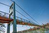
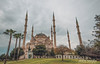
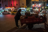

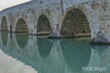
The above images may not be of the site on this page, but were taken nearby. They are loaded from Flickr so please click on them for image credits.
Click here to see more info for this site
Nearby sites
Click here to view sites on an interactive map of the areaKey: Red: member's photo, Blue: 3rd party photo, Yellow: other image, Green: no photo - please go there and take one, Grey: site destroyed
Download sites to:
KML (Google Earth)
GPX (GPS waypoints)
CSV (Garmin/Navman)
CSV (Excel)
To unlock full downloads you need to sign up as a Contributory Member. Otherwise downloads are limited to 50 sites.
Turn off the page maps and other distractions
Nearby sites listing. In the following links * = Image available
15.4km W 263° Zeytinli Hoyuk Ancient Village or Settlement
27.9km E 99° Mopsuestia* Ancient Village or Settlement
36.9km W 279° Kurbanli Roman Road* Ancient Trackway
38.4km E 88° King Muwatalli Relief Rock Art
48.9km ESE 120° Aegeae Ancient Village or Settlement
50.1km S 176° Magarsus Ancient Village or Settlement
59.4km ENE 61° Anazarbus Ancient Village or Settlement
66.7km WSW 251° Yümük Tepe Ancient Village or Settlement
71.7km E 92° Issus (Cilicia) Ancient Village or Settlement
74.4km WSW 248° Pompeiopolis* Ancient Village or Settlement
76.5km NE 41° Uzunoglantepe Relief Sculptured Stone
80.0km ENE 75° Castabala Ancient Village or Settlement
89.8km ENE 68° Karatepe Ancient Village or Settlement
97.2km NNW 338° Kestel Ancient Mine, Quarry or other Industry
111.1km WNW 295° Ivriz Relief* Carving
111.6km SSE 151° Seleukeia Temple of Zeus Ancient Temple
113.1km NW 325° Tyana (Kemerhisar)* Ancient Village or Settlement
113.2km NNW 327° Kösk Höyük* Ancient Village or Settlement
116.0km SE 138° Antakya Museum Museum
116.4km WSW 241° Elaiussa Sebaste* Ancient Village or Settlement
116.8km SE 139° Antioch on the Orontes Ancient Village or Settlement
121.0km SSE 150° Al Mina Ancient Village or Settlement
121.4km NW 308° Eregli Kara Hoyuk Ancient Village or Settlement
121.7km NNW 333° Nahita Ancient Village or Settlement
121.8km E 84° Sam'al* Ancient Village or Settlement
View more nearby sites and additional images


 We would like to know more about this location. Please feel free to add a brief description and any relevant information in your own language.
 Wir möchten mehr über diese Stätte erfahren. Bitte zögern Sie nicht, eine kurze Beschreibung und relevante Informationen in Deutsch hinzuzufügen.
 Nous aimerions en savoir encore un peu sur les lieux. S'il vous plaît n'hesitez pas à ajouter une courte description et tous les renseignements pertinents dans votre propre langue.
 Quisieramos informarnos un poco más de las lugares. No dude en añadir una breve descripción y otros datos relevantes en su propio idioma.