<< Text Pages >> Arastu Tepe - Ancient Village or Settlement in Iran
Submitted by coldrum on Monday, 24 October 2011 Page Views: 7402
Multi-periodSite Name: Arastu TepeCountry: Iran
NOTE: This site is 19.667 km away from the location you searched for.
Type: Ancient Village or Settlement
Nearest Town: Malard Nearest Village: Malard
Latitude: 35.670000N Longitude: 50.990000E
Condition:
| 5 | Perfect |
| 4 | Almost Perfect |
| 3 | Reasonable but with some damage |
| 2 | Ruined but still recognisable as an ancient site |
| 1 | Pretty much destroyed, possibly visible as crop marks |
| 0 | No data. |
| -1 | Completely destroyed |
| 5 | Superb |
| 4 | Good |
| 3 | Ordinary |
| 2 | Not Good |
| 1 | Awful |
| 0 | No data. |
| 5 | Can be driven to, probably with disabled access |
| 4 | Short walk on a footpath |
| 3 | Requiring a bit more of a walk |
| 2 | A long walk |
| 1 | In the middle of nowhere, a nightmare to find |
| 0 | No data. |
| 5 | co-ordinates taken by GPS or official recorded co-ordinates |
| 4 | co-ordinates scaled from a detailed map |
| 3 | co-ordinates scaled from a bad map |
| 2 | co-ordinates of the nearest village |
| 1 | co-ordinates of the nearest town |
| 0 | no data |
Be the first person to rate this site - see the 'Contribute!' box in the right hand menu.
Internal Links:
External Links:
Ancient Village or Settlement in Iran
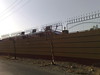
Archaeologists excavating Arastu Tepe for signs of Kura-Aras culture
A team of Archaeologists is currently working on the Arastu Tepe in order to find signs of the Kura-Aras culture in the mound located near the town of Malard in the southwest of Tehran.
Signs of the Kura-Aras culture were previously discovered during a series of initial excavations done by the team led by Akbar Purfaraj of Tehran’s Allameh Tabatabai University.
They gathered a large number of shards scattered on the ground of the mound in the excavations, Tehran Cultural Heritage, Tourism and Handicrafts Department Director told the Persian service of the Mehr News Agency on Tuesday.
Various motifs are seen on the shards, which are mostly red in color.
Purfaraj said that this season of excavation runs until late September and the second term is expected to begin next year.
The Kura-Aras culture includes a complex of civilizations, which is delimited by the Greater Caucasus from the north, Lesser Caucasus from the west and the Talysh Mountains from the south.
Signs of the Kura-Aras culture were discovered at the Yanik Tepe, a multi-period site located northwest of Lake Urmia in Iran, which was extensively excavated by Charles Burney in 1960s.
The earliest layers date back to the late 7th millennium BC.
According to the concise Oxford Dictionary of Archaeology by Timothy Darvill, these represent some of the earliest permanent settlements in the region.
Nine phases were represented, characterized by rectangular houses with plastered floors. The early Bronze Age phases, dating to the later 5th millennium BC, included closely packed circular dwellings equipped with benches and storage bins all set within a stone walled enclosure. Exploration of the Iron Age levels included the initial discovery of painted triangle ware dating back to the second quarter of the 1st millennium BC.
http://tehrantimes.com/index.php/arts-and-culture/1698-archaeologists-excavating-arastu-tepe-for-signs-of-kura-aras-culture
You may be viewing yesterday's version of this page. To see the most up to date information please register for a free account.
Do not use the above information on other web sites or publications without permission of the contributor.
Nearby Images from Flickr


The above images may not be of the site on this page, but were taken nearby. They are loaded from Flickr so please click on them for image credits.
Click here to see more info for this site
Nearby sites
Click here to view sites on an interactive map of the areaKey: Red: member's photo, Blue: 3rd party photo, Yellow: other image, Green: no photo - please go there and take one, Grey: site destroyed
Download sites to:
KML (Google Earth)
GPX (GPS waypoints)
CSV (Garmin/Navman)
CSV (Excel)
To unlock full downloads you need to sign up as a Contributory Member. Otherwise downloads are limited to 50 sites.
Turn off the page maps and other distractions
Nearby sites listing. In the following links * = Image available
176.1km SSE 165° Vigol Ancient Village or Settlement
193.0km SSE 169° Tepe Sialk* Ancient Temple
194.8km S 170° Kashan National Museum* Museum
234.1km ENE 62° Gohar Tepe* Ancient Village or Settlement
244.3km WSW 248° Ecbatana Ancient Village or Settlement
245.3km WSW 247° Avicenna Mausoleum and Museum* Museum
252.8km WSW 247° Ganjnameh* Carving
266.0km WNW 298° Chehr-Abad Salt Mine Ancient Mine, Quarry or other Industry
295.0km WSW 245° Godin Tepe* Ancient Village or Settlement
304.9km WSW 246° Anahita Temple* Ancient Temple
327.1km WSW 247° Sahneh Rock Cut Tombs* Rock Cut Tomb
333.8km WSW 238° Bābā Jān Tepe* Ancient Village or Settlement
333.9km WSW 246° Charkhab Palace Ancient Palace
340.2km S 171° Marabin Fire Temple* Ancient Temple
342.6km SW 226° Falak-ol-Aflak Fortress* Museum
353.5km WSW 247° Bisitun* Ancient Village or Settlement
375.7km W 261° Rabat Tepe Ancient Village or Settlement
379.1km WSW 249° Taq-e Bostan Reliefs* Carving
420.0km NW 321° Shahar Yeri* Ancient Village or Settlement
443.9km SSW 211° Chogha Mish* Ancient Village or Settlement
462.0km SW 214° Susa (Iran)* Ancient Palace
466.5km SSW 210° Chogha Zanbil* Ancient Temple
468.6km SSW 212° Haft Tepe* Ancient Temple
495.0km NW 304° Yanik Tepe Ancient Village or Settlement
512.0km NNW 345° Gobustan* Ancient Village or Settlement
View more nearby sites and additional images


 We would like to know more about this location. Please feel free to add a brief description and any relevant information in your own language.
 Wir möchten mehr über diese Stätte erfahren. Bitte zögern Sie nicht, eine kurze Beschreibung und relevante Informationen in Deutsch hinzuzufügen.
 Nous aimerions en savoir encore un peu sur les lieux. S'il vous plaît n'hesitez pas à ajouter une courte description et tous les renseignements pertinents dans votre propre langue.
 Quisieramos informarnos un poco más de las lugares. No dude en añadir una breve descripción y otros datos relevantes en su propio idioma.