<< Our Photo Pages >> Kaname-ishi - Misc. Earthwork in Japan
Submitted by Aska on Saturday, 15 January 2022 Page Views: 964
Multi-periodSite Name: Kaname-ishi Alternative Name: 要石 鹿島神宮 香取神宮Country: Japan Type: Misc. Earthwork
Nearest Town: Kashima (Ibaraki prefecture) Nearest Village: Kyūchū 宮中
Latitude: 35.968700N Longitude: 140.636230E
Condition:
| 5 | Perfect |
| 4 | Almost Perfect |
| 3 | Reasonable but with some damage |
| 2 | Ruined but still recognisable as an ancient site |
| 1 | Pretty much destroyed, possibly visible as crop marks |
| 0 | No data. |
| -1 | Completely destroyed |
| 5 | Superb |
| 4 | Good |
| 3 | Ordinary |
| 2 | Not Good |
| 1 | Awful |
| 0 | No data. |
| 5 | Can be driven to, probably with disabled access |
| 4 | Short walk on a footpath |
| 3 | Requiring a bit more of a walk |
| 2 | A long walk |
| 1 | In the middle of nowhere, a nightmare to find |
| 0 | No data. |
| 5 | co-ordinates taken by GPS or official recorded co-ordinates |
| 4 | co-ordinates scaled from a detailed map |
| 3 | co-ordinates scaled from a bad map |
| 2 | co-ordinates of the nearest village |
| 1 | co-ordinates of the nearest town |
| 0 | no data |
Internal Links:
External Links:
")
In those days Japanese people believed that the earthquakes were caused by a giant catfish living in the underground world. Kaname-ishi (= pivot stone)s have been supposed to have function like pins to fix it absolutely still. The one in Kashima Jingū (鹿島神宮) shrine (35.96870N, 140.63623E) is believed to fix the head and the one in Katori Jingū (香取神宮) shrine (35.88468N, 140.52763E), 8km away southward, fix the tail.
There is a legend that Mito Kōmon, ex-vice shōgun (real name : Mitsukuni TOKUGAWA, 1628-1701) who had interested in Japanese history (and also in imported goods from abroad), tried to dig out one of Kaname-ishi but after 7 days and 7 night throughout digging, he could not reached the bottom end. In 2022 Japanese disaster anime Suzume which was inspired by 1995 and 2013 great earthquakes in Japan, one of pivot stones ("keystone" in the movie) gets away from its fixing duty and escapes in a form of living cat, then the underground supernatural power called "(earth)worm" are released and causes an earthquake. Then the protagonists, a girl (named Suzume) and the young exorcist, travel throughout Japan to seal the "worm" leaking points and to capture the runaway "keystone".
You may be viewing yesterday's version of this page. To see the most up to date information please register for a free account.
")
Do not use the above information on other web sites or publications without permission of the contributor.
Nearby Images from Flickr


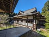
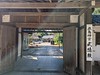
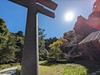
The above images may not be of the site on this page, but were taken nearby. They are loaded from Flickr so please click on them for image credits.
Click here to see more info for this site
Nearby sites
Click here to view sites on an interactive map of the areaKey: Red: member's photo, Blue: 3rd party photo, Yellow: other image, Green: no photo - please go there and take one, Grey: site destroyed
Download sites to:
KML (Google Earth)
GPX (GPS waypoints)
CSV (Garmin/Navman)
CSV (Excel)
To unlock full downloads you need to sign up as a Contributory Member. Otherwise downloads are limited to 50 sites.
Turn off the page maps and other distractions
Nearby sites listing. In the following links * = Image available
29.7km WNW 302° Ajiki Taishi Kofon* Passage Grave
35.8km SSW 212° Shibayama Kohun Haniwa Museum* Museum
36.5km WSW 243° Ryūkakuji Kofungun* Passage Grave
39.9km NNW 329° Obata Kitayama Haniwa Serisaku Iseki* Ancient Mine, Quarry or other Industry
45.4km N 352° Torazuka Kofun* Long Barrow
45.7km NNW 342° Yoshida Kofun* Passage Grave
48.7km N 352° Mawatari Haniwa Seisaku Iseki* Ancient Mine, Quarry or other Industry
53.1km NNW 332° Kurefushi-no-Sato Kofun Kōen park* Passage Grave
56.0km NW 322° Shumpū Banri-sō* Modern Stone Circle etc
58.6km NNW 336° Masui Kofun* Passage Grave
59.1km NNW 346° Shirakōchi Kofungun* Passage Grave
63.8km N 352° Hata Bakke Yokoana* Rock Cut Tomb
64.4km NW 313° Hanazono Kofungun* Passage Grave
66.6km NNW 347° Nekobuchi Yokoana* Rock Cut Tomb
67.7km NNW 346° Mi Kofun* Passage Grave
69.4km SSW 211° Nagara Yokoana* Rock Cut Tomb
73.6km WNW 298° Funadama Kofun* Passage Grave
77.5km N 4° Jūōmae Yokoana* Rock Cut Tomb
82.1km WSW 247° Kiyosumi Teien garden* Modern Stone Circle etc
83.6km WSW 251° Yayoi* Ancient Mine, Quarry or other Industry
85.1km WSW 248° Hemisphere* Modern Stone Circle etc
91.2km SW 214° Enchō-ji temple* Standing Stone (Menhir)
91.8km WSW 243° Ōmori Kaizuka* Ancient Village or Settlement
96.0km WSW 249° Gōtoku-ji temple* Modern Stone Circle etc
97.1km WSW 244° Sengen Jinja Kofun* NOT SET
View more nearby sites and additional images


 We would like to know more about this location. Please feel free to add a brief description and any relevant information in your own language.
 Wir möchten mehr über diese Stätte erfahren. Bitte zögern Sie nicht, eine kurze Beschreibung und relevante Informationen in Deutsch hinzuzufügen.
 Nous aimerions en savoir encore un peu sur les lieux. S'il vous plaît n'hesitez pas à ajouter une courte description et tous les renseignements pertinents dans votre propre langue.
 Quisieramos informarnos un poco más de las lugares. No dude en añadir una breve descripción y otros datos relevantes en su propio idioma.