<< Our Photo Pages >> Arako (Kyūshū) - Burial Chamber or Dolmen in Japan in Kyūshū
Submitted by Aska on Friday, 05 July 2013 Page Views: 1533
Iron Age and Later PrehistorySite Name: Arako (Kyūshū) Alternative Name: 荒子, 平良石 HiraraishiCountry: Japan
NOTE: This site is 5.338 km away from the location you searched for.
Region: Kyūshū Type: Burial Chamber or Dolmen
Nearest Town: Yamaga (Kumamoto pref.) Nearest Village: Kamotomachi-Shō 鹿本
Latitude: 33.016040N Longitude: 130.769560E
Condition:
| 5 | Perfect |
| 4 | Almost Perfect |
| 3 | Reasonable but with some damage |
| 2 | Ruined but still recognisable as an ancient site |
| 1 | Pretty much destroyed, possibly visible as crop marks |
| 0 | No data. |
| -1 | Completely destroyed |
| 5 | Superb |
| 4 | Good |
| 3 | Ordinary |
| 2 | Not Good |
| 1 | Awful |
| 0 | No data. |
| 5 | Can be driven to, probably with disabled access |
| 4 | Short walk on a footpath |
| 3 | Requiring a bit more of a walk |
| 2 | A long walk |
| 1 | In the middle of nowhere, a nightmare to find |
| 0 | No data. |
| 5 | co-ordinates taken by GPS or official recorded co-ordinates |
| 4 | co-ordinates scaled from a detailed map |
| 3 | co-ordinates scaled from a bad map |
| 2 | co-ordinates of the nearest village |
| 1 | co-ordinates of the nearest town |
| 0 | no data |
Internal Links:
External Links:
 (PID:110090)")
A flat stone with cupules was dug out from a paddy filed, it seems to be a capstone of a dolmen.
Aslo called 'Hiraraishi(平良石)', hira=flat + ishi=stone, in Kyūshū such flat stones in the paddy field are generally called "hiraraishi" and most of them seems to be the capstones of the dolmens which have had huge urns (pottery cost) beneath the capstones
You may be viewing yesterday's version of this page. To see the most up to date information please register for a free account.
Do not use the above information on other web sites or publications without permission of the contributor.
Nearby Images from Flickr

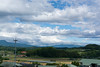
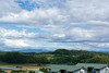
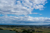
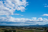
The above images may not be of the site on this page, but were taken nearby. They are loaded from Flickr so please click on them for image credits.
Click here to see more info for this site
Nearby sites
Click here to view sites on an interactive map of the areaKey: Red: member's photo, Blue: 3rd party photo, Yellow: other image, Green: no photo - please go there and take one, Grey: site destroyed
Download sites to:
KML (Google Earth)
GPX (GPS waypoints)
CSV (Garmin/Navman)
CSV (Excel)
To unlock full downloads you need to sign up as a Contributory Member. Otherwise downloads are limited to 50 sites.
Turn off the page maps and other distractions
Nearby sites listing. In the following links * = Image available
1.1km S 181° Keikō Tennō-no Koshikake-ishi* Burial Chamber or Dolmen
2.5km SE 130° Kukuchi-no-ki* Hillfort
3.4km S 174° Okada* Burial Chamber or Dolmen
3.6km S 181° Nagarekawa* Burial Chamber or Dolmen
4.6km SSE 152° Otodo* Burial Chamber or Dolmen
7.1km S 176° Futatsukasan* Sculptured Stone
7.8km SW 217° Hirahata* Burial Chamber or Dolmen
8.1km ESE 108° Hiraraishi* Burial Chamber or Dolmen
8.2km WNW 291° Ryūōzan Kofun (in Kumamoto)* Passage Grave
9.2km W 273° Nabeta* Rock Cut Tomb
9.4km W 279° Chibusan Kofun* Passage Grave
9.6km W 260° Nagaiwa* Rock Cut Tomb
9.7km WSW 255° Kumamoto Kenritsu Sōshoku Kofun-kan museum* Museum
9.7km W 280° Obusan Kofun* Passage Grave
10.8km SSE 168° Ishinomoto* Burial Chamber or Dolmen
11.4km SE 125° Kokan-yama* Burial Chamber or Dolmen
11.5km SE 128° Fujio* Burial Chamber or Dolmen
12.3km SSW 193° Nagata* Burial Chamber or Dolmen
13.9km SE 133° Mutabaru* Stone Circle
14.1km W 279° Usonomae* Burial Chamber or Dolmen
16.3km WSW 251° Tonkararin (in Kumamoto)* Souterrain (Fogou, Earth House)
16.6km SW 215° Nerenoki Kannon* Standing Stones
16.6km WSW 253° Eta Funayama Kofun* Long Barrow
18.1km S 172° Umenoki* Burial Chamber or Dolmen
19.8km WSW 255° Ishinuki-Nagino* Rock Cut Tomb
View more nearby sites and additional images


 We would like to know more about this location. Please feel free to add a brief description and any relevant information in your own language.
 Wir möchten mehr über diese Stätte erfahren. Bitte zögern Sie nicht, eine kurze Beschreibung und relevante Informationen in Deutsch hinzuzufügen.
 Nous aimerions en savoir encore un peu sur les lieux. S'il vous plaît n'hesitez pas à ajouter une courte description et tous les renseignements pertinents dans votre propre langue.
 Quisieramos informarnos un poco más de las lugares. No dude en añadir una breve descripción y otros datos relevantes en su propio idioma.