<< Text Pages >> Las Flores - Pyramid / Mastaba in Mexico in Tamaulipas
Submitted by davidmorgan on Monday, 18 February 2019 Page Views: 1172
Multi-periodSite Name: Las FloresCountry: Mexico
NOTE: This site is 15.927 km away from the location you searched for.
Region: Tamaulipas Type: Pyramid / Mastaba
Nearest Town: Tampico
Latitude: 22.249520N Longitude: 97.87684W
Condition:
| 5 | Perfect |
| 4 | Almost Perfect |
| 3 | Reasonable but with some damage |
| 2 | Ruined but still recognisable as an ancient site |
| 1 | Pretty much destroyed, possibly visible as crop marks |
| 0 | No data. |
| -1 | Completely destroyed |
| 5 | Superb |
| 4 | Good |
| 3 | Ordinary |
| 2 | Not Good |
| 1 | Awful |
| 0 | No data. |
| 5 | Can be driven to, probably with disabled access |
| 4 | Short walk on a footpath |
| 3 | Requiring a bit more of a walk |
| 2 | A long walk |
| 1 | In the middle of nowhere, a nightmare to find |
| 0 | No data. |
| 5 | co-ordinates taken by GPS or official recorded co-ordinates |
| 4 | co-ordinates scaled from a detailed map |
| 3 | co-ordinates scaled from a bad map |
| 2 | co-ordinates of the nearest village |
| 1 | co-ordinates of the nearest town |
| 0 | no data |
Internal Links:
External Links:
Pyramid in Tamaulipas State, Mexico
A small Huastec culture pyramid on the outskirts of Tampico.
You may be viewing yesterday's version of this page. To see the most up to date information please register for a free account.
Do not use the above information on other web sites or publications without permission of the contributor.
Nearby Images from Flickr
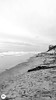
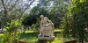
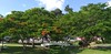
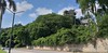
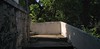
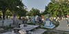
The above images may not be of the site on this page, but were taken nearby. They are loaded from Flickr so please click on them for image credits.
Click here to see more info for this site
Nearby sites
Click here to view sites on an interactive map of the areaKey: Red: member's photo, Blue: 3rd party photo, Yellow: other image, Green: no photo - please go there and take one, Grey: site destroyed
Download sites to:
KML (Google Earth)
GPX (GPS waypoints)
CSV (Garmin/Navman)
CSV (Excel)
To unlock full downloads you need to sign up as a Contributory Member. Otherwise downloads are limited to 50 sites.
Turn off the page maps and other distractions
Nearby sites listing. In the following links * = Image available
102.9km WSW 250° Tamtoc Ancient Village or Settlement
151.7km S 177° Cerro del Sombrerete Rock Art
154.5km SSE 159° Tubuco Ancient Mine, Quarry or other Industry
199.9km NW 318° Balcon de Montezuma Ancient Village or Settlement
206.9km SSE 165° El Tajin* Ancient Village or Settlement
242.4km SSW 192° Huapalcalco Pyramid Pyramid / Mastaba
279.9km SSW 195° Tepeapulco Pyramid* Pyramid / Mastaba
286.1km SSW 212° Tula.* Ancient Village or Settlement
300.8km SSW 200° Teotihuacan - Pyramid of the Moon* Pyramid / Mastaba
301.6km SSW 200° Teotihuacan - Pyramid of the Sun* Pyramid / Mastaba
301.6km SSW 200° Teotihuacan* Ancient Village or Settlement
302.0km SSW 200° Teotihuacan - Atelelco* Ancient Palace
302.3km SSW 200° Teotihuacan - Tetitla Ancient Village or Settlement
302.8km SSW 200° Teotihuacan - Temple of Quetzalcoatl* Pyramid / Mastaba
315.8km SSE 162° Museo de Antropologia de Xalapa* Museum
321.3km SSW 198° Texcotzingo* Ancient Palace
324.6km SSE 152° Quiahuiztlan* Rock Cut Tomb
326.0km SW 235° El Cerrito Pyramid / Mastaba
326.1km SW 220° Huamango Ancient Village or Settlement
328.7km SSW 204° Acatitlan* Ancient Temple
330.6km SSW 204° Tenayuca* Pyramid / Mastaba
337.6km SSW 203° Tlatelolco* Ancient Village or Settlement
337.7km S 188° Cacaxtla* Ancient Village or Settlement
337.7km S 188° Xochitecatl* Pyramid / Mastaba
339.0km SSW 203° Tenochtitlan - Templo Mayor* Ancient Temple
View more nearby sites and additional images


 We would like to know more about this location. Please feel free to add a brief description and any relevant information in your own language.
 Wir möchten mehr über diese Stätte erfahren. Bitte zögern Sie nicht, eine kurze Beschreibung und relevante Informationen in Deutsch hinzuzufügen.
 Nous aimerions en savoir encore un peu sur les lieux. S'il vous plaît n'hesitez pas à ajouter une courte description et tous les renseignements pertinents dans votre propre langue.
 Quisieramos informarnos un poco más de las lugares. No dude en añadir una breve descripción y otros datos relevantes en su propio idioma.