<< Text Pages >> Indian Creek - Ancient Village or Settlement in Caribbean Islands
Submitted by bat400 on Tuesday, 06 March 2007 Page Views: 7792
Site WatchSite Name: Indian CreekCountry: Caribbean Islands
NOTE: This site is 13.746 km away from the location you searched for.
Type: Ancient Village or Settlement
Nearest Village: English Harbour
Latitude: 17.009800N Longitude: 61.7452W
Condition:
| 5 | Perfect |
| 4 | Almost Perfect |
| 3 | Reasonable but with some damage |
| 2 | Ruined but still recognisable as an ancient site |
| 1 | Pretty much destroyed, possibly visible as crop marks |
| 0 | No data. |
| -1 | Completely destroyed |
| 5 | Superb |
| 4 | Good |
| 3 | Ordinary |
| 2 | Not Good |
| 1 | Awful |
| 0 | No data. |
| 5 | Can be driven to, probably with disabled access |
| 4 | Short walk on a footpath |
| 3 | Requiring a bit more of a walk |
| 2 | A long walk |
| 1 | In the middle of nowhere, a nightmare to find |
| 0 | No data. |
| 5 | co-ordinates taken by GPS or official recorded co-ordinates |
| 4 | co-ordinates scaled from a detailed map |
| 3 | co-ordinates scaled from a bad map |
| 2 | co-ordinates of the nearest village |
| 1 | co-ordinates of the nearest town |
| 0 | no data |
Be the first person to rate this site - see the 'Contribute!' box in the right hand menu.
Internal Links:
External Links:
Ancient Village in Antigua.
Indian Creek is now a dry streambed, but pre-Columbian people settled here from 200BC - 1300AD. This period covers the transition when ceramics were first developed on the island.
The site was partially excavated in the 1970's leaving large areas untouched. There has been no development, although the Antigua museum website advocates some type of tourism development to preserve the site from more intrusive forms of development. Unesco has suggested Indian Creek as a World Heritage site due to its record of continuous occupation and the transition of ceramic technology.
The location given is only roughly accurate.
Note: Development threatens most important Antiguan archaeology site. See comment.
You may be viewing yesterday's version of this page. To see the most up to date information please register for a free account.
Do not use the above information on other web sites or publications without permission of the contributor.
Nearby Images from Flickr


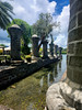

The above images may not be of the site on this page, but were taken nearby. They are loaded from Flickr so please click on them for image credits.
Click here to see more info for this site
Nearby sites
Click here to view sites on an interactive map of the areaKey: Red: member's photo, Blue: 3rd party photo, Yellow: other image, Green: no photo - please go there and take one, Grey: site destroyed
Download sites to:
KML (Google Earth)
GPX (GPS waypoints)
CSV (Garmin/Navman)
CSV (Excel)
To unlock full downloads you need to sign up as a Contributory Member. Otherwise downloads are limited to 50 sites.
Turn off the page maps and other distractions
Nearby sites listing. In the following links * = Image available
116.1km S 175° Trois Rivières Rock Carvings Rock Art
423.0km S 173° St Vincent - Borrouallie* Rock Art
423.8km S 171° St Vincent, Colonarie* Rock Art
427.4km S 173° St Vincent, Buccament* Rock Art
431.4km S 171° St Vincent - Yambou Pass* Rock Art
527.9km WNW 283° Ponce Plaza (Puerto Rico) Rock Art
534.1km S 179° Man-Face petroglyph (Union, Grenada)* Rock Art
534.4km S 179° Rock Art near Waltham, Victoria, Grenada* Rock Art
534.4km S 179° Duquense Bay Petroglyphs, Grenada (Caribbean)* Rock Art
535.5km S 180° Rock Art near Victoria, Grenada* Rock Art
536.2km S 179° Mt Rich Grenada (Caribbean)* Rock Art
544.1km WNW 288° La Cueva del Indio (Puerto Rico)* Rock Art
552.4km WNW 286° Caguana* Standing Stones
692.7km S 176° Blanchisseuse Ancient Village or Settlement
878.1km WNW 282° Padre Nuestro Caves (Dominican Republic) Rock Art
917.3km WNW 286° Raul de Monteclaro (Dominican Rep) Rock Art
942.8km SW 236° Curaçao Hato Caves Rock Art
1058.1km SSE 165° Wyva Creek Shell Mound Artificial Mound
1066.6km W 281° Las Caritas de Los Indios* Rock Art
1417.9km SSW 207° Orinoco Rock Art Rock Art
1462.4km WSW 246° El Pueblito Ancient Village or Settlement
1471.5km WSW 245° Ciudad Perdida* Ancient Village or Settlement
1476.5km SW 229° El Porvenir Not Known (by us)
1532.5km WNW 289° Chorro de Maita Ancient Village or Settlement
1790.4km SE 141° Mont d'Argent rock art* Rock Art
View more nearby sites and additional images


 We would like to know more about this location. Please feel free to add a brief description and any relevant information in your own language.
 Wir möchten mehr über diese Stätte erfahren. Bitte zögern Sie nicht, eine kurze Beschreibung und relevante Informationen in Deutsch hinzuzufügen.
 Nous aimerions en savoir encore un peu sur les lieux. S'il vous plaît n'hesitez pas à ajouter une courte description et tous les renseignements pertinents dans votre propre langue.
 Quisieramos informarnos un poco más de las lugares. No dude en añadir una breve descripción y otros datos relevantes en su propio idioma.