<< Text Pages >> Trois Rivières Rock Carvings - Rock Art in Caribbean Islands
Submitted by KaiHofmann on Sunday, 25 August 2013 Page Views: 2726
Rock ArtSite Name: Trois Rivières Rock CarvingsCountry: Caribbean Islands
NOTE: This site is 35.308 km away from the location you searched for.
Type: Rock Art
Nearest Town: Trois Riviéres
Latitude: 15.970249N Longitude: 61.641648W
Condition:
| 5 | Perfect |
| 4 | Almost Perfect |
| 3 | Reasonable but with some damage |
| 2 | Ruined but still recognisable as an ancient site |
| 1 | Pretty much destroyed, possibly visible as crop marks |
| 0 | No data. |
| -1 | Completely destroyed |
| 5 | Superb |
| 4 | Good |
| 3 | Ordinary |
| 2 | Not Good |
| 1 | Awful |
| 0 | No data. |
| 5 | Can be driven to, probably with disabled access |
| 4 | Short walk on a footpath |
| 3 | Requiring a bit more of a walk |
| 2 | A long walk |
| 1 | In the middle of nowhere, a nightmare to find |
| 0 | No data. |
| 5 | co-ordinates taken by GPS or official recorded co-ordinates |
| 4 | co-ordinates scaled from a detailed map |
| 3 | co-ordinates scaled from a bad map |
| 2 | co-ordinates of the nearest village |
| 1 | co-ordinates of the nearest town |
| 0 | no data |
Be the first person to rate this site - see the 'Contribute!' box in the right hand menu.
Internal Links:
External Links:
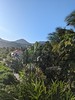
Rock art in the southern part of Gouadeloupe island.
You may be viewing yesterday's version of this page. To see the most up to date information please register for a free account.
Do not use the above information on other web sites or publications without permission of the contributor.
Nearby Images from Flickr
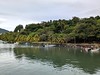
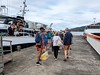
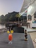
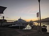

The above images may not be of the site on this page, but were taken nearby. They are loaded from Flickr so please click on them for image credits.
Click here to see more info for this site
Nearby sites
Click here to view sites on an interactive map of the areaKey: Red: member's photo, Blue: 3rd party photo, Yellow: other image, Green: no photo - please go there and take one, Grey: site destroyed
Download sites to:
KML (Google Earth)
GPX (GPS waypoints)
CSV (Garmin/Navman)
CSV (Excel)
To unlock full downloads you need to sign up as a Contributory Member. Otherwise downloads are limited to 50 sites.
Turn off the page maps and other distractions
Nearby sites listing. In the following links * = Image available
116.1km N 355° Indian Creek Ancient Village or Settlement
307.0km S 172° St Vincent - Borrouallie* Rock Art
308.0km S 170° St Vincent, Colonarie* Rock Art
311.4km S 172° St Vincent, Buccament* Rock Art
315.5km S 170° St Vincent - Yambou Pass* Rock Art
418.4km S 180° Man-Face petroglyph (Union, Grenada)* Rock Art
418.8km S 181° Duquense Bay Petroglyphs, Grenada (Caribbean)* Rock Art
418.8km S 181° Rock Art near Waltham, Victoria, Grenada* Rock Art
420.0km S 181° Rock Art near Victoria, Grenada* Rock Art
420.5km S 180° Mt Rich Grenada (Caribbean)* Rock Art
575.1km WNW 294° Ponce Plaza (Puerto Rico) Rock Art
576.7km S 176° Blanchisseuse Ancient Village or Settlement
600.5km WNW 299° La Cueva del Indio (Puerto Rico)* Rock Art
604.2km WNW 296° Caguana* Standing Stones
893.6km WSW 243° Curaçao Hato Caves Rock Art
919.5km WNW 289° Padre Nuestro Caves (Dominican Republic) Rock Art
943.9km SSE 164° Wyva Creek Shell Mound Artificial Mound
965.3km WNW 292° Raul de Monteclaro (Dominican Rep) Rock Art
1104.7km WNW 287° Las Caritas de Los Indios* Rock Art
1411.4km SW 232° El Porvenir Not Known (by us)
1429.6km WSW 250° El Pueblito Ancient Village or Settlement
1436.4km WSW 249° Ciudad Perdida* Ancient Village or Settlement
1583.8km WNW 293° Chorro de Maita Ancient Village or Settlement
1695.1km SE 139° Mont d'Argent rock art* Rock Art
1734.0km SW 230° El Infiernito* Standing Stones
View more nearby sites and additional images


 We would like to know more about this location. Please feel free to add a brief description and any relevant information in your own language.
 Wir möchten mehr über diese Stätte erfahren. Bitte zögern Sie nicht, eine kurze Beschreibung und relevante Informationen in Deutsch hinzuzufügen.
 Nous aimerions en savoir encore un peu sur les lieux. S'il vous plaît n'hesitez pas à ajouter une courte description et tous les renseignements pertinents dans votre propre langue.
 Quisieramos informarnos un poco más de las lugares. No dude en añadir una breve descripción y otros datos relevantes en su propio idioma.