<< Text Pages >> Rumicucho Pucara - Hillfort in Ecuador
Submitted by davidmorgan on Friday, 01 December 2017 Page Views: 1029
Iron Age and Later PrehistorySite Name: Rumicucho PucaraCountry: Ecuador
NOTE: This site is 161.895 km away from the location you searched for.
Type: Hillfort
Nearest Town: Quito
Latitude: 0.013340N Longitude: 78.431W
Condition:
| 5 | Perfect |
| 4 | Almost Perfect |
| 3 | Reasonable but with some damage |
| 2 | Ruined but still recognisable as an ancient site |
| 1 | Pretty much destroyed, possibly visible as crop marks |
| 0 | No data. |
| -1 | Completely destroyed |
| 5 | Superb |
| 4 | Good |
| 3 | Ordinary |
| 2 | Not Good |
| 1 | Awful |
| 0 | No data. |
| 5 | Can be driven to, probably with disabled access |
| 4 | Short walk on a footpath |
| 3 | Requiring a bit more of a walk |
| 2 | A long walk |
| 1 | In the middle of nowhere, a nightmare to find |
| 0 | No data. |
| 5 | co-ordinates taken by GPS or official recorded co-ordinates |
| 4 | co-ordinates scaled from a detailed map |
| 3 | co-ordinates scaled from a bad map |
| 2 | co-ordinates of the nearest village |
| 1 | co-ordinates of the nearest town |
| 0 | no data |
Internal Links:
External Links:
Hillfort in Ecuador
An Inca military outpost built by Tupac Yupanqui in the 15th century.
You may be viewing yesterday's version of this page. To see the most up to date information please register for a free account.
Do not use the above information on other web sites or publications without permission of the contributor.
Nearby Images from Flickr

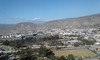
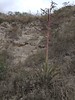
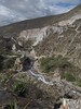

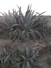
The above images may not be of the site on this page, but were taken nearby. They are loaded from Flickr so please click on them for image credits.
Click here to see more info for this site
Nearby sites
Click here to view sites on an interactive map of the areaKey: Red: member's photo, Blue: 3rd party photo, Yellow: other image, Green: no photo - please go there and take one, Grey: site destroyed
Download sites to:
KML (Google Earth)
GPX (GPS waypoints)
CSV (Garmin/Navman)
CSV (Excel)
To unlock full downloads you need to sign up as a Contributory Member. Otherwise downloads are limited to 50 sites.
Turn off the page maps and other distractions
Nearby sites listing. In the following links * = Image available
1.5km S 169° Catequilla* Stone Circle
14.7km ENE 72° Cochasqui Ancient Village or Settlement
44.9km ENE 62° Pyramids of Zuleta Pyramid / Mastaba
48.6km NE 45° Inca-Caranqui* Ancient Village or Settlement
95.3km SSW 213° Malqui-Machay* Ancient Village or Settlement
227.8km SSE 162° Cueva de los Tayos Cave or Rock Shelter
289.1km S 190° Ingapirca* Ancient Village or Settlement
317.3km NE 49° San Agustin Parque Arqueologico* Sculptured Stone
317.8km NE 48° El Purutal* Burial Chamber or Dolmen
317.9km NE 48° La Pelota* Sculptured Stone
318.0km NE 48° Petroglifos del Estrecho* Rock Art
318.3km NE 49° El Tablon (San Agustin)* Sculptured Stone
319.4km NE 49° La Chaquira* Rock Art
319.4km NE 48° Obando* Rock Cut Tomb
321.3km NE 50° Alto del Tigre* Rock Art
321.8km NE 49° Alto de las Guacas* Burial Chamber or Dolmen
322.6km NE 49° Alto de los Idolos* Artificial Mound
330.8km S 191° Pumapungo Ancient Village or Settlement
388.6km NE 43° El Aguacate* Rock Cut Tomb
390.0km NE 43° Alto de Segovia* Rock Cut Tomb
390.8km NE 43° El Tablon (Tierradentro)* Sculptured Stone
440.7km NNE 29° Deportivo Cali Tombs Barrow Cemetery
522.9km S 189° Santa Ana - La Florida Ancient Village or Settlement
610.6km SSW 197° Laynes Vicus Site Ancient Village or Settlement
619.2km S 178° Cordillera de Colan Citadel Hillfort
View more nearby sites and additional images


 We would like to know more about this location. Please feel free to add a brief description and any relevant information in your own language.
 Wir möchten mehr über diese Stätte erfahren. Bitte zögern Sie nicht, eine kurze Beschreibung und relevante Informationen in Deutsch hinzuzufügen.
 Nous aimerions en savoir encore un peu sur les lieux. S'il vous plaît n'hesitez pas à ajouter une courte description et tous les renseignements pertinents dans votre propre langue.
 Quisieramos informarnos un poco más de las lugares. No dude en añadir una breve descripción y otros datos relevantes en su propio idioma.