<< Text Pages >> Cipari - Ancient Village or Settlement in Indonesia
Submitted by kaiHofmann on Sunday, 24 March 2013 Page Views: 4134
Multi-periodSite Name: CipariCountry: Indonesia
NOTE: This site is 99.666 km away from the location you searched for.
Type: Ancient Village or Settlement
Nearest Town: Cipari Nearest Village: Cigugur
Latitude: 6.973244S Longitude: 108.473699E
Condition:
| 5 | Perfect |
| 4 | Almost Perfect |
| 3 | Reasonable but with some damage |
| 2 | Ruined but still recognisable as an ancient site |
| 1 | Pretty much destroyed, possibly visible as crop marks |
| 0 | No data. |
| -1 | Completely destroyed |
| 5 | Superb |
| 4 | Good |
| 3 | Ordinary |
| 2 | Not Good |
| 1 | Awful |
| 0 | No data. |
| 5 | Can be driven to, probably with disabled access |
| 4 | Short walk on a footpath |
| 3 | Requiring a bit more of a walk |
| 2 | A long walk |
| 1 | In the middle of nowhere, a nightmare to find |
| 0 | No data. |
| 5 | co-ordinates taken by GPS or official recorded co-ordinates |
| 4 | co-ordinates scaled from a detailed map |
| 3 | co-ordinates scaled from a bad map |
| 2 | co-ordinates of the nearest village |
| 1 | co-ordinates of the nearest town |
| 0 | no data |
Be the first person to rate this site - see the 'Contribute!' box in the right hand menu.
Internal Links:
External Links:
Ancient Village or Settlement in Indonesia
Neolithic settlement in the Kuningan district on the island of Java. Megalithic monuments like tombs and standing stone can be found there. They are dated for around 1000 BCE.
You may be viewing yesterday's version of this page. To see the most up to date information please register for a free account.
Do not use the above information on other web sites or publications without permission of the contributor.
Nearby Images from Flickr


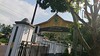


The above images may not be of the site on this page, but were taken nearby. They are loaded from Flickr so please click on them for image credits.
Click here to see more info for this site
Nearby sites
Click here to view sites on an interactive map of the areaKey: Red: member's photo, Blue: 3rd party photo, Yellow: other image, Green: no photo - please go there and take one, Grey: site destroyed
Download sites to:
KML (Google Earth)
GPX (GPS waypoints)
CSV (Garmin/Navman)
CSV (Excel)
To unlock full downloads you need to sign up as a Contributory Member. Otherwise downloads are limited to 50 sites.
Turn off the page maps and other distractions
Nearby sites listing. In the following links * = Image available
52.9km WSW 244° Mount Sadahurip* Natural Stone / Erratic / Other Natural Feature
62.9km WSW 257° Candi Gangkuang Ancient Temple
104.3km W 270° Footprint Stone, Mount Paseban Natural Stone / Erratic / Other Natural Feature
105.2km W 271° Mount Lalakon Not Known (by us)
156.4km W 269° Gunung Padang* Ancient Temple
160.2km E 99° Candi Gatotkaca Ancient Temple
160.2km E 99° Candi Arjuna Ancient Temple
160.8km E 100° Candi Bima Ancient Temple
193.5km ESE 105° Selogriyo Temple Ancient Temple
202.7km WNW 296° Museum Nasional* Museum
203.3km ESE 110° Dieng Plateau Temple* Ancient Temple
203.5km ESE 110° Borobudur temple* Ancient Temple
205.0km ESE 110° Pawon Temple Ancient Temple
206.1km ESE 110° Mendut Temple Ancient Temple
210.4km ESE 110° Ngawen Temple Ancient Temple
211.5km ESE 109° Gunungsari Temple Ancient Temple
215.8km W 273° Situs Pangguyangan Artificial Mound
216.1km ESE 107° Candi Pendem Sengi Ancient Temple
216.1km ESE 107° Asu Temple Ancient Temple
216.9km W 272° Situs Tugu Cengku* Standing Stone (Menhir)
228.7km ESE 108° The Lost World Stonehenge. Cangkringan, Sleman. Modern Stone Circle etc
238.8km ESE 111° Prambanan Ancient Temple
239.6km ESE 112° Sojiwan Temple Ancient Temple
239.7km ESE 111° Plaosan Temple Ancient Temple
240.1km ESE 112° Candi Banyunibo Ancient Temple
View more nearby sites and additional images


 We would like to know more about this location. Please feel free to add a brief description and any relevant information in your own language.
 Wir möchten mehr über diese Stätte erfahren. Bitte zögern Sie nicht, eine kurze Beschreibung und relevante Informationen in Deutsch hinzuzufügen.
 Nous aimerions en savoir encore un peu sur les lieux. S'il vous plaît n'hesitez pas à ajouter une courte description et tous les renseignements pertinents dans votre propre langue.
 Quisieramos informarnos un poco más de las lugares. No dude en añadir una breve descripción y otros datos relevantes en su propio idioma.