<< Our Photo Pages >> Arai Te Tonga - Ancient Temple in Pacific Islands
Submitted by PAB on Saturday, 22 August 2015 Page Views: 4693
Multi-periodSite Name: Arai Te Tonga Alternative Name: Araite TongaCountry: Pacific Islands
NOTE: This site is 2349.752 km away from the location you searched for.
Type: Ancient Temple
Latitude: 21.2131S Longitude: 159.7457W
Condition:
| 5 | Perfect |
| 4 | Almost Perfect |
| 3 | Reasonable but with some damage |
| 2 | Ruined but still recognisable as an ancient site |
| 1 | Pretty much destroyed, possibly visible as crop marks |
| 0 | No data. |
| -1 | Completely destroyed |
| 5 | Superb |
| 4 | Good |
| 3 | Ordinary |
| 2 | Not Good |
| 1 | Awful |
| 0 | No data. |
| 5 | Can be driven to, probably with disabled access |
| 4 | Short walk on a footpath |
| 3 | Requiring a bit more of a walk |
| 2 | A long walk |
| 1 | In the middle of nowhere, a nightmare to find |
| 0 | No data. |
| 5 | co-ordinates taken by GPS or official recorded co-ordinates |
| 4 | co-ordinates scaled from a detailed map |
| 3 | co-ordinates scaled from a bad map |
| 2 | co-ordinates of the nearest village |
| 1 | co-ordinates of the nearest town |
| 0 | no data |
Internal Links:
External Links:
I have visited· I would like to visit
PAB has visited here
")
On the coast of Rarotonga (Cook Islands), there is a site which operated as both a meeting place and sanctuary, with parts of its stone surround and pillar still in situ.
This is one of several such locations established by the families who took over the island from its original inhabitants - before moving on to the land of the long white cloud...aka New Zealand.
According to the legends on Rarotonga, it was the people from here who set off for Aotea - the original Maori who established the pahs and other sites which Drew Parsons has posted in New Zealand.
As with the New Zealand sites, dates are less important than stages of development, so the fact that this location has been dated to 1250 AD doesn't preclude it from submission to the Portal.
As described on the information panel...:
Araite Tonga
These stone structures were Koutu Chiefly Courts where the political function of the Investiture of an Ariki (Chief) took place. The Kouto could properly be called the Royal Court of a reigning Ariki or High Chief.
It was a special place where all offerings to the ancient gods were first assembled prior to being conveyed to, and placed upon, the Marae (meeting place) where all tribal annual feasts and the presentation of 'First fruits’ were held. The outstanding surviving feature or Arai-Te-Tonga is a rectangular platform approximately 12 feet long, 7 feet and 8 inches high offset from the central….
You may be viewing yesterday's version of this page. To see the most up to date information please register for a free account.
")
")
Do not use the above information on other web sites or publications without permission of the contributor.
Nearby Images from Flickr
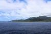

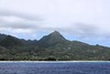
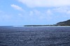
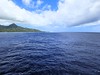

The above images may not be of the site on this page, but were taken nearby. They are loaded from Flickr so please click on them for image credits.
Click here to see more info for this site
Nearby sites
Click here to view sites on an interactive map of the areaKey: Red: member's photo, Blue: 3rd party photo, Yellow: other image, Green: no photo - please go there and take one, Grey: site destroyed
Download sites to:
KML (Google Earth)
GPX (GPS waypoints)
CSV (Garmin/Navman)
CSV (Excel)
To unlock full downloads you need to sign up as a Contributory Member. Otherwise downloads are limited to 50 sites.
Turn off the page maps and other distractions
Nearby sites listing. In the following links * = Image available
996.8km ENE 62° Marae Tainuu* Ancient Temple
1006.1km ENE 63° Taputapuatea* Ancient Temple
1048.8km ENE 63° Marae Manunu Huanhine Ancient Temple
1134.9km ENE 72° Marae Arahurahu Ancient Temple
1524.5km W 274° Foa Island Petroglyphs Rock Art
1586.1km W 268° Ha'amonga 'a Maui* Standing Stones
1586.1km W 268° Maka Fa'akinanga Standing Stone (Menhir)
1593.0km W 267° Langi (Tonga) Cairn
1594.9km W 267° Nukuleka Ancient Village or Settlement
2355.6km W 276° Nakauvadra Standing Stones and Narara Caves Standing Stones
2508.3km ENE 60° Taetae Tupuna He'e Tai* Museum
2509.1km ENE 60° Temehea Tohua* Ancient Village or Settlement
2537.0km ENE 64° Hanamiai Dune* Ancient Village or Settlement
2553.4km ENE 63° Tehueto Tohua* Ancient Village or Settlement
2928.8km SW 228° Hereheretaura Pā Hillfort
2975.2km SW 229° Men's Bay North Pa* Hillfort
2979.8km SW 228° Tapapakanga Park* Ancient Village or Settlement
2980.5km SW 230° Okakari Point Pa* Hillfort
2980.5km SW 230° Papahi Headland Pa* Hillfort
2982.5km SW 230° Te Kiri's Pa* Hillfort
2985.0km SW 231° Te Arai o Tahuhu Pa* Hillfort
2985.1km SW 231° Mangawhai Heads North Pa* Hillfort
2985.1km SW 231° Mangawhai Heads South Pa* Hillfort
2986.9km SW 230° Matakana Modern Stone Circle* Modern Stone Circle etc
2987.7km SW 230° Pukematakeo Pa* Hillfort
View more nearby sites and additional images


 We would like to know more about this location. Please feel free to add a brief description and any relevant information in your own language.
 Wir möchten mehr über diese Stätte erfahren. Bitte zögern Sie nicht, eine kurze Beschreibung und relevante Informationen in Deutsch hinzuzufügen.
 Nous aimerions en savoir encore un peu sur les lieux. S'il vous plaît n'hesitez pas à ajouter une courte description et tous les renseignements pertinents dans votre propre langue.
 Quisieramos informarnos un poco más de las lugares. No dude en añadir una breve descripción y otros datos relevantes en su propio idioma.