<< Text Pages >> El Shincal - Ancient Village or Settlement in Argentina
Submitted by davidmorgan on Wednesday, 04 January 2017 Page Views: 2699
Multi-periodSite Name: El Shincal Alternative Name: ShinkalCountry: Argentina
NOTE: This site is 493.546 km away from the location you searched for.
Type: Ancient Village or Settlement
Nearest Town: Belén Nearest Village: Londres
Latitude: 27.686735S Longitude: 67.178632W
Condition:
| 5 | Perfect |
| 4 | Almost Perfect |
| 3 | Reasonable but with some damage |
| 2 | Ruined but still recognisable as an ancient site |
| 1 | Pretty much destroyed, possibly visible as crop marks |
| 0 | No data. |
| -1 | Completely destroyed |
| 5 | Superb |
| 4 | Good |
| 3 | Ordinary |
| 2 | Not Good |
| 1 | Awful |
| 0 | No data. |
| 5 | Can be driven to, probably with disabled access |
| 4 | Short walk on a footpath |
| 3 | Requiring a bit more of a walk |
| 2 | A long walk |
| 1 | In the middle of nowhere, a nightmare to find |
| 0 | No data. |
| 5 | co-ordinates taken by GPS or official recorded co-ordinates |
| 4 | co-ordinates scaled from a detailed map |
| 3 | co-ordinates scaled from a bad map |
| 2 | co-ordinates of the nearest village |
| 1 | co-ordinates of the nearest town |
| 0 | no data |
Internal Links:
External Links:
Ancient Settlement in Catamarca Province, Argentina
An Inca city founded in 1471.
You may be viewing yesterday's version of this page. To see the most up to date information please register for a free account.
Do not use the above information on other web sites or publications without permission of the contributor.
Nearby Images from Flickr
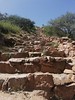
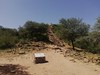
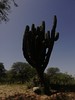
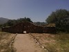
The above images may not be of the site on this page, but were taken nearby. They are loaded from Flickr so please click on them for image credits.
Click here to see more info for this site
Nearby sites
Click here to view sites on an interactive map of the areaKey: Red: member's photo, Blue: 3rd party photo, Yellow: other image, Green: no photo - please go there and take one, Grey: site destroyed
Download sites to:
KML (Google Earth)
GPX (GPS waypoints)
CSV (Garmin/Navman)
CSV (Excel)
To unlock full downloads you need to sign up as a Contributory Member. Otherwise downloads are limited to 50 sites.
Turn off the page maps and other distractions
Nearby sites listing. In the following links * = Image available
158.0km NE 44° Fuerte Quemado* Ancient Village or Settlement
167.2km ENE 61° Tafi del Valle* Sculptured Stone
174.4km NE 46° Museo Pachamama* Museum
176.7km NE 40° Los Quilmes* Ancient Village or Settlement
302.9km NNE 20° Archaeological Museum Pío Pablo Díaz* Museum
303.7km NNE 20° Mariscal Ancient Village or Settlement
305.4km NNE 19° Bogatta Ancient Village or Settlement
337.4km NNE 20° Potrero de Payogasta* Ancient Village or Settlement
358.9km NNW 337° Llullaillaco Vault Chambered Tomb
367.3km NNE 29° MAAM* Museum
371.6km NW 315° San Ramon 15 Ancient Mine, Quarry or other Industry
388.1km WSW 242° Los petroglifos del Cerro La Silla Rock Art
466.8km WSW 237° Archaeological Museum of La Serena* Museum
469.3km SW 229° Stone house Pichasca* Ancient Village or Settlement
474.0km SW 229° Petroglifos de las Tinajas* Rock Art
489.4km NNE 22° Pucará de Tilcara* Ancient Village or Settlement
495.5km NNE 13° Barrancas Rock Art
496.9km NNE 21° Pucará de Juella Hillfort
500.9km NNE 22° Pucará del Angosto de Perchel Hillfort
504.4km NNE 22° La Huerta Ancient Village or Settlement
508.8km NNE 22° Pucará de Campo Morado Hillfort
513.8km NNE 21° Los Armarillos Ancient Village or Settlement
513.9km NNE 21° Pucará de Yacoraite Hillfort
527.9km SW 230° Valle del Encanto* Rock Art
532.1km NNE 21° Pucará de Peñas Blancas Hillfort
View more nearby sites and additional images


 We would like to know more about this location. Please feel free to add a brief description and any relevant information in your own language.
 Wir möchten mehr über diese Stätte erfahren. Bitte zögern Sie nicht, eine kurze Beschreibung und relevante Informationen in Deutsch hinzuzufügen.
 Nous aimerions en savoir encore un peu sur les lieux. S'il vous plaît n'hesitez pas à ajouter une courte description et tous les renseignements pertinents dans votre propre langue.
 Quisieramos informarnos un poco más de las lugares. No dude en añadir una breve descripción y otros datos relevantes en su propio idioma.