<< Text Pages >> Gamu Haiytheli - Ancient Temple in Maldives
Submitted by KaiHofmann on Sunday, 28 July 2013 Page Views: 4903
Multi-periodSite Name: Gamu HaiytheliCountry: Maldives
NOTE: This site is 2586.666 km away from the location you searched for.
Type: Ancient Temple
Nearest Village: Mukurimagu
Latitude: 1.901316N Longitude: 73.536649E
Condition:
| 5 | Perfect |
| 4 | Almost Perfect |
| 3 | Reasonable but with some damage |
| 2 | Ruined but still recognisable as an ancient site |
| 1 | Pretty much destroyed, possibly visible as crop marks |
| 0 | No data. |
| -1 | Completely destroyed |
| 5 | Superb |
| 4 | Good |
| 3 | Ordinary |
| 2 | Not Good |
| 1 | Awful |
| 0 | No data. |
| 5 | Can be driven to, probably with disabled access |
| 4 | Short walk on a footpath |
| 3 | Requiring a bit more of a walk |
| 2 | A long walk |
| 1 | In the middle of nowhere, a nightmare to find |
| 0 | No data. |
| 5 | co-ordinates taken by GPS or official recorded co-ordinates |
| 4 | co-ordinates scaled from a detailed map |
| 3 | co-ordinates scaled from a bad map |
| 2 | co-ordinates of the nearest village |
| 1 | co-ordinates of the nearest town |
| 0 | no data |
Be the first person to rate this site - see the 'Contribute!' box in the right hand menu.
Internal Links:
External Links:
Ancient Temple in Maldives Islands
Ruins of an ancient Buddhist temple on Mudhin Hinna in the Mukurimagu ward.
You may be viewing yesterday's version of this page. To see the most up to date information please register for a free account.
Do not use the above information on other web sites or publications without permission of the contributor.
Nearby Images from Flickr

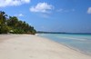


The above images may not be of the site on this page, but were taken nearby. They are loaded from Flickr so please click on them for image credits.
Click here to see more info for this site
Nearby sites
Click here to view sites on an interactive map of the areaKey: Red: member's photo, Blue: 3rd party photo, Yellow: other image, Green: no photo - please go there and take one, Grey: site destroyed
Download sites to:
KML (Google Earth)
GPX (GPS waypoints)
CSV (Garmin/Navman)
CSV (Excel)
To unlock full downloads you need to sign up as a Contributory Member. Otherwise downloads are limited to 50 sites.
Turn off the page maps and other distractions
Nearby sites listing. In the following links * = Image available
339.8km N 359° Kuruhinna Tharaagandu* Ancient Temple
818.2km NNE 33° Kanniyakumari* Ancient Temple
823.3km NNE 27° Padmanabhaswamy Temple* Ancient Temple
836.8km NNE 25° Janardana Swami Temple Ancient Temple
905.1km NNE 29° Kilikkallingal Kodakkal stones* Burial Chamber or Dolmen
909.4km NE 54° Pahiyangala, Sri Lanka Cave or Rock Shelter
926.3km ENE 59° Mulkirigala* Ancient Temple
933.7km NE 54° Batadomba Lena Cave Cave or Rock Shelter
934.2km ENE 60° Kasagala Vihara* Ancient Temple
937.2km ENE 60° Kahandawa Purana Viharaya* Ancient Temple
945.2km NE 55° Adam's Peak* Natural Stone / Erratic / Other Natural Feature
948.9km ENE 60° Ussangoda* Natural Stone / Erratic / Other Natural Feature
955.8km ENE 60° Gothapabbata Vihara* Ancient Temple
958.3km ENE 60° Karabagala Aranya Senasanaya Cave or Rock Shelter
958.8km NNE 21° Nedumala Caves Cave or Rock Shelter
965.0km NNE 17° Muziris Ancient Village or Settlement
967.5km NNE 25° Thovalappady Cist
968.9km NE 51° Gal Messa of Padavigampola* Burial Chamber or Dolmen
981.3km NE 55° Seetha Amman Temple* Modern Stone Circle etc
986.7km ENE 60° Galkanumandiya Ruins* Ancient Temple
987.0km ENE 60° Yatala Dagoba* Ancient Temple
987.9km ENE 60° Building of the Silapassa Parivena Ancient Temple
988.2km ENE 60° Tissamaharama Raja Maha Vihara Ancient Temple
988.6km ENE 60° Tissa Sandagiri Vihara Ancient Temple
988.8km ENE 61° Kirinda Temple* Ancient Temple
View more nearby sites and additional images


 We would like to know more about this location. Please feel free to add a brief description and any relevant information in your own language.
 Wir möchten mehr über diese Stätte erfahren. Bitte zögern Sie nicht, eine kurze Beschreibung und relevante Informationen in Deutsch hinzuzufügen.
 Nous aimerions en savoir encore un peu sur les lieux. S'il vous plaît n'hesitez pas à ajouter une courte description et tous les renseignements pertinents dans votre propre langue.
 Quisieramos informarnos un poco más de las lugares. No dude en añadir una breve descripción y otros datos relevantes en su propio idioma.