Contributory members are able to log private notes and comments about each site
Sites markj99 has logged. View this log as a table or view the most recent logs from everyone
Narrator Brookhead Cairn
Date Added: 30th Aug 2025
Site Type: Cairn
Country: England (Devon)
Visited: Yes on 29th Nov 2017. My rating: Condition 3 Ambience 4 Access 2
Narrator Brookhead Cairn submitted by TheCaptain on 22nd Nov 2010. This is a big old cairn about 20 metres in diameter, and up to 2 metres high.
(View photo, vote or add a comment)
Log Text: Narrator Brookhead Cairn is a different animal to the kerb cairn on the WSW end of Down Tor Stone Row. It is a substantial mound retaining a covering of original stones. It is probable that it has been robbed to construct the enclosure c. 75 yards WSW. There is an intriguing recumbent stone c. 6 feet long located c. 15 yards NW of the cairn.
Na Tri Sithean
Date Added: 5th Jul 2025
Site Type: Chambered Cairn
Country: Scotland (Caithness)
Visited: Yes on 4th Sep 2021. My rating: Condition 3 Ambience 5 Access 4
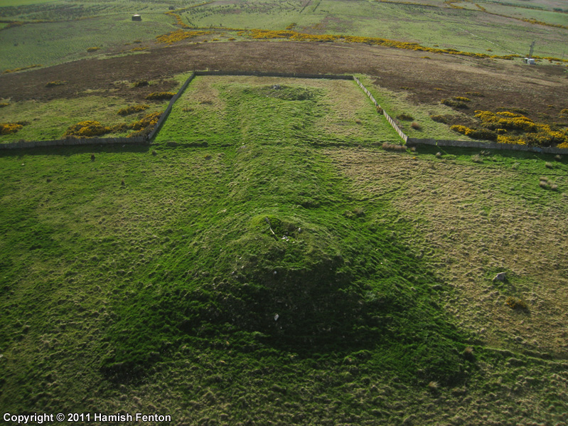
Na Tri Sithean submitted by h_fenton on 18th Aug 2011. Na Tri Sithean - chambered long horned cairn dating from the Neolithic, this particular cairn is one of the largest and the best preserved of its type. It measures 32m long, 9.7 metres wide and 1.2 metres high. The ends of the cairn grow into large mounds, the larger mound at the southeast end is 21.3metres wide and 3 metres high, the smaller mound at the northwestern end is 18 metres wide and 2.1metres high.
Kite Aerial Photograph taken from the southeast.
10 May 2011
(View photo, vote or add a comment)
Log Text: Na Tri Sithean Long Cairn is easily visited from a dedicated car park off the single track road between Shebster and Skiall. An uphill path leads to a pair of long cairns. The N long cairn, Cnoc Freiceadain runs from SW to NE, with a round terminal cairn on the SW end. Na Tri Sithean long cairn starts c. 100 yards SSW at a terminal cairn. It runs ESE-WSW.
Mynydd Cefn Amlwch
Date Added: 15th Apr 2021
Site Type: Chambered Tomb
Country: Wales (Gwynedd)
Visited: Yes on 25th Aug 2014. My rating: Condition 3 Ambience 4 Access 4
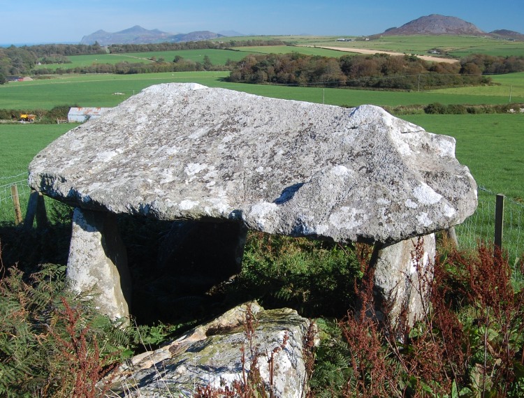
Mynydd Cefn Amlwch submitted by pab on 16th Oct 2007. On a wonderfully clear day in October, looking north east up the Lleyn Peninsula.
The location is noted on COFLEIN as also being known as Coetan Arthur, their ref being NPRN: 93509, at GR SH22973456.
(View photo, vote or add a comment)
Log Text: Mynydd Cefn Amlwch is in a pastoral setting protected from livestock by a wooden fence. It is a classic tripod dolmen. I enjoyed the quiet ambience of the site.
Mother's Jam
Date Added: 21st Nov 2022
Site Type: Natural Stone / Erratic / Other Natural Feature
Country: England (Wiltshire)
Visited: Yes on 8th Feb 2011. My rating: Condition 5 Ambience 5 Access 2
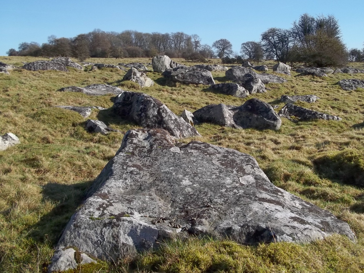
Mother's Jam submitted by markj99 on 17th Nov 2022. Mother's Jam viewed from SE.
(View photo, vote or add a comment)
Log Text: I combined my visit to Mother's Jam with The Polisher, a very impressive, grooved stone used to manufacture ceremonial axes. Polisher stones are very rare, a must visit.
Moss Knowes
Date Added: 14th Nov 2023
Site Type: Natural Stone / Erratic / Other Natural Feature
Country: Scotland (South Ayrshire)
Visited: Yes on 26th Sep 2009. My rating: Condition 4 Ambience 4 Access 1
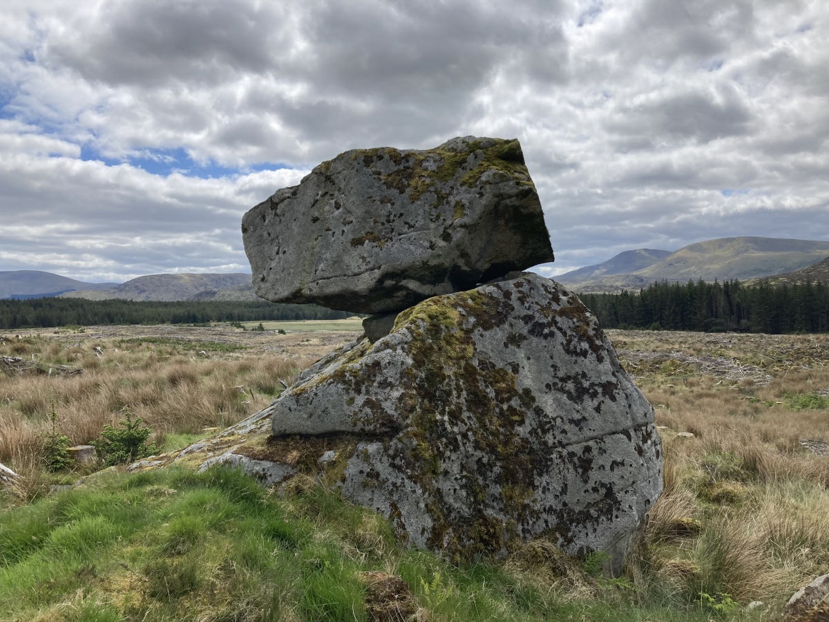
Moss Knowes submitted by markj99 on 28th May 2023. Moss Knowes Rocking Stone viewed from NW.
(View photo, vote or add a comment)
Log Text: When I first saw Moss Knowes Rocking Stone it was on the edge of a pine forest on the way to Tunskeen Bothy.
Moss Knowes
Date Added: 14th Nov 2023
Site Type: Natural Stone / Erratic / Other Natural Feature
Country: Scotland (South Ayrshire)
Visited: Yes on 27th May 2023. My rating: Condition 4 Ambience 4 Access 1

Moss Knowes submitted by markj99 on 28th May 2023. Moss Knowes Rocking Stone viewed from NW.
(View photo, vote or add a comment)
Log Text: On my return to Moss Knowe Rocking Stone, the pine forest had been felled. The stone was now on the edge of a large clearing, still intact.
Morangie Forest
Date Added: 30th May 2025
Site Type: Chambered Cairn
Country: Scotland (Highlands)
Visited: Yes on 26th Apr 2012. My rating: Condition 3 Ambience 4 Access 2

Morangie Forest submitted by markj99 on 30th May 2025. An Excavated Pit in Carn Liath (Morangie Forest) Long Cairn.
(View photo, vote or add a comment)
Log Text: Carn Liath (Morangie Forest) is hidden in forestry c. 3 miles WSW of Tain. It is possible to access the cairn by walking or cycling 2.2 miles from Aldie Burn Car Park off Scotsburn road. See main page for directions.
Moorgate menhir
Date Added: 15th Nov 2022
Site Type: Standing Stone (Menhir)
Country: England (Cornwall)
Visited: Yes on 30th May 2019. My rating: Condition 4 Ambience 4 Access 4
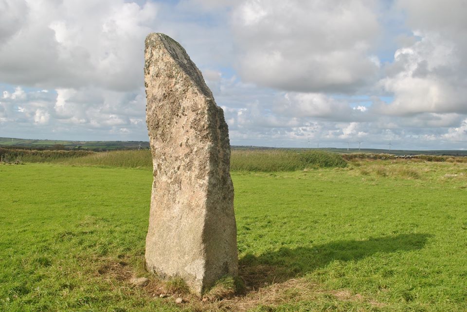
Moorgate menhir submitted by lucasn on 12th Jun 2020. Moorgate Menhir
(View photo, vote or add a comment)
Log Text: Moorgate Menhir is one of the taller standing stones in Cornwall and easily accessible from a path. What's not to like?
Mochrum Fell (Elrig)
Date Added: 24th Oct 2023
Site Type: Cairn
Country: Scotland (Dumfries and Galloway)
Visited: Yes on 4th Aug 2023. My rating: Condition 3 Ambience 5 Access 3
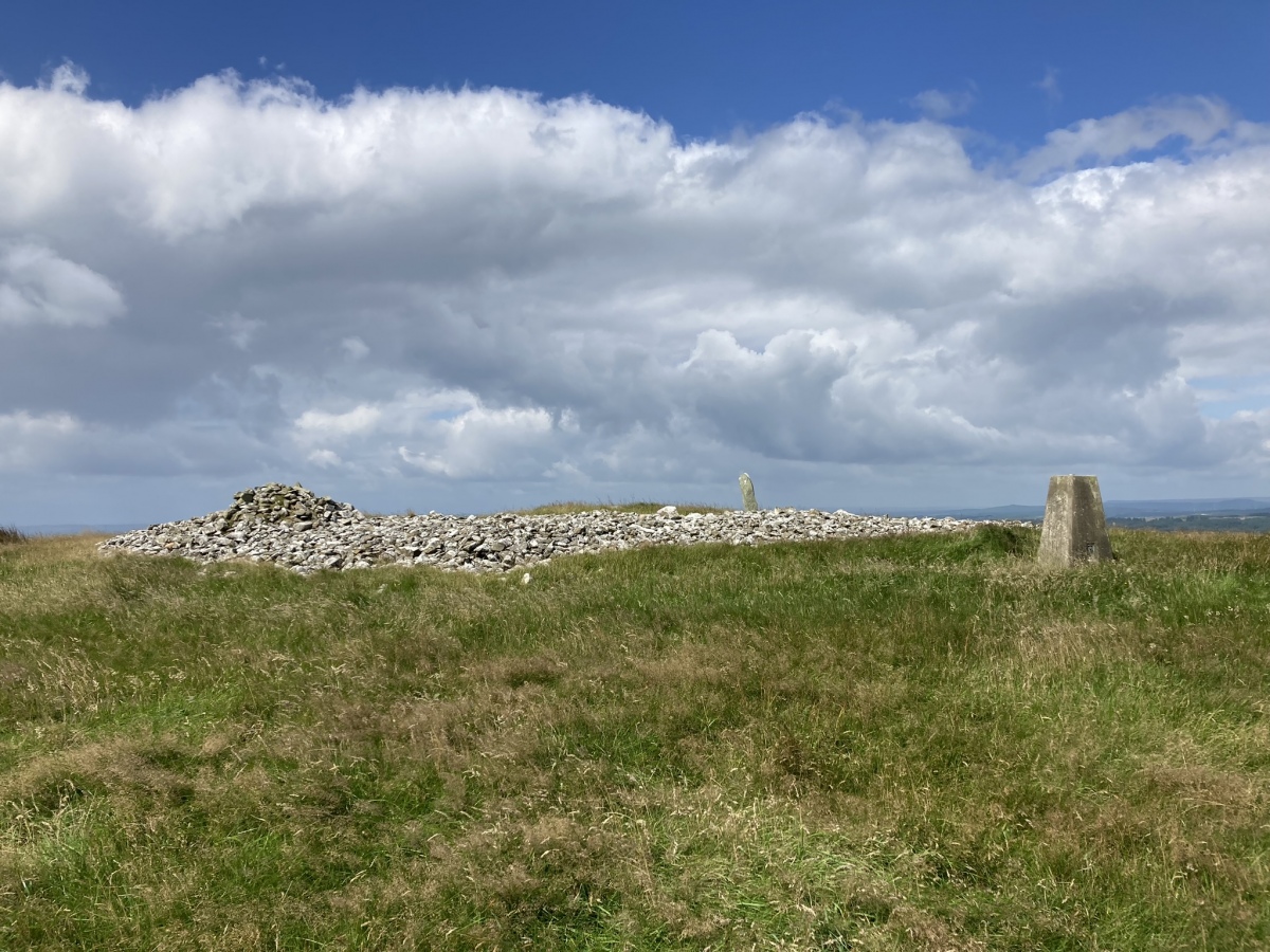
Mochrum Fell (Elrig) submitted by markj99 on 5th Aug 2023. Mochrum Fell (Elrig) Cairn viewed from east.
(View photo, vote or add a comment)
Log Text: Directions to Mochrum Fell (Elrig): Take the A747 Port William turn off the A75 at Glenluce. Stay on the A747 for c. 6.6 miles to an unsigned left turn onto the B7005 at NX 27136 49953. Travel on the B7005 for c. 2.2 miles to reach a minor road signed for Kirkcowan. Continue on the B7005 for c. 300 yards to a track opposite Culshabbin Schoolhouse at NX 30667 51023. There is room to park up here. Follow the track S for c. 0.5 mile. Turn right at NX 3104 5036 onto a vague path heading W through rough ground. Stay on this path heading uphill to the obvious summit of Mochrum Fell. The cairn is on the summit of Mochrum Fell. My route is viewable on Mochrum Fell (Elrig) Cairn.
Minions Platform Round Barrow
Date Added: 21st Jun 2023
Site Type: Cairn
Country: England (Cornwall)
Visited: Yes on 6th Jun 2023. My rating: Condition 2 Ambience 4 Access 3
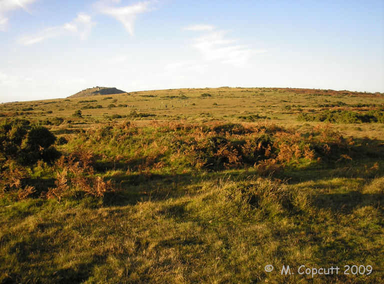
Minions Platform Round Barrow submitted by thecaptain on 22nd Oct 2009. The platform cairn marked on OS Maps as "Minions Mound", but in reality is not.
View here to The Hurlers, with Stowe's Pound and the Rillaton Barrow on the horizon.
(View photo, vote or add a comment)
Log Text: The tumulus may not be well preserved but it is only 300 yards NW of Minions Car Park, so why not take a small detour before visiting the Hurlers.
Minions Mound
Date Added: 21st Jun 2023
Site Type: Round Barrow(s)
Country: England (Cornwall)
Visited: Yes on 6th Jun 2023. My rating: Condition 2 Ambience 3 Access 4
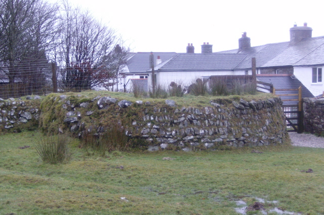
Minions Mound submitted by windowman on 21st Jan 2012. Minions Mound, a bronze age cairn that is situated by the car park for the Hurlers stone circle site. Easy to miss, many if not all the visitors to the car park are probably unaware just what this small mound is. The mound was damaged when the walls for the adjacent cottages were built, and half the mound was cut away, forming a 'D' shape. The cairn gave it's name to the village of Minions, which was previously called Cheewring Railway, a major junction point for the original Liskeard and Carad...
(View photo, vote or add a comment)
Log Text: The stone wall constructed round the mound may be protecting it for future antiquarians, however it also disguises the antiquity of the site.
Milton Loch SE
Date Added: 18th Dec 2023
Site Type: Crannog
Country: Scotland (Dumfries and Galloway)
Visited: Yes on 22nd Jun 2023. My rating: Condition 2 Ambience 3 Access 3
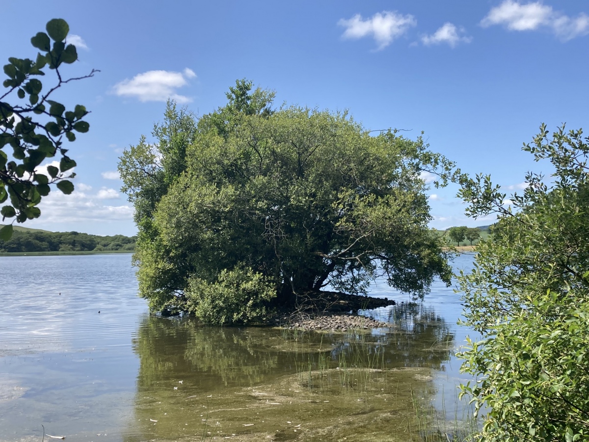
Milton Loch SE submitted by markj99 on 27th Jun 2023. Milton Loch SE Crannog viewed from the east.
(View photo, vote or add a comment)
Log Text: Directions: Take the Park of Brandedleys turn off the A75 on the SW edge of Crocketford. Follow the road for c. 0.8 mile to Auchengibbert Farm. Bear left to Kirkgungeon for c. 0.8 mile to a lay-by at the junction with Little Milton farm road on the left. Park up and walk for c. 250 yards down the farm road to a large lay-by on the left. Head W through the trees to the loch's edge. Milton Loch SE Crannog is c. 20 yards off the E bank. My route is viewable on Milton Loch SE Crannog.
Milton Loch NW
Date Added: 12th Nov 2023
Site Type: Crannog
Country: Scotland (Dumfries and Galloway)
Visited: Yes on 22nd Jun 2023. My rating: Condition 2 Ambience 3 Access 3
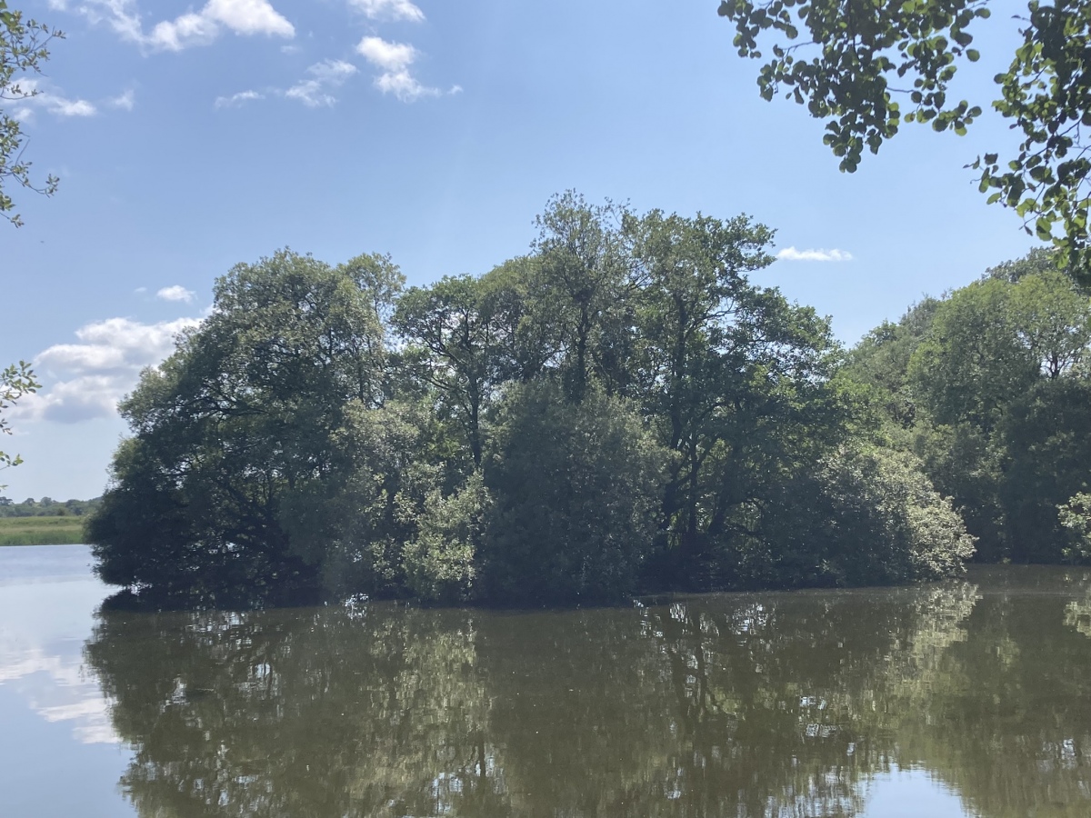
Milton Loch NW submitted by markj99 on 26th Jun 2023. Milton Loch NW Crannog viewed from NNE.
(View photo, vote or add a comment)
Log Text: Directions to Green Island, Milton Loch: Take the Park of Brandedleys turn off the A75 on the SW edge of Crocketford. Follow the road for c. 0.8 mile to Auchengibbert Farm. Bear left to Kirkgunzeon for c. 0.2 mile to a passing place on the left. Park up and follow a vague path along the margin of the field to the W bank of Milton Loch. My route is viewable on Milton Loch Crannogs.
Milton Loch Central
Date Added: 12th Nov 2023
Site Type: Crannog
Country: Scotland (Dumfries and Galloway)
Visited: Yes on 22nd Jun 2023. My rating: Condition 2 Ambience 3 Access 3
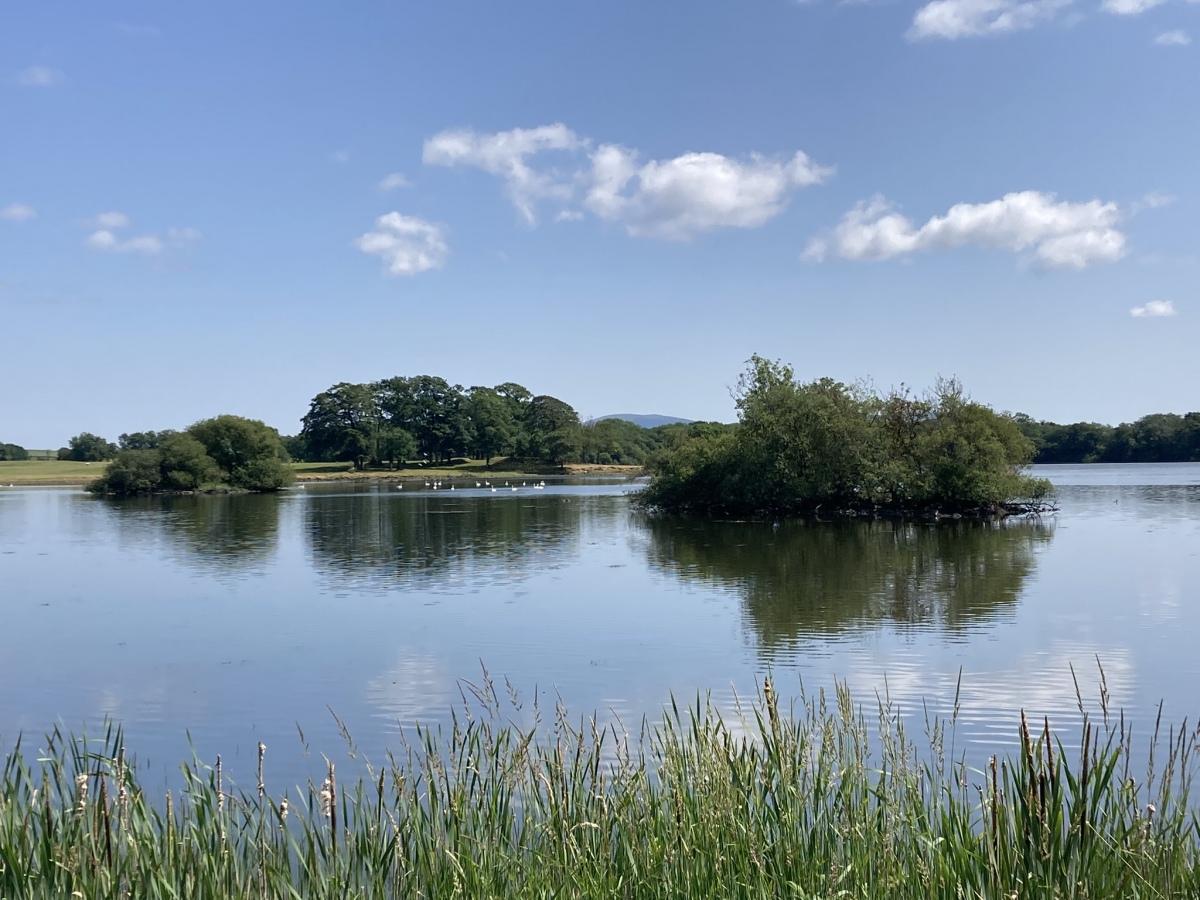
Milton Loch Central submitted by markj99 on 26th Jun 2023. Milton Loch Central Crannog (left background) viewed from NW.
(View photo, vote or add a comment)
Log Text: Directions to Green Island, Milton Loch: Take the Park of Brandedleys turn off the A75 on the SW edge of Crocketford. Follow the road for c. 0.8 mile to Auchengibbert Farm. Bear left to Kirkgunzeon for c. 0.2 mile to a passing place on the left. Park up and follow a vague path along the margin of the field to the W bank of Milton Loch. My route is viewable on Milton Loch Crannogs.
Milton Hill
Date Added: 20th May 2021
Site Type: Standing Stones
Country: Scotland (Dumfries and Galloway)
Visited: Yes on 7th Feb 2009. My rating: Condition 4 Ambience 5 Access 3
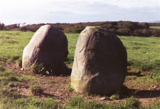
Milton Hill submitted by cosmic on 7th Oct 2004. Along the Line
(View photo, vote or add a comment)
Log Text: There is something magical about a perfectly matched pair of standing stones. The Blairbuy Stones are almost perfectly matched in shape and size. They could be the portal to another world.
Millmoan Hill
Date Added: 19th May 2024
Site Type: Cairn
Country: Scotland (South Ayrshire)
Visited: Yes on 16th May 2024. My rating: Condition 2 Ambience 4 Access 3
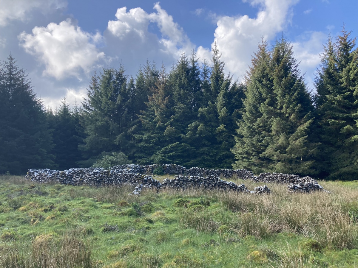
Millmoan Hill submitted by markj99 on 18th May 2024. Millmoan Hill Cairn viewed from N.
(View photo, vote or add a comment)
Log Text: Millmoan Hill Cairn is located in a forest clearing, easily accessed via an obscure forest track off the A77. Directions are available in Comments on the site page.
Middleton Standing Stone (Isle of Tiree)
Date Added: 26th Nov 2022
Site Type: Standing Stone (Menhir)
Country: Scotland (Isle of Tiree)
Visited: Yes on 27th Aug 2018. My rating: Condition 4 Ambience 4 Access 4
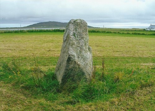
Middleton Standing Stone (Isle of Tiree) submitted by Bladup on 27th Jan 2013. Middleton Standing Stone.
(View photo, vote or add a comment)
Log Text: I accessed Middleton Standing Stone via a croft on the W edge of Barrapoll.
Merry Maidens Holed Stone
Date Added: 21st Jun 2025
Site Type: Holed Stone
Country: England (Cornwall)
Visited: Yes on 8th Feb 2019. My rating: Condition 3 Ambience 4 Access 4
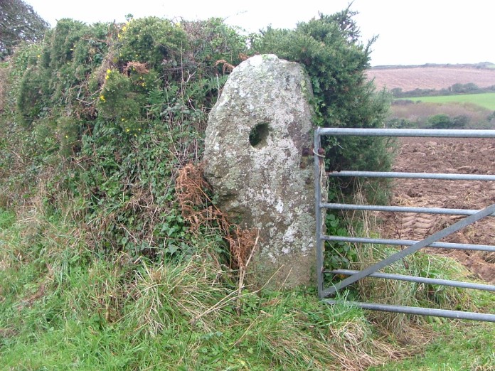
Merry Maidens Holed Stone submitted by enkidu41 on 15th Nov 2004. A definite change of use over the millennia!
(View photo, vote or add a comment)
Log Text: I found Choone Holed Stone by walking c. 250 yards NE along the B3315 from the Merry Maidens Car Park. It is located in the first gateway on the left. In summer it may be obscured by vegetation
Merry Maidens (Circle)
Date Added: 5th Apr 2023
Site Type: Stone Circle
Country: England (Cornwall)
Visited: Yes on 18th Feb 2019. My rating: Condition 4 Ambience 4 Access 4
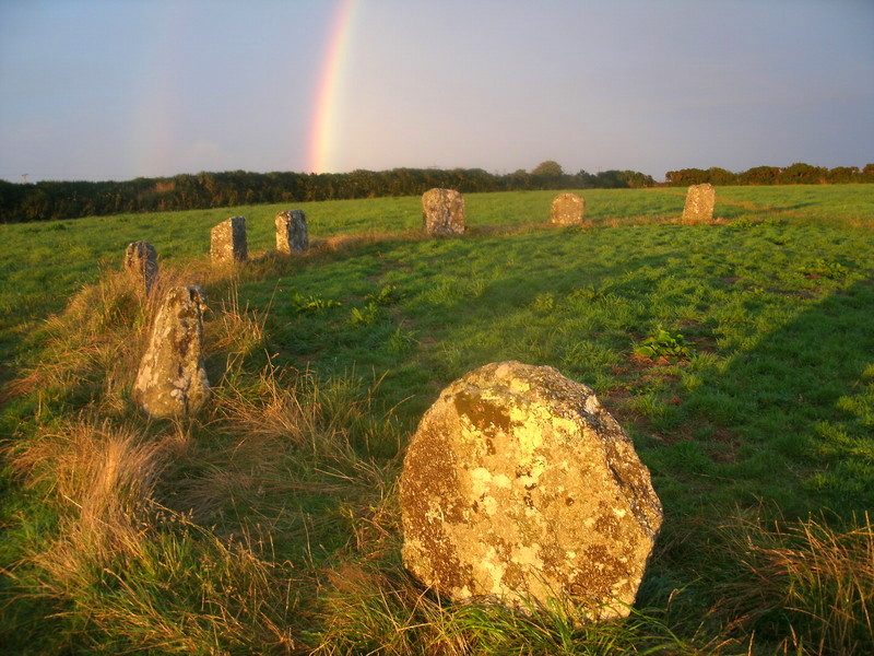
Merry Maidens (Circle) submitted by Bladup on 19th Aug 2013. A Rainbow and the light from the setting sun shining onto Merry Maidens stone circle.
(View photo, vote or add a comment)
Log Text: The Merry Maidens Stone Circle is a beautiful little monument with easy access and parking.
Merrivale Second Menhir and Cairn
Date Added: 14th Nov 2022
Site Type: Standing Stone (Menhir)
Country: England (Devon)
Visited: Yes on 28th Nov 2017. My rating: Condition 2 Ambience 4 Access 3
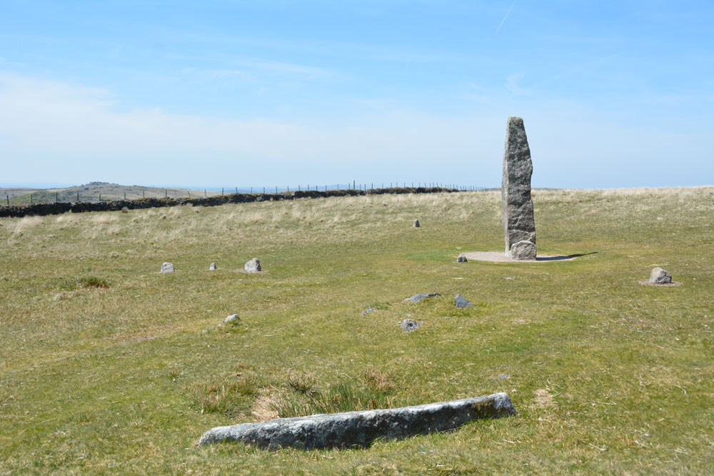
Merrivale Second Menhir and Cairn submitted by Anne T on 9th Jul 2019. To show the relationship of these monuments with the tall Merrivale Menhir, the recumbent granite pillar is in the foreground, with its pit immediately behind it; the cairn is visible as a low mound behind it (just right of centre) The tall menhir is in the background. The cairn is 5.5m from the menhirs and the granite slab 2m from the cairn. Row 4 runs from the centre to the middle left of the photo; the western stone of row 6 is to the left hand side of the menhir.
(View photo, vote or add a comment)
Log Text: I wasn't sure if the recumbent stone was part of an alignment with the standing stone or part of the ruined cairn.
