


<< Our Photo Pages >> Mas de Torreau Dolmen 2 - Burial Chamber or Dolmen in France in Languedoc:Hérault (34)
Submitted by TheCaptain on Thursday, 10 February 2005 Page Views: 2716
Neolithic and Bronze AgeSite Name: Mas de Torreau Dolmen 2 Alternative Name: Las Tianas 2Country: France Département: Languedoc:Hérault (34) Type: Burial Chamber or Dolmen
Nearest Town: Lodève Nearest Village: Arboras
Latitude: 43.761477N Longitude: 3.507193E
Condition:
| 5 | Perfect |
| 4 | Almost Perfect |
| 3 | Reasonable but with some damage |
| 2 | Ruined but still recognisable as an ancient site |
| 1 | Pretty much destroyed, possibly visible as crop marks |
| 0 | No data. |
| -1 | Completely destroyed |
| 5 | Superb |
| 4 | Good |
| 3 | Ordinary |
| 2 | Not Good |
| 1 | Awful |
| 0 | No data. |
| 5 | Can be driven to, probably with disabled access |
| 4 | Short walk on a footpath |
| 3 | Requiring a bit more of a walk |
| 2 | A long walk |
| 1 | In the middle of nowhere, a nightmare to find |
| 0 | No data. |
| 5 | co-ordinates taken by GPS or official recorded co-ordinates |
| 4 | co-ordinates scaled from a detailed map |
| 3 | co-ordinates scaled from a bad map |
| 2 | co-ordinates of the nearest village |
| 1 | co-ordinates of the nearest town |
| 0 | no data |
Be the first person to rate this site - see the 'Contribute!' box in the right hand menu.
Internal Links:
External Links:
I have visited· I would like to visit
regina has visited here
")
Location Source: T4T35.fr
You may be viewing yesterday's version of this page. To see the most up to date information please register for a free account.
")
Do not use the above information on other web sites or publications without permission of the contributor.
Nearby Images from Flickr
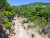
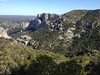
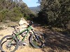
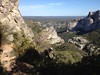
The above images may not be of the site on this page, but were taken nearby. They are loaded from Flickr so please click on them for image credits.
Click here to see more info for this site
Nearby sites
Click here to view sites on an interactive map of the areaKey: Red: member's photo, Blue: 3rd party photo, Yellow: other image, Green: no photo - please go there and take one, Grey: site destroyed
Download sites to:
KML (Google Earth)
GPX (GPS waypoints)
CSV (Garmin/Navman)
CSV (Excel)
To unlock full downloads you need to sign up as a Contributory Member. Otherwise downloads are limited to 50 sites.
Turn off the page maps and other distractions
Nearby sites listing. In the following links * = Image available
93m S 179° Mas de Torreau Dolmen 3* Burial Chamber or Dolmen
150m E 93° Mas de Torreau Dolmen 1* Burial Chamber or Dolmen
1.3km W 278° Dolmen de la Bergerie d'Azirou Burial Chamber or Dolmen
1.9km NE 48° Menhir du Travers des Pioch* Standing Stone (Menhir)
2.0km NNW 336° Bois de la Tude dolmen Burial Chamber or Dolmen
2.1km NE 35° Menhir du Pioch de la Boffia 2* Standing Stone (Menhir)
2.1km NE 35° Menhir du Pioch de la Boffia 1* Standing Stone (Menhir)
2.4km W 264° Menhir du Devois de la Trivalle Standing Stone (Menhir)
2.5km NNE 18° Dolmen de Saint-Martin-d'Azirou Burial Chamber or Dolmen
2.6km ENE 59° Menhir de Lavagnes* Standing Stone (Menhir)
2.8km NE 49° Dolmen de Rigoule* Burial Chamber or Dolmen
3.3km ENE 70° Menhir Pierre de Lapourdous* Standing Stone (Menhir)
3.4km NW 310° Camp del Roube* Chambered Tomb
3.4km ENE 56° Lacam des Lavagnes menhir* Standing Stone (Menhir)
3.7km NW 325° Petit Dolmen du Ferrussac* Burial Chamber or Dolmen
3.7km NNW 330° Grand Dolmen du Ferrussac* Burial Chamber or Dolmen
3.7km NNW 329° Menhir de Ferrussac 1* Standing Stone (Menhir)
3.7km NNW 331° Menhir de Ferrussac 2* Standing Stone (Menhir)
4.0km NE 35° Dolmen de la Roubie Burial Chamber or Dolmen
4.3km NNE 15° Dolmen de la Cisternette Burial Chamber or Dolmen
4.3km SW 229° Menhir Côte d'Arboras* Standing Stone (Menhir)
4.6km SE 132° Abbey of Saint Guilhem le Desert* Early Christian Sculptured Stone
4.7km NE 51° Dolmen de Thières* Burial Chamber or Dolmen
4.8km SW 215° Menhir Bois de la Sourde* Standing Stone (Menhir)
4.8km SSW 208° Dolmen du Bois de la Sourde Burial Chamber or Dolmen
View more nearby sites and additional images


 We would like to know more about this location. Please feel free to add a brief description and any relevant information in your own language.
 Wir möchten mehr über diese Stätte erfahren. Bitte zögern Sie nicht, eine kurze Beschreibung und relevante Informationen in Deutsch hinzuzufügen.
 Nous aimerions en savoir encore un peu sur les lieux. S'il vous plaît n'hesitez pas à ajouter une courte description et tous les renseignements pertinents dans votre propre langue.
 Quisieramos informarnos un poco más de las lugares. No dude en añadir una breve descripción y otros datos relevantes en su propio idioma.