


<< Text Pages >> Ciste de Palats - Burial Chamber or Dolmen in France in Languedoc:Aude (11)
Submitted by TheCaptain on Thursday, 10 February 2005 Page Views: 2847
Neolithic and Bronze AgeSite Name: Ciste de PalatsCountry: France Département: Languedoc:Aude (11) Type: Burial Chamber or Dolmen
Nearest Town: Narbonne Nearest Village: Fontjoncouse
Latitude: 43.023300N Longitude: 2.778290E
Condition:
| 5 | Perfect |
| 4 | Almost Perfect |
| 3 | Reasonable but with some damage |
| 2 | Ruined but still recognisable as an ancient site |
| 1 | Pretty much destroyed, possibly visible as crop marks |
| 0 | No data. |
| -1 | Completely destroyed |
| 5 | Superb |
| 4 | Good |
| 3 | Ordinary |
| 2 | Not Good |
| 1 | Awful |
| 0 | No data. |
| 5 | Can be driven to, probably with disabled access |
| 4 | Short walk on a footpath |
| 3 | Requiring a bit more of a walk |
| 2 | A long walk |
| 1 | In the middle of nowhere, a nightmare to find |
| 0 | No data. |
| 5 | co-ordinates taken by GPS or official recorded co-ordinates |
| 4 | co-ordinates scaled from a detailed map |
| 3 | co-ordinates scaled from a bad map |
| 2 | co-ordinates of the nearest village |
| 1 | co-ordinates of the nearest town |
| 0 | no data |
Be the first person to rate this site - see the 'Contribute!' box in the right hand menu.
Internal Links:
External Links:
Dolmen in Aude
You may be viewing yesterday's version of this page. To see the most up to date information please register for a free account.
Do not use the above information on other web sites or publications without permission of the contributor.
Nearby Images from Flickr
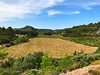
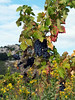
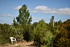
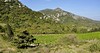


The above images may not be of the site on this page, but were taken nearby. They are loaded from Flickr so please click on them for image credits.
Click here to see more info for this site
Nearby sites
Click here to view sites on an interactive map of the areaKey: Red: member's photo, Blue: 3rd party photo, Yellow: other image, Green: no photo - please go there and take one, Grey: site destroyed
Download sites to:
KML (Google Earth)
GPX (GPS waypoints)
CSV (Garmin/Navman)
CSV (Excel)
To unlock full downloads you need to sign up as a Contributory Member. Otherwise downloads are limited to 50 sites.
Turn off the page maps and other distractions
Nearby sites listing. In the following links * = Image available
456m SSW 194° Dolmen de la Mulgue* Burial Chamber or Dolmen
581m W 269° Dolmen de Palats* Burial Chamber or Dolmen
645m SW 223° Coffre mégalitique de Moural Grand* Cist
2.5km NNW 331° Dolmen de Bellongue Burial Chamber or Dolmen
2.9km NNE 16° Fontjoncouse 3 burial chamber Burial Chamber or Dolmen
4.5km SE 135° Durban-Corbieres burial chamber Burial Chamber or Dolmen
10.9km NW 307° La Pierre de Charlemagne Standing Stone (Menhir)
11.1km W 279° Peira Dreta de Talairan Standing Stone (Menhir)
11.4km NW 304° Tournissan burial chamber Burial Chamber or Dolmen
11.5km ESE 112° Dolmen de l'Aven Burial Chamber or Dolmen
12.1km WNW 295° La Coumette* Standing Stone (Menhir)
12.5km WNW 299° La Pèira Dreta (Tournissan)* Standing Stone (Menhir)
14.7km E 80° Oppidum de Pech de Maho* Ancient Village or Settlement
14.7km ESE 105° Roquefort-des-Corbieres burial chamber Burial Chamber or Dolmen
14.8km W 279° St-Pierre-des-Champs burial chamber Burial Chamber or Dolmen
15.1km WSW 258° Dolmen de Porteille* Burial Chamber or Dolmen
15.7km WSW 243° Davejean burial chamber Burial Chamber or Dolmen
17.1km WSW 256° Moulintour menhir* Standing Stone (Menhir)
17.8km WSW 257° Roc de Fenne Prenz* Cave or Rock Shelter
18.2km SW 234° Dernacueillette burial chamber Burial Chamber or Dolmen
18.3km WSW 244° Dolmen de la Clape 8* Burial Chamber or Dolmen
18.3km WSW 244° Dolmen de la Clape 7 Burial Chamber or Dolmen
18.4km WSW 244° Dolmen de la Clape 3 Burial Chamber or Dolmen
18.4km WSW 244° Dolmen de la Clape 6 Burial Chamber or Dolmen
18.4km WSW 244° Dolmen de la Clape 5 Burial Chamber or Dolmen
View more nearby sites and additional images


 We would like to know more about this location. Please feel free to add a brief description and any relevant information in your own language.
 Wir möchten mehr über diese Stätte erfahren. Bitte zögern Sie nicht, eine kurze Beschreibung und relevante Informationen in Deutsch hinzuzufügen.
 Nous aimerions en savoir encore un peu sur les lieux. S'il vous plaît n'hesitez pas à ajouter une courte description et tous les renseignements pertinents dans votre propre langue.
 Quisieramos informarnos un poco más de las lugares. No dude en añadir una breve descripción y otros datos relevantes en su propio idioma.