


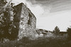
<< Our Photo Pages >> Dolmen de l'Arquette 1 - Burial Chamber or Dolmen in France in Languedoc:Aude (11)
Submitted by TheCaptain on Thursday, 10 February 2005 Page Views: 2887
Neolithic and Bronze AgeSite Name: Dolmen de l'Arquette 1Country: France Département: Languedoc:Aude (11) Type: Burial Chamber or Dolmen
Nearest Town: Maury Nearest Village: Massac
Latitude: 42.926279N Longitude: 2.578635E
Condition:
| 5 | Perfect |
| 4 | Almost Perfect |
| 3 | Reasonable but with some damage |
| 2 | Ruined but still recognisable as an ancient site |
| 1 | Pretty much destroyed, possibly visible as crop marks |
| 0 | No data. |
| -1 | Completely destroyed |
| 5 | Superb |
| 4 | Good |
| 3 | Ordinary |
| 2 | Not Good |
| 1 | Awful |
| 0 | No data. |
| 5 | Can be driven to, probably with disabled access |
| 4 | Short walk on a footpath |
| 3 | Requiring a bit more of a walk |
| 2 | A long walk |
| 1 | In the middle of nowhere, a nightmare to find |
| 0 | No data. |
| 5 | co-ordinates taken by GPS or official recorded co-ordinates |
| 4 | co-ordinates scaled from a detailed map |
| 3 | co-ordinates scaled from a bad map |
| 2 | co-ordinates of the nearest village |
| 1 | co-ordinates of the nearest town |
| 0 | no data |
Be the first person to rate this site - see the 'Contribute!' box in the right hand menu.
Internal Links:
External Links:
")
Location Source: T4T35.fr
You may be viewing yesterday's version of this page. To see the most up to date information please register for a free account.
")
")
")
Do not use the above information on other web sites or publications without permission of the contributor.
Nearby Images from Flickr
The above images may not be of the site on this page, but were taken nearby. They are loaded from Flickr so please click on them for image credits.
Click here to see more info for this site
Nearby sites
Click here to view sites on an interactive map of the areaKey: Red: member's photo, Blue: 3rd party photo, Yellow: other image, Green: no photo - please go there and take one, Grey: site destroyed
Download sites to:
KML (Google Earth)
GPX (GPS waypoints)
CSV (Garmin/Navman)
CSV (Excel)
To unlock full downloads you need to sign up as a Contributory Member. Otherwise downloads are limited to 50 sites.
Turn off the page maps and other distractions
Nearby sites listing. In the following links * = Image available
63m SSE 153° Dolmen de l'Arquette 2 Burial Chamber or Dolmen
374m W 266° Dolmen des Tres Peyros* Burial Chamber or Dolmen
403m ENE 63° Dolmen dit Table des Morts* Burial Chamber or Dolmen
1.0km SSW 203° Massac Dolmen 3 Burial Chamber or Dolmen
1.0km SSW 203° Massac Dolmen 4 Burial Chamber or Dolmen
1.0km SSW 202° Massac Dolmen 5 Burial Chamber or Dolmen
1.5km E 83° Dernacueillette burial chamber Burial Chamber or Dolmen
2.4km S 187° Dolmen de Trillol* Burial Chamber or Dolmen
2.7km N 355° Dolmen de la Clape 1* Burial Chamber or Dolmen
2.7km N 355° Dolmen de la Clape 4 Burial Chamber or Dolmen
2.7km N 356° Dolmen de la Clape 8* Burial Chamber or Dolmen
2.7km N 355° Dolmen de la Clape 5 Burial Chamber or Dolmen
2.7km N 354° Dolmens de la Clape* Burial Chamber or Dolmen
2.7km N 355° Dolmen de la Clape 3 Burial Chamber or Dolmen
2.7km N 354° Dolmen de la Clape 6 Burial Chamber or Dolmen
2.8km NNW 340° Dolmen de Coume Jonquières Burial Chamber or Dolmen
2.9km N 354° Dolmen de la Clape 7 Burial Chamber or Dolmen
3.4km SE 127° Montgaillard burial chamber Burial Chamber or Dolmen
4.4km NNE 31° Davejean burial chamber Burial Chamber or Dolmen
5.7km NW 311° Mouthoumet burial chamber Burial Chamber or Dolmen
5.8km SW 218° Dolmens de Counezeil* Burial Chamber or Dolmen
6.6km N 357° Moulintour menhir* Standing Stone (Menhir)
6.7km N 351° Roc de Fenne Prenz* Cave or Rock Shelter
7.0km S 189° Duilhac Abri Sous Roche Epipaleolithic* Cave or Rock Shelter
7.0km SSW 212° Dolmen de Paza* Burial Chamber or Dolmen
View more nearby sites and additional images


 We would like to know more about this location. Please feel free to add a brief description and any relevant information in your own language.
 Wir möchten mehr über diese Stätte erfahren. Bitte zögern Sie nicht, eine kurze Beschreibung und relevante Informationen in Deutsch hinzuzufügen.
 Nous aimerions en savoir encore un peu sur les lieux. S'il vous plaît n'hesitez pas à ajouter une courte description et tous les renseignements pertinents dans votre propre langue.
 Quisieramos informarnos un poco más de las lugares. No dude en añadir una breve descripción y otros datos relevantes en su propio idioma.