

<< Our Photo Pages >> Castellu di Cucuruzzu - Ancient Village or Settlement in France in Corsica:Corse-Sud (2A)
Submitted by AlexHunger on Thursday, 10 February 2005 Page Views: 10480
Multi-periodSite Name: Castellu di CucuruzzuCountry: France Département: Corsica:Corse-Sud (2A) Type: Ancient Village or Settlement
Nearest Town: Porto-Vecchio Nearest Village: Levie
Latitude: 41.724590N Longitude: 9.126670E
Condition:
| 5 | Perfect |
| 4 | Almost Perfect |
| 3 | Reasonable but with some damage |
| 2 | Ruined but still recognisable as an ancient site |
| 1 | Pretty much destroyed, possibly visible as crop marks |
| 0 | No data. |
| -1 | Completely destroyed |
| 5 | Superb |
| 4 | Good |
| 3 | Ordinary |
| 2 | Not Good |
| 1 | Awful |
| 0 | No data. |
| 5 | Can be driven to, probably with disabled access |
| 4 | Short walk on a footpath |
| 3 | Requiring a bit more of a walk |
| 2 | A long walk |
| 1 | In the middle of nowhere, a nightmare to find |
| 0 | No data. |
| 5 | co-ordinates taken by GPS or official recorded co-ordinates |
| 4 | co-ordinates scaled from a detailed map |
| 3 | co-ordinates scaled from a bad map |
| 2 | co-ordinates of the nearest village |
| 1 | co-ordinates of the nearest town |
| 0 | no data |
Internal Links:
External Links:
I have visited· I would like to visit
bishop_pam visited on 25th Dec 2016 - their rating: Cond: 4 Amb: 5 Access: 4
nicoladidsbury have visited here
")
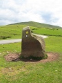
Bronze Age Settlement with 5 Meter high and 2 meter thick outer walls.
IMPORTANT NOTE: Positional co-ordinates scaled from a detailed map source
Opening Hours:
You may be viewing yesterday's version of this page. To see the most up to date information please register for a free account.
")
")
")
Do not use the above information on other web sites or publications without permission of the contributor.
Nearby Images from Flickr
The above images may not be of the site on this page, but were taken nearby. They are loaded from Flickr so please click on them for image credits.
Click here to see more info for this site
Nearby sites
Click here to view sites on an interactive map of the areaKey: Red: member's photo, Blue: 3rd party photo, Yellow: other image, Green: no photo - please go there and take one, Grey: site destroyed
Download sites to:
KML (Google Earth)
GPX (GPS waypoints)
CSV (Garmin/Navman)
CSV (Excel)
To unlock full downloads you need to sign up as a Contributory Member. Otherwise downloads are limited to 50 sites.
Turn off the page maps and other distractions
Nearby sites listing. In the following links * = Image available
531m ESE 122° Castellu di Capula * Stone Fort or Dun
551m ESE 122° Capula Statue-Menhir* Sculptured Stone
1.8km ESE 103° Paccionitoli menhirs Standing Stones
1.9km SSW 207° Coffre de Caleca Burial Chamber or Dolmen
3.2km E 90° Pacciunituli dolmen* Cave or Rock Shelter
3.4km E 89° Alignement de Pacciunituli* Standing Stone (Menhir)
4.6km NE 54° Tozze Bianche menhirs Standing Stones
4.6km NE 54° Valle statue-menhir Sculptured Stone
14.1km SE 127° Casteddu d'Araggiu* Hillfort
14.3km WNW 302° Petreto-Bicchisano* Modern Stone Circle etc
14.4km NW 323° Torre de Foce Stone Fort or Dun
14.5km SW 235° Pozzone statue-menhir* Sculptured Stone
14.6km SW 235° Pozzone* Stone Fort or Dun
14.6km WNW 296° Site Mégalithique de Settiva* Burial Chamber or Dolmen
14.7km SW 236° Muntagnola statue-menhir Sculptured Stone
17.1km SW 228° Petra Pinzuta statue-menhir Sculptured Stone
17.1km SW 229° Foce-Pastini coffres Burial Chamber or Dolmen
17.1km ESE 124° Torre (Porto-Vecchio) Stone Fort or Dun
17.1km SW 228° Rizzanezze statue-menhir Sculptured Stone
17.1km SW 228° Curgia statue-menhir Sculptured Stone
17.2km SW 228° Musée de Sartène* Museum
17.2km WSW 240° U Frate e a Sora menhirs* Standing Stones
17.3km SW 228° Arghjola dolmen Burial Chamber or Dolmen
17.3km W 267° Scalsa Murta statue-menhir* Sculptured Stone
17.3km SW 228° Palaghju coffre Burial Chamber or Dolmen
View more nearby sites and additional images


 We would like to know more about this location. Please feel free to add a brief description and any relevant information in your own language.
 Wir möchten mehr über diese Stätte erfahren. Bitte zögern Sie nicht, eine kurze Beschreibung und relevante Informationen in Deutsch hinzuzufügen.
 Nous aimerions en savoir encore un peu sur les lieux. S'il vous plaît n'hesitez pas à ajouter une courte description et tous les renseignements pertinents dans votre propre langue.
 Quisieramos informarnos un poco más de las lugares. No dude en añadir una breve descripción y otros datos relevantes en su propio idioma.