


<< Text Pages >> Allée Couverte de Trélan - Passage Grave in France in Bretagne:Morbihan (56)
Submitted by AlexHunger on Monday, 03 January 2005 Page Views: 2811
Neolithic and Bronze AgeSite Name: Allée Couverte de TrélanCountry: France Département: Bretagne:Morbihan (56) Type: Passage Grave
Nearest Town: Ploërmel Nearest Village: Saint-Marcel
Latitude: 47.821601N Longitude: 2.428884W
Condition:
| 5 | Perfect |
| 4 | Almost Perfect |
| 3 | Reasonable but with some damage |
| 2 | Ruined but still recognisable as an ancient site |
| 1 | Pretty much destroyed, possibly visible as crop marks |
| 0 | No data. |
| -1 | Completely destroyed |
| 5 | Superb |
| 4 | Good |
| 3 | Ordinary |
| 2 | Not Good |
| 1 | Awful |
| 0 | No data. |
| 5 | Can be driven to, probably with disabled access |
| 4 | Short walk on a footpath |
| 3 | Requiring a bit more of a walk |
| 2 | A long walk |
| 1 | In the middle of nowhere, a nightmare to find |
| 0 | No data. |
| 5 | co-ordinates taken by GPS or official recorded co-ordinates |
| 4 | co-ordinates scaled from a detailed map |
| 3 | co-ordinates scaled from a bad map |
| 2 | co-ordinates of the nearest village |
| 1 | co-ordinates of the nearest town |
| 0 | no data |
Be the first person to rate this site - see the 'Contribute!' box in the right hand menu.
Internal Links:
External Links:
Allée Couverte in Morbihan
You may be viewing yesterday's version of this page. To see the most up to date information please register for a free account.
Do not use the above information on other web sites or publications without permission of the contributor.
Nearby Images from Flickr
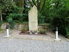
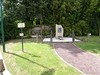
The above images may not be of the site on this page, but were taken nearby. They are loaded from Flickr so please click on them for image credits.
Click here to see more info for this site
Nearby sites
Click here to view sites on an interactive map of the areaKey: Red: member's photo, Blue: 3rd party photo, Yellow: other image, Green: no photo - please go there and take one, Grey: site destroyed
Download sites to:
KML (Google Earth)
GPX (GPS waypoints)
CSV (Garmin/Navman)
CSV (Excel)
To unlock full downloads you need to sign up as a Contributory Member. Otherwise downloads are limited to 50 sites.
Turn off the page maps and other distractions
Nearby sites listing. In the following links * = Image available
2.4km S 191° Dolmens de Béhélec* Burial Chamber or Dolmen
2.8km SE 128° Bois-Solon Menhirs Standing Stones
3.5km ENE 69° Allée Couverte du Pray Passage Grave
4.1km SSW 198° Allée Couverte de Trébiguet Passage Grave
6.4km N 353° La Touche-Carné Dolmen Burial Chamber or Dolmen
6.5km NNE 19° Allée Couverte de Saint-Méen 1* Passage Grave
6.5km NNE 18° Allée Couverte de Saint-Méen 2* Passage Grave
6.6km SW 222° Allée couverte du Bignon* Passage Grave
6.7km NE 50° Gajal allée couverte* Passage Grave
6.7km NNE 23° Pas de Gargantua (Le Bignon) Passage Grave
6.8km SW 220° Menhir Le Bignon* Standing Stone (Menhir)
7.0km S 179° Ranion sud menhir* Standing Stone (Menhir)
7.1km SW 217° Menhir de Bignon 2* Standing Stone (Menhir)
7.1km NNE 20° Allée couverte dite les Chambrettes* Passage Grave
7.2km SW 231° Menhir dit la Pierre Droite (Saint-Guyomard)* Standing Stone (Menhir)
7.2km ENE 63° Allée Couverte du Grand-Village Ouest Passage Grave
7.2km NNE 25° Alignement dit le Pas de Gargantua* Stone Row / Alignment
7.2km NNE 23° Allée couverte dite la Maison du Diable* Passage Grave
7.4km SSE 159° Menhir des Hautes-Landes* Standing Stone (Menhir)
7.5km ENE 66° Grand Village allée couverte* Passage Grave
7.5km SSW 210° Pierre Longue (Molac)* Standing Stone (Menhir)
7.8km ESE 103° Alignement d'Evas Stone Row / Alignment
7.9km NNE 28° Tumulus La Ville au voyer (Monterrein)* Passage Grave
8.2km NNE 28° Dolmen de la Maison-Trouvée* Burial Chamber or Dolmen
8.4km ENE 69° Allée Couverte de Lobo Passage Grave
View more nearby sites and additional images


 We would like to know more about this location. Please feel free to add a brief description and any relevant information in your own language.
 Wir möchten mehr über diese Stätte erfahren. Bitte zögern Sie nicht, eine kurze Beschreibung und relevante Informationen in Deutsch hinzuzufügen.
 Nous aimerions en savoir encore un peu sur les lieux. S'il vous plaît n'hesitez pas à ajouter une courte description et tous les renseignements pertinents dans votre propre langue.
 Quisieramos informarnos un poco más de las lugares. No dude en añadir una breve descripción y otros datos relevantes en su propio idioma.