 with our Megalithic Portal iPhone app")

<< Text Pages >> Camp des Gaulois - Ancient Village or Settlement in France in Bretagne:Morbihan (56)
Submitted by TheCaptain on Monday, 03 January 2005 Page Views: 2151
Multi-periodSite Name: Camp des GauloisCountry: France Département: Bretagne:Morbihan (56) Type: Ancient Village or Settlement
Nearest Town: Île de Groix Nearest Village: Île de Groix
Latitude: 47.640100N Longitude: 3.5053W
Condition:
| 5 | Perfect |
| 4 | Almost Perfect |
| 3 | Reasonable but with some damage |
| 2 | Ruined but still recognisable as an ancient site |
| 1 | Pretty much destroyed, possibly visible as crop marks |
| 0 | No data. |
| -1 | Completely destroyed |
| 5 | Superb |
| 4 | Good |
| 3 | Ordinary |
| 2 | Not Good |
| 1 | Awful |
| 0 | No data. |
| 5 | Can be driven to, probably with disabled access |
| 4 | Short walk on a footpath |
| 3 | Requiring a bit more of a walk |
| 2 | A long walk |
| 1 | In the middle of nowhere, a nightmare to find |
| 0 | No data. |
| 5 | co-ordinates taken by GPS or official recorded co-ordinates |
| 4 | co-ordinates scaled from a detailed map |
| 3 | co-ordinates scaled from a bad map |
| 2 | co-ordinates of the nearest village |
| 1 | co-ordinates of the nearest town |
| 0 | no data |
Be the first person to rate this site - see the 'Contribute!' box in the right hand menu.
Internal Links:
External Links:
Ancient Settlement in Morbihan
IMPORTANT NOTE: Positional co-ordinates scaled from a detailed map source
You may be viewing yesterday's version of this page. To see the most up to date information please register for a free account.
Do not use the above information on other web sites or publications without permission of the contributor.
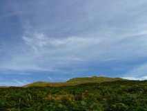
Nearby Images from Flickr
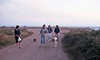
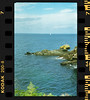
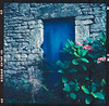
The above images may not be of the site on this page, but were taken nearby. They are loaded from Flickr so please click on them for image credits.
Click here to see more info for this site
Nearby sites
Click here to view sites on an interactive map of the areaKey: Red: member's photo, Blue: 3rd party photo, Yellow: other image, Green: no photo - please go there and take one, Grey: site destroyed
Download sites to:
KML (Google Earth)
GPX (GPS waypoints)
CSV (Garmin/Navman)
CSV (Excel)
To unlock full downloads you need to sign up as a Contributory Member. Otherwise downloads are limited to 50 sites.
Turn off the page maps and other distractions
Nearby sites listing. In the following links * = Image available
750m E 99° Men Hoat menhir Standing Stone (Menhir)
1.4km NE 56° Butten er Hac'h Chambered Tomb
1.4km ESE 109° Dolmen de Men Cam Burial Chamber or Dolmen
1.5km ESE 111° Dolmen de Men Yann Burial Chamber or Dolmen
1.6km ENE 66° Menhir de Quelhuit* Standing Stone (Menhir)
1.8km E 101° Kerloret menhir Standing Stone (Menhir)
2.0km ESE 103° Allée Couverte de Kerloret Passage Grave
2.0km NE 50° Menhir de Fort Grognon Standing Stone (Menhir)
3.1km E 89° Menhir du Salver-er-Bed* Standing Stone (Menhir)
3.8km E 86° Dolmen du Gripp Burial Chamber or Dolmen
4.3km E 96° L'Aperitif Standing Stone (Menhir)
4.4km ESE 115° Allée Couverte de Locqueltas Passage Grave
5.8km ESE 108° Dolmen de Magouer-Huen* Burial Chamber or Dolmen
5.9km E 90° Dolmen de Port-Mélite* Burial Chamber or Dolmen
5.9km E 93° Allée Couverte de Kerrohet* Passage Grave
8.1km NNE 25° Menhir de Kerroc'h (Ploemeur)* Standing Stone (Menhir)
8.3km NNE 31° Dolmen de Caudric* Burial Chamber or Dolmen
8.7km NNE 25° Dolmen dit Ar Roc'h* Burial Chamber or Dolmen
8.7km NNE 18° Menhir de Courégant* Standing Stone (Menhir)
8.9km NNE 13° Tumulus de Kerham* Round Barrow(s)
9.0km NNE 13° Tuchenn Pol* Passage Grave
10.6km NE 46° Dolmens de Kerguélen* Burial Chamber or Dolmen
10.8km N 8° Cruguellic dolmen* Burial Chamber or Dolmen
11.0km NE 39° Allée Couverte de Kergalan* Passage Grave
11.1km N 5° Dolmen de Saint-Adrien Burial Chamber or Dolmen
View more nearby sites and additional images


 We would like to know more about this location. Please feel free to add a brief description and any relevant information in your own language.
 Wir möchten mehr über diese Stätte erfahren. Bitte zögern Sie nicht, eine kurze Beschreibung und relevante Informationen in Deutsch hinzuzufügen.
 Nous aimerions en savoir encore un peu sur les lieux. S'il vous plaît n'hesitez pas à ajouter une courte description et tous les renseignements pertinents dans votre propre langue.
 Quisieramos informarnos un poco más de las lugares. No dude en añadir una breve descripción y otros datos relevantes en su propio idioma.