


<< Text Pages >> Dolmens de Parc-Lie - Burial Chamber or Dolmen in France in Bretagne:Finistère (29)
Submitted by TheCaptain on Tuesday, 28 December 2004 Page Views: 3246
Neolithic and Bronze AgeSite Name: Dolmens de Parc-Lie Alternative Name: Penn-Ar-MenezCountry: France Département: Bretagne:Finistère (29) Type: Burial Chamber or Dolmen
Nearest Town: Pont l'Abbé Nearest Village: Treffiagat
Latitude: 47.819381N Longitude: 4.276429W
Condition:
| 5 | Perfect |
| 4 | Almost Perfect |
| 3 | Reasonable but with some damage |
| 2 | Ruined but still recognisable as an ancient site |
| 1 | Pretty much destroyed, possibly visible as crop marks |
| 0 | No data. |
| -1 | Completely destroyed |
| 5 | Superb |
| 4 | Good |
| 3 | Ordinary |
| 2 | Not Good |
| 1 | Awful |
| 0 | No data. |
| 5 | Can be driven to, probably with disabled access |
| 4 | Short walk on a footpath |
| 3 | Requiring a bit more of a walk |
| 2 | A long walk |
| 1 | In the middle of nowhere, a nightmare to find |
| 0 | No data. |
| 5 | co-ordinates taken by GPS or official recorded co-ordinates |
| 4 | co-ordinates scaled from a detailed map |
| 3 | co-ordinates scaled from a bad map |
| 2 | co-ordinates of the nearest village |
| 1 | co-ordinates of the nearest town |
| 0 | no data |
Be the first person to rate this site - see the 'Contribute!' box in the right hand menu.
Internal Links:
External Links:
Penn-ar-Menez dolmen was once a compartmented dolmen, but has now thought to have been destroyed. It is possible that some remains can be found.
Compartmented dolmens are a type of monument only found in this coastal part of southwest Brittany, which have chambers with internal compartment slabs to break up the chamber into sections.
IMPORTANT NOTE: Site was once near this position.
You may be viewing yesterday's version of this page. To see the most up to date information please register for a free account.
Do not use the above information on other web sites or publications without permission of the contributor.
Nearby Images from Flickr


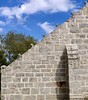
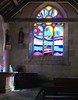
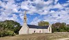
The above images may not be of the site on this page, but were taken nearby. They are loaded from Flickr so please click on them for image credits.
Click here to see more info for this site
Nearby sites
Click here to view sites on an interactive map of the areaKey: Red: member's photo, Blue: 3rd party photo, Yellow: other image, Green: no photo - please go there and take one, Grey: site destroyed
Download sites to:
KML (Google Earth)
GPX (GPS waypoints)
CSV (Garmin/Navman)
CSV (Excel)
To unlock full downloads you need to sign up as a Contributory Member. Otherwise downloads are limited to 50 sites.
Turn off the page maps and other distractions
Nearby sites listing. In the following links * = Image available
234m E 91° Dolmen de Kervillogan Burial Chamber or Dolmen
764m N 7° Pendreff Alignement* Stone Row / Alignment
1.3km W 271° Dolmen de Penquer-Bloas* Burial Chamber or Dolmen
1.7km E 100° Kervintic menhir Standing Stone (Menhir)
1.9km SSW 200° Guilvinec menhir* Standing Stone (Menhir)
2.0km ESE 109° Quélarn menhir* Standing Stone (Menhir)
2.0km ESE 108° Quélarn Dolmens* Burial Chamber or Dolmen
2.0km SSE 150° Menhir de la Mairie* Standing Stone (Menhir)
2.2km NNE 19° Dolmen de Coet Tail Burial Chamber or Dolmen
2.2km ESE 109° Tronval Dolmen* Burial Chamber or Dolmen
2.2km SW 230° Dolmen de Kersidal Burial Chamber or Dolmen
2.4km WNW 302° Allée Couverte de Menez Landu* Passage Grave
2.5km ENE 63° Dolmen de Kerlay Burial Chamber or Dolmen
2.6km WSW 237° Dolmen du Poulguen* Burial Chamber or Dolmen
2.6km W 274° Menhir de Kervéen Standing Stone (Menhir)
2.7km WNW 284° Dolmen de Lestriguiou* Burial Chamber or Dolmen
3.1km W 267° Allée Couverte de Gouesnach Passage Grave
3.1km W 277° Gravures de Feuntenigou* Rock Art
3.2km SSE 165° Léchiagat menhir* Standing Stone (Menhir)
3.4km W 271° Menhir de Kerscaven 2* Standing Stone (Menhir)
3.4km ESE 108° Kerfuens Dolmens* Burial Chamber or Dolmen
3.4km WNW 286° Chapelle de la Madeleine alignement* Stone Row / Alignment
3.5km W 269° Menhir de Kerscaven 1* Standing Stone (Menhir)
3.5km SE 138° Reun menhir* Standing Stone (Menhir)
3.5km SE 139° Rochers Gravés du Reun* Rock Art
View more nearby sites and additional images


 We would like to know more about this location. Please feel free to add a brief description and any relevant information in your own language.
 Wir möchten mehr über diese Stätte erfahren. Bitte zögern Sie nicht, eine kurze Beschreibung und relevante Informationen in Deutsch hinzuzufügen.
 Nous aimerions en savoir encore un peu sur les lieux. S'il vous plaît n'hesitez pas à ajouter une courte description et tous les renseignements pertinents dans votre propre langue.
 Quisieramos informarnos un poco más de las lugares. No dude en añadir una breve descripción y otros datos relevantes en su propio idioma.