

<< Text Pages >> Alignement de Leintant - Stone Row / Alignment in France in Bretagne:Finistère (29)
Submitted by TheCaptain on Tuesday, 28 December 2004 Page Views: 2980
Neolithic and Bronze AgeSite Name: Alignement de Leintant Alternative Name: Parc Peulven alignement de menhirsCountry: France Département: Bretagne:Finistère (29) Type: Stone Row / Alignment
Nearest Town: Carhaix-Plouger Nearest Village: Brennilis
Latitude: 48.355000N Longitude: 3.8129W
Condition:
| 5 | Perfect |
| 4 | Almost Perfect |
| 3 | Reasonable but with some damage |
| 2 | Ruined but still recognisable as an ancient site |
| 1 | Pretty much destroyed, possibly visible as crop marks |
| 0 | No data. |
| -1 | Completely destroyed |
| 5 | Superb |
| 4 | Good |
| 3 | Ordinary |
| 2 | Not Good |
| 1 | Awful |
| 0 | No data. |
| 5 | Can be driven to, probably with disabled access |
| 4 | Short walk on a footpath |
| 3 | Requiring a bit more of a walk |
| 2 | A long walk |
| 1 | In the middle of nowhere, a nightmare to find |
| 0 | No data. |
| 5 | co-ordinates taken by GPS or official recorded co-ordinates |
| 4 | co-ordinates scaled from a detailed map |
| 3 | co-ordinates scaled from a bad map |
| 2 | co-ordinates of the nearest village |
| 1 | co-ordinates of the nearest town |
| 0 | no data |
Be the first person to rate this site - see the 'Contribute!' box in the right hand menu.
Internal Links:
External Links:
I have visited· I would like to visit
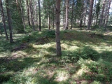
TheCaptain couldn't find on 23rd Jun 2005 Row of fallen menhirs now incorporated into a bank at the edge of a field. I could find no trace of this alignment, supposed to contain one standing and three fallen menhirs, which was said to align on mid-summer sunrise. I found the farm, and went up and down the road several times, with no luck. Supposedly, the standing stone is nearly 4 metres tall and beside the road.....
IMPORTANT NOTE: Positional co-ordinates scaled from a detailed map source
You may be viewing yesterday's version of this page. To see the most up to date information please register for a free account.
Do not use the above information on other web sites or publications without permission of the contributor.
Nearby Images from Flickr

The above images may not be of the site on this page, but were taken nearby. They are loaded from Flickr so please click on them for image credits.
Click here to see more info for this site
Nearby sites
Click here to view sites on an interactive map of the areaKey: Red: member's photo, Blue: 3rd party photo, Yellow: other image, Green: no photo - please go there and take one, Grey: site destroyed
Download sites to:
KML (Google Earth)
GPX (GPS waypoints)
CSV (Garmin/Navman)
CSV (Excel)
To unlock full downloads you need to sign up as a Contributory Member. Otherwise downloads are limited to 50 sites.
Turn off the page maps and other distractions
Nearby sites listing. In the following links * = Image available
13m SSE 147° Leintant menhir* Standing Stone (Menhir)
715m NNE 16° Dolmen de Coat Mocun Burial Chamber or Dolmen
836m ENE 67° Dolmen de Plouénez Burial Chamber or Dolmen
923m ESE 106° Menhir du Roz Perez* Standing Stone (Menhir)
1.1km NE 56° Menhir de Coat Mocoun (sud)* Standing Stone (Menhir)
1.1km NE 41° Menhir de Coatmocun (Huelgoat)* Standing Stone (Menhir)
1.3km NNE 29° Coatmocun north menhir Standing Stone (Menhir)
1.4km NE 41° Menhir de Coatmocun * Standing Stone (Menhir)
1.8km WNW 283° Menhir de Kermorvan Standing Stone (Menhir)
1.8km E 83° St-Guinec menhir* Standing Stone (Menhir)
2.7km W 275° Brennilis Menhirs* Standing Stones
2.7km NNW 336° Kerelcun Menhir* Standing Stone (Menhir)
2.7km WNW 286° Ty ar Boudiquet Dolmen* Burial Chamber or Dolmen
2.9km NW 322° Tumulus de Kerelcan* Round Barrow(s)
3.0km ESE 119° Menhir de Kervic Standing Stone (Menhir)
3.6km SSW 204° Allée couverte de Be Keor Passage Grave
4.2km N 7° Dolmen de Quinoualc'h* Burial Chamber or Dolmen
4.7km NE 41° Dolmen de Coscastel Burial Chamber or Dolmen
5.0km E 82° Fontaine Notre Dame des Cieux* Holy Well or Sacred Spring
5.2km ENE 75° Roche Tremblante de Huelgoat* Natural Stone / Erratic / Other Natural Feature
5.2km ENE 57° Kerampeulven Menhir* Standing Stone (Menhir)
5.6km ENE 68° Camp d'Artus Hillfort
5.8km ENE 74° Menhir d'Artus Standing Stone (Menhir)
6.0km NNE 13° Dolmen de Croaz Pulviny* Burial Chamber or Dolmen
6.5km NNW 338° Menhir de Flagous Standing Stone (Menhir)
View more nearby sites and additional images


 We would like to know more about this location. Please feel free to add a brief description and any relevant information in your own language.
 Wir möchten mehr über diese Stätte erfahren. Bitte zögern Sie nicht, eine kurze Beschreibung und relevante Informationen in Deutsch hinzuzufügen.
 Nous aimerions en savoir encore un peu sur les lieux. S'il vous plaît n'hesitez pas à ajouter une courte description et tous les renseignements pertinents dans votre propre langue.
 Quisieramos informarnos un poco más de las lugares. No dude en añadir una breve descripción y otros datos relevantes en su propio idioma.