 with our Megalithic Portal iPhone app")


<< Our Photo Pages >> Men Bras menhir - Standing Stone (Menhir) in France in Bretagne:Côtes-D'Armor (22)
Submitted by TheCaptain on Sunday, 19 December 2004 Page Views: 2863
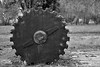
Neolithic and Bronze AgeSite Name: Men Bras menhir Alternative Name: Menhir Rochell Bras, Menhir de KeranscotCountry: France Département: Bretagne:Côtes-D'Armor (22) Type: Standing Stone (Menhir)
Nearest Town: Lannion Nearest Village: Trégrom
Latitude: 48.573500N Longitude: 3.41062W
Condition:
| 5 | Perfect |
| 4 | Almost Perfect |
| 3 | Reasonable but with some damage |
| 2 | Ruined but still recognisable as an ancient site |
| 1 | Pretty much destroyed, possibly visible as crop marks |
| 0 | No data. |
| -1 | Completely destroyed |
| 5 | Superb |
| 4 | Good |
| 3 | Ordinary |
| 2 | Not Good |
| 1 | Awful |
| 0 | No data. |
| 5 | Can be driven to, probably with disabled access |
| 4 | Short walk on a footpath |
| 3 | Requiring a bit more of a walk |
| 2 | A long walk |
| 1 | In the middle of nowhere, a nightmare to find |
| 0 | No data. |
| 5 | co-ordinates taken by GPS or official recorded co-ordinates |
| 4 | co-ordinates scaled from a detailed map |
| 3 | co-ordinates scaled from a bad map |
| 2 | co-ordinates of the nearest village |
| 1 | co-ordinates of the nearest town |
| 0 | no data |
Internal Links:
External Links:
I have visited· I would like to visit
johnstone visited on 24th Jun 2005 - their rating: Cond: 4 Amb: 3 Access: 4
")
You may be viewing yesterday's version of this page. To see the most up to date information please register for a free account.
")
")
")
Do not use the above information on other web sites or publications without permission of the contributor.
Nearby Images from Flickr
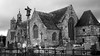
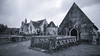
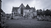

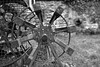
The above images may not be of the site on this page, but were taken nearby. They are loaded from Flickr so please click on them for image credits.
Click here to see more info for this site
Nearby sites
Click here to view sites on an interactive map of the areaKey: Red: member's photo, Blue: 3rd party photo, Yellow: other image, Green: no photo - please go there and take one, Grey: site destroyed
Download sites to:
KML (Google Earth)
GPX (GPS waypoints)
CSV (Garmin/Navman)
CSV (Excel)
To unlock full downloads you need to sign up as a Contributory Member. Otherwise downloads are limited to 50 sites.
Turn off the page maps and other distractions
Nearby sites listing. In the following links * = Image available
161m S 186° Men Bihan menhir* Standing Stone (Menhir)
5.0km E 79° Pergat menhirs* Standing Stones
6.7km N 352° Chapelle-des-Sept-Saints* Burial Chamber or Dolmen
6.7km WSW 255° Menhir de Keramanac'h Standing Stone (Menhir)
9.1km ENE 63° Crec'h Coulm Menhir* Standing Stone (Menhir)
9.7km NW 317° Kerzistalen tumulus Chambered Tomb
11.8km NE 56° Menhir de Kerguézennec* Standing Stone (Menhir)
12.5km SW 220° Allée Couverte de Brohet* Passage Grave
12.9km NNW 329° Clandy menhir* Standing Stone (Menhir)
14.3km WSW 258° Menhir de Kerellou* Standing Stone (Menhir)
14.3km ESE 111° Allée Couverte de Bongoat Passage Grave
15.3km WNW 288° La Salle menhir Standing Stone (Menhir)
16.0km SW 215° Allée Couverte de Kernescop* Passage Grave
16.1km NNE 33° Manoir de Coadélan menhir* Standing Stone (Menhir)
16.7km ENE 65° Menhir de Menou-Glas Standing Stone (Menhir)
16.8km NW 324° Toul an Lann menhir* Standing Stone (Menhir)
16.9km ENE 64° Allée Couverte Ros Vras Passage Grave
17.1km SSE 161° Fontaine des Sept Saints* Holy Well or Sacred Spring
17.1km SSE 161° Fontaine du Coq* Holy Well or Sacred Spring
17.4km NNW 344° Stèle de Saint-Patrice* Standing Stone (Menhir)
17.6km NW 323° Lann Ar Peulven menhir* Standing Stone (Menhir)
17.9km ENE 56° Menhir de Camarel Standing Stone (Menhir)
18.5km ENE 67° Menhirs de Kerdudalou* Standing Stones
18.8km ESE 116° Dolmen de Kervoaic Burial Chamber or Dolmen
19.1km ENE 75° Dolmen de Beuzil-Bras Burial Chamber or Dolmen
View more nearby sites and additional images


 We would like to know more about this location. Please feel free to add a brief description and any relevant information in your own language.
 Wir möchten mehr über diese Stätte erfahren. Bitte zögern Sie nicht, eine kurze Beschreibung und relevante Informationen in Deutsch hinzuzufügen.
 Nous aimerions en savoir encore un peu sur les lieux. S'il vous plaît n'hesitez pas à ajouter une courte description et tous les renseignements pertinents dans votre propre langue.
 Quisieramos informarnos un poco más de las lugares. No dude en añadir una breve descripción y otros datos relevantes en su propio idioma.