Featured: Hare and Tabor T Shirts for discerning antiquarians

Hare and Tabor T Shirts for discerning antiquarians

Inscribed Across the Landscape: The Cursus Monuments of Great Britain

Inscribed Across the Landscape: The Cursus Monuments of Great Britain

Who's Online

There are currently, 249 guests and 0 members online.

You are a guest. To join in, please register for free by clicking here

Sponsors

<< Our Photo Pages >> Tingwall Broch - Broch or Nuraghe in Scotland in Orkney

Submitted by howar on Thursday, 25 March 2004  Page Views: 5602

Iron Age and Later PrehistorySite Name: Tingwall Broch
Country: Scotland County: Orkney Type: Broch or Nuraghe
Nearest Town: Finstown  Nearest Village: Norseman Village
Map Ref: HY401228  Landranger Map Number: 5
Latitude: 59.087881N  Longitude: 3.047007W
Condition:
5Perfect
4Almost Perfect
3Reasonable but with some damage
2Ruined but still recognisable as an ancient site
1Pretty much destroyed, possibly visible as crop marks
0No data.
-1Completely destroyed
3 Ambience:
5Superb
4Good
3Ordinary
2Not Good
1Awful
0No data.
2 Access:
5Can be driven to, probably with disabled access
4Short walk on a footpath
3Requiring a bit more of a walk
2A long walk
1In the middle of nowhere, a nightmare to find
0No data.
4 Accuracy:
5co-ordinates taken by GPS or official recorded co-ordinates
4co-ordinates scaled from a detailed map
3co-ordinates scaled from a bad map
2co-ordinates of the nearest village
1co-ordinates of the nearest town
0no data
3

Internal Links:
External Links:

Tingwall Broch
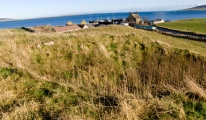
Tingwall Broch submitted by howar : looking down atTingwall Broch HY401228 Orkney (Vote or comment on this photo)
Broch in Orkney

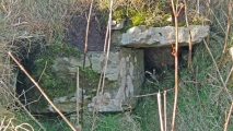
As you go to the Tingwall Ferry the left-side of the road just before the farm. Most of what remains dates from its Viking use as a thing but there is one curious feature that looks like it could be either modern or a tomb-entrance !
You may be viewing yesterday's version of this page. To see the most up to date information please register for a free account.


Tingwall Broch
Tingwall Broch submitted by howar : looking across burn to W end (Vote or comment on this photo)

Tingwall Broch
Tingwall Broch submitted by howar : site looking along from E, ?mill foundation LH and broch top RH (Vote or comment on this photo)

Tingwall Broch
Tingwall Broch submitted by howar : site looking E (Vote or comment on this photo)

Tingwall Broch
Tingwall Broch submitted by howar : E end (Vote or comment on this photo)

Tingwall Broch
Tingwall Broch submitted by howar : E end from main broch (Vote or comment on this photo)

Tingwall Broch
Tingwall Broch submitted by howar : stones S side of E end

Tingwall Broch
Tingwall Broch submitted by howar : E half from S

Tingwall Broch
Tingwall Broch submitted by howar : broch N-S

Tingwall Broch
Tingwall Broch submitted by howar : central broch section

Tingwall Broch
Tingwall Broch submitted by howar : large pit W-E

Tingwall Broch
Tingwall Broch submitted by howar : large pit S-N from top

Tingwall Broch
Tingwall Broch submitted by howar : looking down on large pit

Tingwall Broch
Tingwall Broch submitted by howar : E side of large pit, curve turns further about 3/4 along

Tingwall Broch
Tingwall Broch submitted by howar : W side of large pit

Tingwall Broch
Tingwall Broch submitted by howar : lower E side of large pit with orthostat

Tingwall Broch
Tingwall Broch submitted by howar : stones W side of large pit with ?wallface RH

Tingwall Broch
Tingwall Broch submitted by howar : stones E side of large pit with orthostat top visible RH bottom corner

Tingwall Broch
Tingwall Broch submitted by howar : ? outer wallface of broch tower

Tingwall Broch
Tingwall Broch submitted by howar : exposure in pit in top of W half

Tingwall Broch
Tingwall Broch submitted by howar : W end

Tingwall Broch
Tingwall Broch submitted by howar : W end levels, ?rampart across centre of image

Tingwall Broch
Tingwall Broch submitted by howar : looking onto W end bank

Tingwall Broch
Tingwall Broch submitted by howar : W end bank ?entrance

Tingwall Broch
Tingwall Broch submitted by howar : SW pit

Tingwall Broch
Tingwall Broch submitted by howar : site from W

These are just the first 25 photos of Tingwall Broch. If you log in with a free user account you will be able to see our entire collection.

Do not use the above information on other web sites or publications without permission of the contributor.
Click here to see more info for this site

Nearby sites

Click here to view sites on an interactive OS map

Key: Red: member's photo, Blue: 3rd party photo, Yellow: other image, Green: no photo - please go there and take one, Grey: site destroyed

Download sites to:
KML (Google Earth)
GPX (GPS waypoints)
CSV (Garmin/Navman)
CSV (Excel)

To unlock full downloads you need to sign up as a Contributory Member. Otherwise downloads are limited to 50 sites.


Turn off the page maps and other distractions

Nearby sites listing. In the following links * = Image available
 859m NNW 339° Knowe of Midgarth* Ancient Village or Settlement (HY39812361)
 2.1km N 358° Ness of Woodwick* Broch or Nuraghe (HY40072487)
 2.2km SSW 201° Seven Knowes* Barrow Cemetery (HY39282072)
 2.9km NW 313° Redland South* Chambered Cairn (HY38002484)
 3.2km NW 314° Quoys Chambered Cairn Chambered Cairn (HY37822507)
 3.4km S 182° Sandyhall* Barrow Cemetery (HY399194)
 3.4km SE 126° Holm of Rendall* Cairn (HY4283220735)
 3.7km SE 138° Knowe of Dishero* Broch or Nuraghe (HY42561998)
 4.1km S 181° St Mary's Kirk, Isbister* Broch or Nuraghe (HY39971872)
 4.3km SW 226° Black Knowe of Blubbersdale* Round Barrow(s) (HY36951988)
 4.5km NNW 334° Gurness* Broch or Nuraghe (HY3818926842)
 4.5km NNW 334° Aikerness Class I Pictish Symbol Stone (HY38182685)
 4.6km NNE 16° Knowe of Hunclett* Broch or Nuraghe (HY41442722)
 4.6km N 359° Knowe of Burrian (Frotoft)* Broch or Nuraghe (HY40062745)
 4.7km N 3° Langstane (Orkney)* Standing Stone (Menhir) (HY404275)
 4.8km E 94° Gairsay Cairn (HY44942237)
 4.9km SSW 192° Oyce of Isbister* Round Barrow(s) (HY39021802)
 5.0km NNE 14° Blackhammer* Chambered Tomb (HY41422761)
 5.2km N 357° Knowe of Lairo* Chambered Cairn (HY39922796)
 5.2km N 3° Knowe of Yarso* Chambered Cairn (HY40482795)
 5.2km N 358° Knowe of Ramsay* Chambered Cairn (HY40042800)
 5.4km N 349° Viera Lodge Broch or Nuraghe (HY392281)
 5.4km NNE 26° Taversoe Tuick* Chambered Cairn (HY42572761)
 5.4km NW 316° Knowe of Stenso* Broch or Nuraghe (HY3639426747)
 5.5km NE 51° Braes of Ha’Breck, Wyre. Ancient Village or Settlement (HY445262)
View more nearby sites and additional images

<< Hafod-y-bwch

Howe Harper >>

Please add your thoughts on this site

Neolithic Britain And Ireland

Neolithic Britain And Ireland

Sponsors

Auto-Translation (Google)

Translate from English into:

"Tingwall Broch" | Login/Create an Account | 3 News and Comments
  
Go back to top of page    Comments are owned by the poster. We aren't responsible for their content.
Re: Tingwall by SandyG on Thursday, 16 July 2015
(User Info | Send a Message)
A few photographs of a standing stone on Shetland seem to have crept in here. [Fixed - thanks - Ed][
[ Reply to This ]

Re: Tingwall by howar on Friday, 17 December 2010
(User Info | Send a Message)
The Tingwall mound is in the form of a figure-of-eight or else two mounds of disparate sizes have been joined together, the larger and more mutilated at the west end and the smaller at the east by the farm. Using the 1st O.S. to look at the brochs from Dishero to Burgar you find the broch depicted as not quite circular except for the east end of this mound where its circle is a geometric circle. Which seemed strange. Then I had reason to ponder whether the sluice behind had been made using stones from the broch and the light went on - the sluice makes the burn behind a millstream and so this is a strong candidate for being a mill mound. Which isn't to say that it had no prior use [unless the mound had been constructed specifically for the mill]. The early map isn't as detailed as that for Dishero, showing a bank occupying the inside of the west circle's western half and orthostats on the south periphery (seven shown).
On a modern-day aerial view [192.com IIRC] this is generally confirmed, with little appearing at the east quadrant and the stones part of the plant-covered ditch obscuring it from a roadside view. The view from above shows the large irregular pit seen roadside as coming from the south edge of the circle, a little right of centre, up to the broch tower marks with a small circle where it contacts. There are several pits inside the broch tower area. These are probably from antiquarian investigations. To my mind these would post-date the 1880 survey or more detail would be shown on the 1st O.S. (like Dishero). The photo shows a circular ditch on the west side and inside this the broch tower wall in the W-N quadrant with what appears to be an out-turning at the north end, perhaps a gateway or the east side of an external cell. I imagine the ditch to be is connected to the substantial rampart fragment referred to in the NMRS. Virtually nothing can be seen at the east side of the broch circle over or from there to the mill-mound.
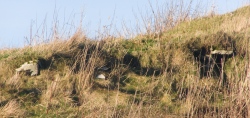
All of the foregoing I learned after this particular visit. Coming from the harbour I first came to the eastern end. Looked across this end from the east it is the south side that has been touched by man, at the base on the left what appears to be a low bank across this end, then an apparently manufactured curve to the top and an equally low rise or foundation from whose north side the mound slopes gradually down seemingly naturally. To the right of the 'foundation' you can see the top of the broch in the distance. Along the side facing the road a few stones of different sizes are exposed, though truth to tell if they have a pattern it is a line rather than a curve. Even in winter the gouge of a ditch cutting in front of the west end and up into this end of the mound like a stairway to heaven is heavily fringed with dock. Exposed in the cut above are a mix of small thin slabs and blocks. All are still where placed by man, but only in one spot are you priveleged to see a tiny section of plain to see walling. This horizontal block with a slab coming onto it I had previously believed to be part of a small passage entrance but later close inspection reveals a vertical surface behind and below the slab, probably one block and part of another - it feels different from the rest and I would like to think this is the outer face of the broch tower wall.
Up at the crossroads the west end presents the multiple levels now familiar from Dishero. After entering the field I am about halfway to the mound when to my surprise I see a deep ditch cut into the ground by this end just beyond a sharp bend in the burn, and the broch sits on the other side. Up on the mound the bank/s on this end are easier to see. From the top it is more obvious how regular the east end is and there may be another bank between. Spot another interesting thing to my left as I look past a pit to the mound (or top of the mound)'s edge, a broad but very shallow concave curve and what might be slight bumps at either end. Could this be an entranceway ? And if so to the broch or something else ?? I was al

Read the rest of this post...
[ Reply to This ]

Re: Tingwall by howar on Saturday, 17 September 2005
(User Info | Send a Message)
Orkney Name Book gives two Thing Volls, one a circular structure 5 chains SW of Tingwall farmhouse and "another similar" 250 links from this and SW of Tingwall again.
[ Reply to This ]

Your Name: Anonymous [ Register Now ]
Subject:


Add your comment or contribution to this page. Spam or offensive posts are deleted immediately, don't even bother

<<< What is five plus one as a number? (Please type the answer to this question in the little box on the left)
You can also embed videos and other things. For Youtube please copy and paste the 'embed code'.
For Google Street View please include Street View in the text.
Create a web link like this: <a href="https://www.megalithic.co.uk">This is a link</a>  

Allowed HTML is:
<p> <b> <i> <a> <img> <em> <br> <strong> <blockquote> <tt> <li> <ol> <ul> <object> <param> <embed> <iframe>

We would like to know more about this location. Please feel free to add a brief description and any relevant information in your own language.
Wir möchten mehr über diese Stätte erfahren. Bitte zögern Sie nicht, eine kurze Beschreibung und relevante Informationen in Deutsch hinzuzufügen.
Nous aimerions en savoir encore un peu sur les lieux. S'il vous plaît n'hesitez pas à ajouter une courte description et tous les renseignements pertinents dans votre propre langue.
Quisieramos informarnos un poco más de las lugares. No dude en añadir una breve descripción y otros datos relevantes en su propio idioma.