

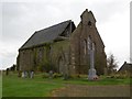
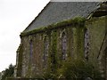
<< Text Pages >> Kinnell Pictish Cross Slab - Class III Pictish Cross Slab in Scotland in Angus
Submitted by alligator on Monday, 24 March 2003 Page Views: 5731
Early Medieval (Dark Age)Site Name: Kinnell Pictish Cross SlabCountry: Scotland County: Angus Type: Class III Pictish Cross Slab
Map Ref: NO60885028 Landranger Map Number: 54
Latitude: 56.642694N Longitude: 2.639469W
Condition:
| 5 | Perfect |
| 4 | Almost Perfect |
| 3 | Reasonable but with some damage |
| 2 | Ruined but still recognisable as an ancient site |
| 1 | Pretty much destroyed, possibly visible as crop marks |
| 0 | No data. |
| -1 | Completely destroyed |
| 5 | Superb |
| 4 | Good |
| 3 | Ordinary |
| 2 | Not Good |
| 1 | Awful |
| 0 | No data. |
| 5 | Can be driven to, probably with disabled access |
| 4 | Short walk on a footpath |
| 3 | Requiring a bit more of a walk |
| 2 | A long walk |
| 1 | In the middle of nowhere, a nightmare to find |
| 0 | No data. |
| 5 | co-ordinates taken by GPS or official recorded co-ordinates |
| 4 | co-ordinates scaled from a detailed map |
| 3 | co-ordinates scaled from a bad map |
| 2 | co-ordinates of the nearest village |
| 1 | co-ordinates of the nearest town |
| 0 | no data |
Be the first person to rate this site - see the 'Contribute!' box in the right hand menu.
Internal Links:
External Links:
Class III Pictish Cross Slab in Angus
For details, visit: http://www.archaeoptics.co.uk/products/ecms/351.html
You may be viewing yesterday's version of this page. To see the most up to date information please register for a free account.
Do not use the above information on other web sites or publications without permission of the contributor.
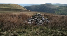
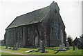
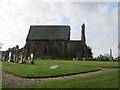
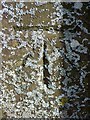
Nearby Images from Geograph Britain and Ireland:
©2013(licence)
©2019(licence)
©2010(licence)
©2015(licence)
©2015(licence)
The above images may not be of the site on this page, they are loaded from Geograph.
Please Submit an Image of this site or go out and take one for us!
Click here to see more info for this site
Nearby sites
Key: Red: member's photo, Blue: 3rd party photo, Yellow: other image, Green: no photo - please go there and take one, Grey: site destroyed
Download sites to:
KML (Google Earth)
GPX (GPS waypoints)
CSV (Garmin/Navman)
CSV (Excel)
To unlock full downloads you need to sign up as a Contributory Member. Otherwise downloads are limited to 50 sites.
Turn off the page maps and other distractions
Nearby sites listing. In the following links * = Image available
607m SSW 197° Kinnell Cursus Cursus (NO607497)
957m SSW 203° Kinnell Cursus Cursus (NO605494)
1.7km WSW 257° Guthrie Cursus Cursus (NO592499)
2.2km W 262° Guthrie Cursus Cursus (NO587500)
2.3km SSE 163° Inverkeilor Cursus Cursus (NO61534812)
3.1km SE 139° Westfield 1 Timber Circle (NO629479)
3.1km SE 139° Westfield 2 Timber Circle (NO629479)
4.4km SE 133° Kinblethmont* Class I Pictish Symbol Stone (NO641472)
6.2km WSW 247° Dumbarrow Hill Stone Fort or Dun (NO55154791)
7.0km NNW 339° St Murdoch's Well (Brechin) Holy Well or Sacred Spring (NO58405682)
7.4km WNW 284° Westerton (Aberlemno)* Stone Circle (NO53645210)
7.9km SSE 158° St. Vigeans Museum* Museum (NO63834294)
8.1km W 266° Girdle Stane of Dunnichen* Rock Art (NO5280849737)
8.1km SE 145° Dickmount Law* Cairn (NO65474355)
8.6km NE 37° Maryton Cursus Cursus (NO66105713)
8.7km SSE 156° Arbroath Eastern Cemetery souterrain* Souterrain (Fogou, Earth House) (NO64394227)
8.9km NE 40° Maryton Cursus Cursus (NO66715699)
9.0km NNW 345° St Ouret's Well (Brechin) Holy Well or Sacred Spring (NO58695904)
9.3km WNW 291° Doo'cot Woods (Turin Hill) Rock Art (NO5224953716)
9.3km W 265° Dunnichen* Class I Pictish Symbol Stone (NO516496)
9.4km WNW 291° West Mains 1 & 2 (Turin Hill) Rock Art (NO52145369)
9.4km SW 222° Carmyllie Hill (Greystone) Cairn (NO545434)
9.4km ESE 117° West Mains of Ethie* Promontory Fort / Cliff Castle (NO69284600)
9.4km SE 130° Castle Rock (Auchmithie)* Promontory Fort / Cliff Castle (NO68074416)
9.5km ESE 113° Prail Castle* Promontory Fort / Cliff Castle (NO69624643)
View more nearby sites and additional images


 We would like to know more about this location. Please feel free to add a brief description and any relevant information in your own language.
 Wir möchten mehr über diese Stätte erfahren. Bitte zögern Sie nicht, eine kurze Beschreibung und relevante Informationen in Deutsch hinzuzufügen.
 Nous aimerions en savoir encore un peu sur les lieux. S'il vous plaît n'hesitez pas à ajouter une courte description et tous les renseignements pertinents dans votre propre langue.
 Quisieramos informarnos un poco más de las lugares. No dude en añadir una breve descripción y otros datos relevantes en su propio idioma.