


<< Our Photo Pages >> Alexander Keiller Museum - Museum in England in Wiltshire
Submitted by Andy B on Friday, 07 September 2012 Page Views: 19868
MuseumsSite Name: Alexander Keiller Museum Alternative Name: Avebury MuseumCountry: England County: Wiltshire Type: Museum
Nearest Town: Marlborough Nearest Village: Avebury
Map Ref: SU100698 Landranger Map Number: 173
Latitude: 51.427120N Longitude: 1.857557W
Condition:
| 5 | Perfect |
| 4 | Almost Perfect |
| 3 | Reasonable but with some damage |
| 2 | Ruined but still recognisable as an ancient site |
| 1 | Pretty much destroyed, possibly visible as crop marks |
| 0 | No data. |
| -1 | Completely destroyed |
| 5 | Superb |
| 4 | Good |
| 3 | Ordinary |
| 2 | Not Good |
| 1 | Awful |
| 0 | No data. |
| 5 | Can be driven to, probably with disabled access |
| 4 | Short walk on a footpath |
| 3 | Requiring a bit more of a walk |
| 2 | A long walk |
| 1 | In the middle of nowhere, a nightmare to find |
| 0 | No data. |
| 5 | co-ordinates taken by GPS or official recorded co-ordinates |
| 4 | co-ordinates scaled from a detailed map |
| 3 | co-ordinates scaled from a bad map |
| 2 | co-ordinates of the nearest village |
| 1 | co-ordinates of the nearest town |
| 0 | no data |
Internal Links:
External Links:
I have visited· I would like to visit
michelle_b007 visited on 13th Aug 2019 - their rating: Cond: 5 Amb: 4
XIII saw from a distance on 13th Aug 2015 - their rating: Amb: 4 Access: 5
graemefield visited on 1st Jan 2011 - their rating: Cond: 5 Amb: 4 Access: 4
coin visited - their rating: Cond: 4 Amb: 4 Access: 5 A great little museum.
Klingon visited - their rating: Cond: 5 Amb: 4 Access: 4
JimChampion myf NickyD FrothNinja have visited here
Average ratings for this site from all visit loggers: Condition: 4.75 Ambience: 4 Access: 4.5
")
Address: Barn Gallery, High Street, SN8 1RF
Phone: 01672 539384
Opening Hours: 1st April - 31st Oct - 10.30am - 5pm, 1st Nov - 31st March - 11.30-4pm (closed Tues & Weds)
Admission: Charge
Visit their web site
Note: Free Entry to Alexander Keiller Museum, Saturday 8th September 2012
You may be viewing yesterday's version of this page. To see the most up to date information please register for a free account.
")
")
")
Do not use the above information on other web sites or publications without permission of the contributor.
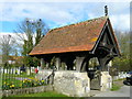
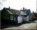
Nearby Images from Geograph Britain and Ireland:
©2008(licence)
©2008(licence)
©2018(licence)
©2019(licence)
©2019(licence)
The above images may not be of the site on this page, they are loaded from Geograph.
Please Submit an Image of this site or go out and take one for us!
Click here to see more info for this site
Nearby sites
Key: Red: member's photo, Blue: 3rd party photo, Yellow: other image, Green: no photo - please go there and take one, Grey: site destroyed
Download sites to:
KML (Google Earth)
GPX (GPS waypoints)
CSV (Garmin/Navman)
CSV (Excel)
To unlock full downloads you need to sign up as a Contributory Member. Otherwise downloads are limited to 50 sites.
Turn off the page maps and other distractions
Nearby sites listing. In the following links * = Image available
170m N 352° St. James's Church (Avebury) Ancient Cross (SU0997669968)
305m ENE 58° Avebury* Stone Circle (SU10266996)
332m NE 49° Avebury - The Cove* Standing Stones (SU10257002)
657m ESE 120° West Kennet Avenue polisher* Polissoir (SU10576947)
862m SE 127° West Kennet Avenue* Multiple Stone Rows / Avenue (SU10696928)
1.1km ESE 117° Falkner's Circle* Stone Circle (SU10986931)
1.1km WSW 242° South Street Long Barrow* Chambered Tomb (SU09006927)
1.2km WSW 246° Longstone Cove* Standing Stones (SU0888769301)
1.3km S 180° Silbury Hill* Artificial Mound (SU10016853)
1.5km WSW 243° Longstones Barrow* Long Barrow (SU08706914)
1.5km NE 34° Avebury Down Earthwork Misc. Earthwork (SU10837102)
1.6km SSE 157° Silbaby* Misc. Earthwork (SU1062668354)
1.6km WSW 249° South of Penning Barn* Round Barrow(s) (SU08506921)
1.7km S 177° Swallowhead Spring* Holy Well or Sacred Spring (SU101681)
1.7km NE 47° Avebury Downs Barn Tumuli* Barrow Cemetery (SU1125170971)
1.7km WSW 253° North of The Grange Round Barrow(s) (SU08346928)
1.9km E 82° Avebury Down barrow cemetery* Barrow Cemetery (SU11877007)
1.9km SSE 148° West Kennet Palisaded Enclosures* Ancient Village or Settlement (SU110682)
1.9km SE 128° Overton Hill barrow cemetery* Barrow Cemetery (SU11526863)
1.9km S 173° West Kennet Barrow Round Barrow(s) (SU10246788)
2.0km NE 44° Avebury Down Stone Circle* Stone Circle (SU11437127)
2.0km NW 317° Picket Barrow* Round Barrow(s) (SU086713)
2.1km NW 319° Windmill Hill Barrows* Round Barrow(s) (SU08637135)
2.1km NW 321° Windmill Hill (Avebury)* Causewayed Enclosure (SU08677144)
2.1km SSE 167° West Kennett Long Barrow* Long Barrow (SU10506774)
View more nearby sites and additional images


 We would like to know more about this location. Please feel free to add a brief description and any relevant information in your own language.
 Wir möchten mehr über diese Stätte erfahren. Bitte zögern Sie nicht, eine kurze Beschreibung und relevante Informationen in Deutsch hinzuzufügen.
 Nous aimerions en savoir encore un peu sur les lieux. S'il vous plaît n'hesitez pas à ajouter une courte description et tous les renseignements pertinents dans votre propre langue.
 Quisieramos informarnos un poco más de las lugares. No dude en añadir una breve descripción y otros datos relevantes en su propio idioma.