

<< Text Pages >> Dolmen de Busserais - Burial Chamber or Dolmen in France in Poitou:Vienne (86)
Submitted by TheCaptain on Friday, 06 May 2011 Page Views: 2319
Neolithic and Bronze AgeSite Name: Dolmen de BusseraisCountry: France Département: Poitou:Vienne (86) Type: Burial Chamber or Dolmen
Nearest Town: Poitiers Nearest Village: La Bussiere
Latitude: 46.632500N Longitude: 0.850600E
Condition:
| 5 | Perfect |
| 4 | Almost Perfect |
| 3 | Reasonable but with some damage |
| 2 | Ruined but still recognisable as an ancient site |
| 1 | Pretty much destroyed, possibly visible as crop marks |
| 0 | No data. |
| -1 | Completely destroyed |
| 5 | Superb |
| 4 | Good |
| 3 | Ordinary |
| 2 | Not Good |
| 1 | Awful |
| 0 | No data. |
| 5 | Can be driven to, probably with disabled access |
| 4 | Short walk on a footpath |
| 3 | Requiring a bit more of a walk |
| 2 | A long walk |
| 1 | In the middle of nowhere, a nightmare to find |
| 0 | No data. |
| 5 | co-ordinates taken by GPS or official recorded co-ordinates |
| 4 | co-ordinates scaled from a detailed map |
| 3 | co-ordinates scaled from a bad map |
| 2 | co-ordinates of the nearest village |
| 1 | co-ordinates of the nearest town |
| 0 | no data |
Be the first person to rate this site - see the 'Contribute!' box in the right hand menu.
Internal Links:
External Links:
burial chamber in Poitou-Charentes:Vienne
Le Busserais is a burial chamber in the community of La Bussiere, Departement of Vienne, Region of Poitou-Charentes
You may be viewing yesterday's version of this page. To see the most up to date information please register for a free account.
Do not use the above information on other web sites or publications without permission of the contributor.
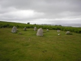
Nearby Images from Flickr
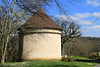
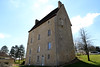
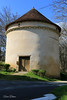
The above images may not be of the site on this page, but were taken nearby. They are loaded from Flickr so please click on them for image credits.
Click here to see more info for this site
Nearby sites
Click here to view sites on an interactive map of the areaKey: Red: member's photo, Blue: 3rd party photo, Yellow: other image, Green: no photo - please go there and take one, Grey: site destroyed
Download sites to:
KML (Google Earth)
GPX (GPS waypoints)
CSV (Garmin/Navman)
CSV (Excel)
To unlock full downloads you need to sign up as a Contributory Member. Otherwise downloads are limited to 50 sites.
Turn off the page maps and other distractions
Nearby sites listing. In the following links * = Image available
6.1km NNE 28° Grotte Angles sur l'Anglin* Cave or Rock Shelter
6.1km NNE 23° Dolmen des Liboureaux 1 Burial Chamber or Dolmen
6.4km NNE 22° Dolmen des Liboureaux 2 Burial Chamber or Dolmen
7.3km NNE 22° Roc-aux-Sorciers Museum
9.6km W 275° Dolmen dit la Maison du Fadet Burial Chamber or Dolmen
11.4km E 96° Dolmen de la Pierre au Loup Burial Chamber or Dolmen
15.6km ENE 64° Dolmen des Barges 1 Burial Chamber or Dolmen
15.8km WNW 287° Dolmen au Trépaizan Burial Chamber or Dolmen
16.1km N 357° Dolmen de la Pierre Levée (Confluent)* Burial Chamber or Dolmen
16.3km ENE 59° Dolmen des Barges 2 Burial Chamber or Dolmen
16.8km ENE 66° Dolmen dit la Pierre Levée (La Josière) Burial Chamber or Dolmen
18.7km NW 322° Dolmen de la Chenaillère Burial Chamber or Dolmen
24.4km ENE 68° Dolmen des Sablons* Burial Chamber or Dolmen
24.9km ENE 57° Menhir du Grand-Aslon* Standing Stone (Menhir)
25.0km ENE 69° Dolmen de la Pierre-à-la-Fade* Burial Chamber or Dolmen
25.2km NW 311° Dolmen des Pelyverts* Burial Chamber or Dolmen
26.0km SSW 192° Dolmen de la Bastière 1* Burial Chamber or Dolmen
26.2km SSW 192° Dolmen de la Bastière 2* Burial Chamber or Dolmen
26.4km N 2° Menhir de La Touche Standing Stone (Menhir)
26.9km SSW 200° Grotte des Fadets* Cave or Rock Shelter
26.9km SSW 209° Dolmen de Loubressac* Burial Chamber or Dolmen
26.9km SSW 201° Grotte de la Marche* Cave or Rock Shelter
27.2km SSW 201° Musée de Préhistoire Lussac-les-Chateaux Museum
27.8km SSE 163° Dolmen dit Pierre-Soupèze* Burial Chamber or Dolmen
28.2km SSE 163° Pierre Brune Dolmen Burial Chamber or Dolmen
View more nearby sites and additional images

")
 We would like to know more about this location. Please feel free to add a brief description and any relevant information in your own language.
 Wir möchten mehr über diese Stätte erfahren. Bitte zögern Sie nicht, eine kurze Beschreibung und relevante Informationen in Deutsch hinzuzufügen.
 Nous aimerions en savoir encore un peu sur les lieux. S'il vous plaît n'hesitez pas à ajouter une courte description et tous les renseignements pertinents dans votre propre langue.
 Quisieramos informarnos un poco más de las lugares. No dude en añadir una breve descripción y otros datos relevantes en su propio idioma.