 with our Megalithic Portal iPhone app")


<< Our Photo Pages >> Dolmen de Barrade - Burial Chamber or Dolmen in France in Midi:Lot (46)
Submitted by TheCaptain on Friday, 06 May 2011 Page Views: 2094
Neolithic and Bronze AgeSite Name: Dolmen de BarradeCountry: France Département: Midi:Lot (46) Type: Burial Chamber or Dolmen
Nearest Town: Souillac Nearest Village: Montvalent
Latitude: 44.876634N Longitude: 1.656291E
Condition:
| 5 | Perfect |
| 4 | Almost Perfect |
| 3 | Reasonable but with some damage |
| 2 | Ruined but still recognisable as an ancient site |
| 1 | Pretty much destroyed, possibly visible as crop marks |
| 0 | No data. |
| -1 | Completely destroyed |
| 5 | Superb |
| 4 | Good |
| 3 | Ordinary |
| 2 | Not Good |
| 1 | Awful |
| 0 | No data. |
| 5 | Can be driven to, probably with disabled access |
| 4 | Short walk on a footpath |
| 3 | Requiring a bit more of a walk |
| 2 | A long walk |
| 1 | In the middle of nowhere, a nightmare to find |
| 0 | No data. |
| 5 | co-ordinates taken by GPS or official recorded co-ordinates |
| 4 | co-ordinates scaled from a detailed map |
| 3 | co-ordinates scaled from a bad map |
| 2 | co-ordinates of the nearest village |
| 1 | co-ordinates of the nearest town |
| 0 | no data |
Be the first person to rate this site - see the 'Contribute!' box in the right hand menu.
Internal Links:
External Links:
")
Barrade is a burial chamber in the community of Montvalent, Departement of Lot, Region of Midi-Pyrénées
You may be viewing yesterday's version of this page. To see the most up to date information please register for a free account.
")
Do not use the above information on other web sites or publications without permission of the contributor.
Nearby Images from Flickr
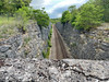

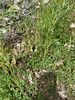
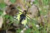

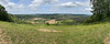
The above images may not be of the site on this page, but were taken nearby. They are loaded from Flickr so please click on them for image credits.
Click here to see more info for this site
Nearby sites
Click here to view sites on an interactive map of the areaKey: Red: member's photo, Blue: 3rd party photo, Yellow: other image, Green: no photo - please go there and take one, Grey: site destroyed
Download sites to:
KML (Google Earth)
GPX (GPS waypoints)
CSV (Garmin/Navman)
CSV (Excel)
To unlock full downloads you need to sign up as a Contributory Member. Otherwise downloads are limited to 50 sites.
Turn off the page maps and other distractions
Nearby sites listing. In the following links * = Image available
1.2km WSW 246° Dolmen de Liade* Burial Chamber or Dolmen
1.3km ESE 104° Dolmen du Pech des Auques Burial Chamber or Dolmen
1.5km S 172° Dolmen de Barthe Soubronne* Burial Chamber or Dolmen
2.3km ESE 112° Dolmen dit la Pierre Levée (Lecusses)* Burial Chamber or Dolmen
2.4km NNE 15° Dolmen des Barthes 1 Burial Chamber or Dolmen
2.5km SW 226° Dolmen de Pélasse Burial Chamber or Dolmen
2.5km SE 125° Dolmen de la Carture Burial Chamber or Dolmen
2.5km NNE 32° Dolmen des Barthes 2 Burial Chamber or Dolmen
2.6km NE 51° Dolmen de Candare 2* Burial Chamber or Dolmen
2.6km E 90° Gisement de Fieux* Cave or Rock Shelter
2.7km NE 51° Dolmen de Candare 1* Burial Chamber or Dolmen
2.7km ESE 106° Dolmen des Barrières 2* Burial Chamber or Dolmen
2.9km SE 124° Dolmen de Sabadel Burial Chamber or Dolmen
3.0km ESE 101° Dolmen de Barrières 1* Burial Chamber or Dolmen
3.0km E 83° Fieux Dolmen* Burial Chamber or Dolmen
3.0km SSW 198° Dolmen des Placels Burial Chamber or Dolmen
3.0km W 277° La Masse Burial Chamber or Dolmen
3.0km NNE 24° Dolmen de Ressegayre* Burial Chamber or Dolmen
3.2km ENE 76° Dolmen dit Peyrebru (Miers)* Burial Chamber or Dolmen
3.4km NNE 23° Dolmen du Pech Cayrou* Burial Chamber or Dolmen
3.6km ENE 60° Dolmen du Cloup de Roual Burial Chamber or Dolmen
3.7km E 89° Dolmen de Niars Burial Chamber or Dolmen
4.0km NNE 33° Dolmen de la Combe de Xey Burial Chamber or Dolmen
4.0km NNE 13° Dolmen de Camp Rastoul Burial Chamber or Dolmen
4.5km NNE 26° Peyrelevade (Camp del Prieu)* Burial Chamber or Dolmen
View more nearby sites and additional images


 We would like to know more about this location. Please feel free to add a brief description and any relevant information in your own language.
 Wir möchten mehr über diese Stätte erfahren. Bitte zögern Sie nicht, eine kurze Beschreibung und relevante Informationen in Deutsch hinzuzufügen.
 Nous aimerions en savoir encore un peu sur les lieux. S'il vous plaît n'hesitez pas à ajouter une courte description et tous les renseignements pertinents dans votre propre langue.
 Quisieramos informarnos un poco más de las lugares. No dude en añadir una breve descripción y otros datos relevantes en su propio idioma.