


<< Text Pages >> Dolmen du Cap de Saint-Marty 1 - Burial Chamber or Dolmen in France in Midi:Aveyron (12)
Submitted by TheCaptain on Friday, 06 May 2011 Page Views: 1289
Neolithic and Bronze AgeSite Name: Dolmen du Cap de Saint-Marty 1Country: France Département: Midi:Aveyron (12) Type: Burial Chamber or Dolmen
Nearest Town: Villefranche-de-Rouergue Nearest Village: Balaguier d'Olt
Latitude: 44.505490N Longitude: 1.962490E
Condition:
| 5 | Perfect |
| 4 | Almost Perfect |
| 3 | Reasonable but with some damage |
| 2 | Ruined but still recognisable as an ancient site |
| 1 | Pretty much destroyed, possibly visible as crop marks |
| 0 | No data. |
| -1 | Completely destroyed |
| 5 | Superb |
| 4 | Good |
| 3 | Ordinary |
| 2 | Not Good |
| 1 | Awful |
| 0 | No data. |
| 5 | Can be driven to, probably with disabled access |
| 4 | Short walk on a footpath |
| 3 | Requiring a bit more of a walk |
| 2 | A long walk |
| 1 | In the middle of nowhere, a nightmare to find |
| 0 | No data. |
| 5 | co-ordinates taken by GPS or official recorded co-ordinates |
| 4 | co-ordinates scaled from a detailed map |
| 3 | co-ordinates scaled from a bad map |
| 2 | co-ordinates of the nearest village |
| 1 | co-ordinates of the nearest town |
| 0 | no data |
Be the first person to rate this site - see the 'Contribute!' box in the right hand menu.
Internal Links:
External Links:
burial chamber in Midi-Pyrénées:Aveyron
Cap de St-Marty 1 is a burial chamber in the community of Balaguier d'Olt, Departement of Aveyron, Region of Midi-Pyrénées
You may be viewing yesterday's version of this page. To see the most up to date information please register for a free account.
Do not use the above information on other web sites or publications without permission of the contributor.
Nearby Images from Flickr
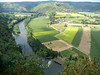
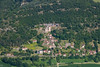
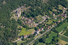
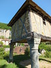
The above images may not be of the site on this page, but were taken nearby. They are loaded from Flickr so please click on them for image credits.
Click here to see more info for this site
Nearby sites
Click here to view sites on an interactive map of the areaKey: Red: member's photo, Blue: 3rd party photo, Yellow: other image, Green: no photo - please go there and take one, Grey: site destroyed
Download sites to:
KML (Google Earth)
GPX (GPS waypoints)
CSV (Garmin/Navman)
CSV (Excel)
To unlock full downloads you need to sign up as a Contributory Member. Otherwise downloads are limited to 50 sites.
Turn off the page maps and other distractions
Nearby sites listing. In the following links * = Image available
41m SE 143° Dolmen du Cap de Saint-Marty 2 Burial Chamber or Dolmen
402m ESE 107° Dolmen de la Combe del Mas Burial Chamber or Dolmen
724m NE 43° Dolmen de la Bouyssière Burial Chamber or Dolmen
1.5km W 264° Pierre Levée (Ambeyrac) Standing Stone (Menhir)
1.8km NNE 26° Dolmen du Mas de Rénailhac Burial Chamber or Dolmen
1.9km ESE 118° Bois des Porcs Burial Chamber or Dolmen
2.3km NNE 21° Dolmen du Bois d'Alary Burial Chamber or Dolmen
2.4km ESE 106° Dolmen des Places 1* Burial Chamber or Dolmen
2.5km NW 320° Dolmen du Pech de Molinié 2 Burial Chamber or Dolmen
2.5km ESE 105° Dolmen des Places 4* Burial Chamber or Dolmen
2.6km ESE 106° Dolmen des Places 2* Burial Chamber or Dolmen
2.6km ESE 104° Dolmen des Places 3* Burial Chamber or Dolmen
2.6km ESE 104° Dolmen du Cloup de Rhines* Burial Chamber or Dolmen
2.8km S 177° Dolmen de l'Homme Mort (Montsales)* Burial Chamber or Dolmen
2.9km E 97° Dolmen de la Jonade 1* Burial Chamber or Dolmen
2.9km E 97° Dolmen de la Jonade 2* Burial Chamber or Dolmen
3.0km SW 219° Dolmen du Pet 3 Burial Chamber or Dolmen
3.0km SW 220° Dolmens du Pet 1 Burial Chamber or Dolmen
3.1km SW 219° Dolmen du Pet 2 Burial Chamber or Dolmen
3.1km E 80° Dolmen du Couderc Burial Chamber or Dolmen
3.2km ESE 109° Mas de Pradie Burial Chamber or Dolmen
3.2km ESE 106° Dolmen des Garrigues 1 Burial Chamber or Dolmen
3.2km ESE 105° Dolmen des Garrigues 2 Burial Chamber or Dolmen
3.4km WSW 247° Menhir de Camboulan Standing Stone (Menhir)
3.5km E 95° Grotte de Foissac* Cave or Rock Shelter
View more nearby sites and additional images


 We would like to know more about this location. Please feel free to add a brief description and any relevant information in your own language.
 Wir möchten mehr über diese Stätte erfahren. Bitte zögern Sie nicht, eine kurze Beschreibung und relevante Informationen in Deutsch hinzuzufügen.
 Nous aimerions en savoir encore un peu sur les lieux. S'il vous plaît n'hesitez pas à ajouter une courte description et tous les renseignements pertinents dans votre propre langue.
 Quisieramos informarnos un poco más de las lugares. No dude en añadir una breve descripción y otros datos relevantes en su propio idioma.