


<< Our Photo Pages >> Holmgård Langdysse - Long Barrow in Denmark in Hovedstaden
Submitted by kristiansen on Thursday, 10 June 2010 Page Views: 1732
Neolithic and Bronze AgeSite Name: Holmgård LangdysseCountry: Denmark County: Hovedstaden Type: Long Barrow
Nearest Town: København Nearest Village: Lille Lyngby
Latitude: 55.931467N Longitude: 12.114987E
Condition:
| 5 | Perfect |
| 4 | Almost Perfect |
| 3 | Reasonable but with some damage |
| 2 | Ruined but still recognisable as an ancient site |
| 1 | Pretty much destroyed, possibly visible as crop marks |
| 0 | No data. |
| -1 | Completely destroyed |
| 5 | Superb |
| 4 | Good |
| 3 | Ordinary |
| 2 | Not Good |
| 1 | Awful |
| 0 | No data. |
| 5 | Can be driven to, probably with disabled access |
| 4 | Short walk on a footpath |
| 3 | Requiring a bit more of a walk |
| 2 | A long walk |
| 1 | In the middle of nowhere, a nightmare to find |
| 0 | No data. |
| 5 | co-ordinates taken by GPS or official recorded co-ordinates |
| 4 | co-ordinates scaled from a detailed map |
| 3 | co-ordinates scaled from a bad map |
| 2 | co-ordinates of the nearest village |
| 1 | co-ordinates of the nearest town |
| 0 | no data |
Be the first person to rate this site - see the 'Contribute!' box in the right hand menu.
Internal Links:
External Links:
")
More information at www.kulturarv.dk: Danish Sites and Monuments Record: 010504-30
"Fortidsmindedata Copyright Kulturarvsstyrelsen"
You may be viewing yesterday's version of this page. To see the most up to date information please register for a free account.
")
")
")
")
Do not use the above information on other web sites or publications without permission of the contributor.
Nearby Images from Flickr
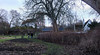

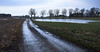
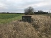
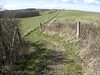
The above images may not be of the site on this page, but were taken nearby. They are loaded from Flickr so please click on them for image credits.
Click here to see more info for this site
Nearby sites
Click here to view sites on an interactive map of the areaKey: Red: member's photo, Blue: 3rd party photo, Yellow: other image, Green: no photo - please go there and take one, Grey: site destroyed
Download sites to:
KML (Google Earth)
GPX (GPS waypoints)
CSV (Garmin/Navman)
CSV (Excel)
To unlock full downloads you need to sign up as a Contributory Member. Otherwise downloads are limited to 50 sites.
Turn off the page maps and other distractions
Nearby sites listing. In the following links * = Image available
1.5km W 273° Humlegaardshøi* Round Barrow(s)
2.2km ENE 60° Flintholmgaard's højgruppe* Barrow Cemetery
2.4km S 178° Markebækgård Langhøj* Long Barrow
2.4km SW 235° Ølsted Gasbetonfabrik* Stone Circle
2.6km SW 221° Vibjerg Hellekiste* Cist
3.2km NE 49° Præstegrd.'s Markers højgruppe* Barrow Cemetery
3.3km NE 47° Ll. Lyngby Stenrække* Standing Stones
4.6km NW 318° Sonnerup Rundhøj* Round Barrow(s)
4.7km WSW 237° Store Havelse Runddysse* Burial Chamber or Dolmen
5.2km NW 325° Auderød Møllehøj* Round Barrow(s)
5.2km SE 136° Borupgård Jættestue* Passage Grave
6.1km NW 308° Brederød Maglehøj* Round Barrow(s)
6.3km S 175° Mankegård Langdysse 1* Long Barrow
6.4km S 176° Mankegård Langdysse 2* Long Barrow
6.8km ESE 114° Freerslev Hegn Langdysse 2* Long Barrow
6.9km SE 130° Marbækgård Jættestue* Passage Grave
6.9km WSW 243° Jægerspris Skove Runddysse 1* Burial Chamber or Dolmen
6.9km NE 52° Neiede Vesterskov Jættestue* Passage Grave
7.0km ENE 60° Holmgård Jættestue* Passage Grave
7.1km SSW 201° Sigerslevvester Runddysse* Burial Chamber or Dolmen
7.2km ESE 106° Freerslev Hegn Langdysse 1* Long Barrow
7.6km NNE 34° Annisse Jættestue 2* Passage Grave
7.6km E 83° Tjæreby Runddysse* Burial Chamber or Dolmen
7.9km NNE 32° Annisse Jættestue 1* Passage Grave
8.4km S 181° Græse Jættestue 2* Passage Grave
View more nearby sites and additional images


 We would like to know more about this location. Please feel free to add a brief description and any relevant information in your own language.
 Wir möchten mehr über diese Stätte erfahren. Bitte zögern Sie nicht, eine kurze Beschreibung und relevante Informationen in Deutsch hinzuzufügen.
 Nous aimerions en savoir encore un peu sur les lieux. S'il vous plaît n'hesitez pas à ajouter une courte description et tous les renseignements pertinents dans votre propre langue.
 Quisieramos informarnos un poco más de las lugares. No dude en añadir una breve descripción y otros datos relevantes en su propio idioma.