 with our Megalithic Portal iPhone app")


<< Our Photo Pages >> Planàs cromlech - Stone Circle in France in Languedoc:Gard (30)
Submitted by TheCaptain on Saturday, 16 April 2005 Page Views: 3161
Neolithic and Bronze AgeSite Name: Planàs cromlechCountry: France Département: Languedoc:Gard (30) Type: Stone Circle
Nearest Town: Le Vigan Nearest Village: Blandas
Latitude: 43.928000N Longitude: 3.537000E
Condition:
| 5 | Perfect |
| 4 | Almost Perfect |
| 3 | Reasonable but with some damage |
| 2 | Ruined but still recognisable as an ancient site |
| 1 | Pretty much destroyed, possibly visible as crop marks |
| 0 | No data. |
| -1 | Completely destroyed |
| 5 | Superb |
| 4 | Good |
| 3 | Ordinary |
| 2 | Not Good |
| 1 | Awful |
| 0 | No data. |
| 5 | Can be driven to, probably with disabled access |
| 4 | Short walk on a footpath |
| 3 | Requiring a bit more of a walk |
| 2 | A long walk |
| 1 | In the middle of nowhere, a nightmare to find |
| 0 | No data. |
| 5 | co-ordinates taken by GPS or official recorded co-ordinates |
| 4 | co-ordinates scaled from a detailed map |
| 3 | co-ordinates scaled from a bad map |
| 2 | co-ordinates of the nearest village |
| 1 | co-ordinates of the nearest town |
| 0 | no data |
Internal Links:
External Links:
I have visited· I would like to visit
TheCaptain visited on 19th Sep 2005 - their rating: Cond: 1 Access: 5 Destroyed many years ago during construction of the road, just a few stumps and fallen stones of this cromlech remain scattered around near the junction. What was once a fine stone circle is now just a large road junction in the middle of nowhere.
")
Destroyed many years ago during construction of the road, just a few stumps and fallen stones of this cromlech remain scattered around near the junction.
You may be viewing yesterday's version of this page. To see the most up to date information please register for a free account.
")
Do not use the above information on other web sites or publications without permission of the contributor.
Nearby Images from Flickr
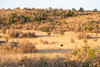
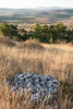


The above images may not be of the site on this page, but were taken nearby. They are loaded from Flickr so please click on them for image credits.
Click here to see more info for this site
Nearby sites
Click here to view sites on an interactive map of the areaKey: Red: member's photo, Blue: 3rd party photo, Yellow: other image, Green: no photo - please go there and take one, Grey: site destroyed
Download sites to:
KML (Google Earth)
GPX (GPS waypoints)
CSV (Garmin/Navman)
CSV (Excel)
To unlock full downloads you need to sign up as a Contributory Member. Otherwise downloads are limited to 50 sites.
Turn off the page maps and other distractions
Nearby sites listing. In the following links * = Image available
37m WNW 298° Menhir de Planàs* Standing Stone (Menhir)
38m NW 307° Planàs Dolmen* Burial Chamber or Dolmen
195m SE 125° Serre de la Gleisa* Standing Stone (Menhir)
547m WSW 247° Lacam de Peyrarines* Stone Circle
927m SSE 151° Regos Dolmen* Burial Chamber or Dolmen
1.3km W 261° Menhir Sotch de Génièvres* Standing Stone (Menhir)
1.8km WNW 296° Menhir de Landre 2* Standing Stone (Menhir)
1.9km S 179° Dolmen du Chateau d'Assas* Burial Chamber or Dolmen
1.9km WNW 299° Menhir de Landre 1* Standing Stone (Menhir)
2.2km SE 141° Dolmen de Barral* Burial Chamber or Dolmen
2.7km SW 227° Cave of the Menhir* Cave or Rock Shelter
2.7km ESE 121° Caucalière Menhir* Standing Stone (Menhir)
2.7km ESE 120° Dolmen de la Caucalière* Burial Chamber or Dolmen
2.9km WNW 292° Arques Dolmen* Burial Chamber or Dolmen
3.1km ESE 121° Flouirac Dolmen* Burial Chamber or Dolmen
3.3km SSW 203° Menhir Travers des Noyers 1* Standing Stone (Menhir)
3.3km SSW 203° Menhir Travers des Noyers 2* Standing Stone (Menhir)
3.4km WNW 285° Combes Menhir* Standing Stone (Menhir)
3.6km WNW 284° Avernat menhir* Standing Stone (Menhir)
3.6km SE 124° Menhirs de Campouillas* Standing Stone (Menhir)
3.7km W 269° Lacam de la Rigalderie* Stone Circle
3.7km W 267° Lacam de la Rigalderie 2* Stone Circle
3.8km S 177° Dolmen de la Borie d'Arre 2* Burial Chamber or Dolmen
3.8km S 177° Dolmen Borie d'Arre 3* Burial Chamber or Dolmen
3.8km S 180° Dolmen de la Borie d'Arre 1* Burial Chamber or Dolmen
View more nearby sites and additional images


 We would like to know more about this location. Please feel free to add a brief description and any relevant information in your own language.
 Wir möchten mehr über diese Stätte erfahren. Bitte zögern Sie nicht, eine kurze Beschreibung und relevante Informationen in Deutsch hinzuzufügen.
 Nous aimerions en savoir encore un peu sur les lieux. S'il vous plaît n'hesitez pas à ajouter une courte description et tous les renseignements pertinents dans votre propre langue.
 Quisieramos informarnos un poco más de las lugares. No dude en añadir una breve descripción y otros datos relevantes en su propio idioma.