 with our Megalithic Portal iPhone app")

<< Our Photo Pages >> Dolmen dit la Table de Roux - Burial Chamber or Dolmen in France in Midi:Lot (46)
Submitted by TheCaptain on Saturday, 16 April 2005 Page Views: 4172
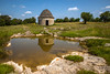
Neolithic and Bronze AgeSite Name: Dolmen dit la Table de Roux Alternative Name: Pierre de RouxCountry: France Département: Midi:Lot (46) Type: Burial Chamber or Dolmen
Nearest Town: Figeac Nearest Village: Assier
Latitude: 44.669279N Longitude: 1.858624E
Condition:
| 5 | Perfect |
| 4 | Almost Perfect |
| 3 | Reasonable but with some damage |
| 2 | Ruined but still recognisable as an ancient site |
| 1 | Pretty much destroyed, possibly visible as crop marks |
| 0 | No data. |
| -1 | Completely destroyed |
| 5 | Superb |
| 4 | Good |
| 3 | Ordinary |
| 2 | Not Good |
| 1 | Awful |
| 0 | No data. |
| 5 | Can be driven to, probably with disabled access |
| 4 | Short walk on a footpath |
| 3 | Requiring a bit more of a walk |
| 2 | A long walk |
| 1 | In the middle of nowhere, a nightmare to find |
| 0 | No data. |
| 5 | co-ordinates taken by GPS or official recorded co-ordinates |
| 4 | co-ordinates scaled from a detailed map |
| 3 | co-ordinates scaled from a bad map |
| 2 | co-ordinates of the nearest village |
| 1 | co-ordinates of the nearest town |
| 0 | no data |
Be the first person to rate this site - see the 'Contribute!' box in the right hand menu.
Internal Links:
External Links:
I have visited· I would like to visit
DrewParsons would like to visit
J_W_R visited on 25th Aug 2022 - their rating: Cond: 4 Amb: 4 Access: 3
")
Location Source: OpenStreetMap
You may be viewing yesterday's version of this page. To see the most up to date information please register for a free account.
")
")
Do not use the above information on other web sites or publications without permission of the contributor.
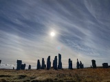
Nearby Images from Flickr
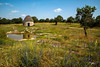
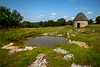
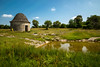


The above images may not be of the site on this page, but were taken nearby. They are loaded from Flickr so please click on them for image credits.
Click here to see more info for this site
Nearby sites
Click here to view sites on an interactive map of the areaKey: Red: member's photo, Blue: 3rd party photo, Yellow: other image, Green: no photo - please go there and take one, Grey: site destroyed
Download sites to:
KML (Google Earth)
GPX (GPS waypoints)
CSV (Garmin/Navman)
CSV (Excel)
To unlock full downloads you need to sign up as a Contributory Member. Otherwise downloads are limited to 50 sites.
Turn off the page maps and other distractions
Nearby sites listing. In the following links * = Image available
788m NNW 335° Garivals Dolmen* Burial Chamber or Dolmen
923m NNW 348° Dolmen du Bois des Boeufs* Burial Chamber or Dolmen
1.1km NNE 13° Mons dolmen 1* Burial Chamber or Dolmen
1.3km NNE 31° Les Vaysses dolmen Burial Chamber or Dolmen
1.4km N 11° Mons menhir Standing Stone (Menhir)
1.4km N 350° Mons Dolmen 2* Burial Chamber or Dolmen
1.6km N 359° Mons Dolmen 3* Burial Chamber or Dolmen
2.2km ESE 123° Dolmen du Puech Roussel Burial Chamber or Dolmen
2.5km SE 143° Causse du Magre Burial Chamber or Dolmen
3.1km WSW 252° La Pierre Martine* Burial Chamber or Dolmen
3.1km WSW 254° Rougié Dolmen* Burial Chamber or Dolmen
3.1km WSW 251° Livernon quarry* Ancient Mine, Quarry or other Industry
3.6km SE 124° Dolmen du Causses Hauts 2 Burial Chamber or Dolmen
3.6km ESE 117° Dolmen du Causses Hauts 1 Burial Chamber or Dolmen
3.8km S 180° Belinac Menhir* Standing Stone (Menhir)
4.0km SSE 167° Dolmen de la Croze Burial Chamber or Dolmen
4.0km SSE 159° Dolmen Le Cun Burial Chamber or Dolmen
4.2km SSE 159° Dolmen de Cloup Caoud 2 Burial Chamber or Dolmen
4.2km SSE 159° Dolmen de Cloup Caoud 1 Burial Chamber or Dolmen
4.3km SE 145° Dolmen de La Terre Burial Chamber or Dolmen
4.6km SW 234° Dolmen de Vichelle Burial Chamber or Dolmen
4.9km SE 140° Dolmen du Champ de Cuzer Burial Chamber or Dolmen
5.1km NNW 334° Dolmen de Roucous Burial Chamber or Dolmen
5.3km WNW 297° Tumulus des Roques Burial Chamber or Dolmen
5.4km WNW 297° Dolmen des Roques Burial Chamber or Dolmen
View more nearby sites and additional images


 We would like to know more about this location. Please feel free to add a brief description and any relevant information in your own language.
 Wir möchten mehr über diese Stätte erfahren. Bitte zögern Sie nicht, eine kurze Beschreibung und relevante Informationen in Deutsch hinzuzufügen.
 Nous aimerions en savoir encore un peu sur les lieux. S'il vous plaît n'hesitez pas à ajouter une courte description et tous les renseignements pertinents dans votre propre langue.
 Quisieramos informarnos un poco más de las lugares. No dude en añadir una breve descripción y otros datos relevantes en su propio idioma.