


<< Other Photo Pages >> Grotte de Villars - Cave or Rock Shelter in France in Aquitaine:Dordogne (24)
Submitted by TheCaptain on Saturday, 16 April 2005 Page Views: 2579
Natural PlacesSite Name: Grotte de Villars Alternative Name: Grotte du CluzeauCountry: France Département: Aquitaine:Dordogne (24) Type: Cave or Rock Shelter
Nearest Town: Périgueux Nearest Village: Villars
Latitude: 45.442562N Longitude: 0.785301E
Condition:
| 5 | Perfect |
| 4 | Almost Perfect |
| 3 | Reasonable but with some damage |
| 2 | Ruined but still recognisable as an ancient site |
| 1 | Pretty much destroyed, possibly visible as crop marks |
| 0 | No data. |
| -1 | Completely destroyed |
| 5 | Superb |
| 4 | Good |
| 3 | Ordinary |
| 2 | Not Good |
| 1 | Awful |
| 0 | No data. |
| 5 | Can be driven to, probably with disabled access |
| 4 | Short walk on a footpath |
| 3 | Requiring a bit more of a walk |
| 2 | A long walk |
| 1 | In the middle of nowhere, a nightmare to find |
| 0 | No data. |
| 5 | co-ordinates taken by GPS or official recorded co-ordinates |
| 4 | co-ordinates scaled from a detailed map |
| 3 | co-ordinates scaled from a bad map |
| 2 | co-ordinates of the nearest village |
| 1 | co-ordinates of the nearest town |
| 0 | no data |
Be the first person to rate this site - see the 'Contribute!' box in the right hand menu.
Internal Links:
External Links:
I have visited· I would like to visit
Podovsky visited on 3rd Jul 2018 - their rating: Cond: 5 Amb: 5 Access: 3
")
Location Source: T4T35.fr
Information with Pictures
hominides.com
You may be viewing yesterday's version of this page. To see the most up to date information please register for a free account.
")
")
")
")
Do not use the above information on other web sites or publications without permission of the contributor.
Nearby Images from Flickr

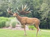
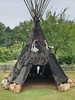
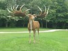
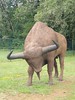
The above images may not be of the site on this page, but were taken nearby. They are loaded from Flickr so please click on them for image credits.
Click here to see more info for this site
Nearby sites
Click here to view sites on an interactive map of the areaKey: Red: member's photo, Blue: 3rd party photo, Yellow: other image, Green: no photo - please go there and take one, Grey: site destroyed
Download sites to:
KML (Google Earth)
GPX (GPS waypoints)
CSV (Garmin/Navman)
CSV (Excel)
To unlock full downloads you need to sign up as a Contributory Member. Otherwise downloads are limited to 50 sites.
Turn off the page maps and other distractions
Nearby sites listing. In the following links * = Image available
4.1km SW 214° Dolmen de Puyruffet Burial Chamber or Dolmen
4.6km E 89° Grotte des Fraux Cave or Rock Shelter
10.0km SW 220° Menhir de Fouret* Standing Stone (Menhir)
10.4km SW 219° Peyre Levade (Condat)* Burial Chamber or Dolmen
11.5km SSW 208° Peyrelevade 2 (Condat)* Burial Chamber or Dolmen
11.6km W 263° Menhir de Champredon* Standing Stone (Menhir)
13.0km NE 48° Dolmen dit Peyre Jazen* Burial Chamber or Dolmen
13.1km NE 49° La Pierre Levée (St Jory)* Burial Chamber or Dolmen
13.1km SW 227° La Pierre Levée (Brantôme)* Burial Chamber or Dolmen
13.9km NNE 33° Dolmen de Vaure (Mialet) Burial Chamber or Dolmen
14.1km NNE 28° Dolmen de Vaure (St Saud)* Burial Chamber or Dolmen
14.5km W 280° Grotte de la Font-Bargeix Cave or Rock Shelter
16.1km SSE 162° Menhir de La Pelletenie* Standing Stone (Menhir)
16.2km SSE 162° Dolmen de Sorges* Burial Chamber or Dolmen
16.2km SSE 161° Dolmen de la Pelletenie* Burial Chamber or Dolmen
16.6km SW 216° Dolmen des Coutoux* Burial Chamber or Dolmen
16.7km NW 324° La Chapoulie* Standing Stones
17.3km WNW 284° Bernardieres* Stone Row / Alignment
17.6km SW 218° Beauroulet Dolmen* Burial Chamber or Dolmen
17.9km SW 227° Mégalithe (Valeuil) Standing Stone (Menhir)
19.4km SW 231° Fourneau du Diable* Rock Outcrop
19.7km SW 231° Grotte des Bernoux Cave or Rock Shelter
20.2km SW 230° Grotte du Trou de la Chèvre Cave or Rock Shelter
20.6km W 280° La Roderie* Standing Stone (Menhir)
20.8km ENE 69° La Lande de Prounoux Burial Chamber or Dolmen
View more nearby sites and additional images


 We would like to know more about this location. Please feel free to add a brief description and any relevant information in your own language.
 Wir möchten mehr über diese Stätte erfahren. Bitte zögern Sie nicht, eine kurze Beschreibung und relevante Informationen in Deutsch hinzuzufügen.
 Nous aimerions en savoir encore un peu sur les lieux. S'il vous plaît n'hesitez pas à ajouter une courte description et tous les renseignements pertinents dans votre propre langue.
 Quisieramos informarnos un poco más de las lugares. No dude en añadir una breve descripción y otros datos relevantes en su propio idioma.