


<< Our Photo Pages >> Rocher Du Rohain - Rock Outcrop in France in Pays de la Loire:Loire-Atlantique
Submitted by AlexHunger on Saturday, 16 April 2005 Page Views: 5056
Natural PlacesSite Name: Rocher Du Rohain Alternative Name: La Butte Aux FeesCountry: France Département: Pays de la Loire:Loire-Atlantique Type: Rock Outcrop
Nearest Town: La Baule-Escoublac Nearest Village: Kerbourg
Latitude: 47.366340N Longitude: 2.33596W
Condition:
| 5 | Perfect |
| 4 | Almost Perfect |
| 3 | Reasonable but with some damage |
| 2 | Ruined but still recognisable as an ancient site |
| 1 | Pretty much destroyed, possibly visible as crop marks |
| 0 | No data. |
| -1 | Completely destroyed |
| 5 | Superb |
| 4 | Good |
| 3 | Ordinary |
| 2 | Not Good |
| 1 | Awful |
| 0 | No data. |
| 5 | Can be driven to, probably with disabled access |
| 4 | Short walk on a footpath |
| 3 | Requiring a bit more of a walk |
| 2 | A long walk |
| 1 | In the middle of nowhere, a nightmare to find |
| 0 | No data. |
| 5 | co-ordinates taken by GPS or official recorded co-ordinates |
| 4 | co-ordinates scaled from a detailed map |
| 3 | co-ordinates scaled from a bad map |
| 2 | co-ordinates of the nearest village |
| 1 | co-ordinates of the nearest town |
| 0 | no data |
Internal Links:
External Links:
I have visited· I would like to visit
johnstone visited on 4th Jul 2013 - their rating: Cond: 4 Amb: 4 Access: 4
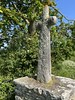
TheCaptain visited on 8th Jun 2005 - their rating: Cond: 1 Amb: 4 Access: 3 I spent ages trying to find this, and in the end found what was a natural granite outcrop on a little mound, up a trackway round the back of some houses. It looked to me like a couple of stones have been moved and sculpted, and may be the remains of some form of burial monument. However, I later found out that the proper dolmen here is not at the rock outcrop, but somewhere to the northwest of it. I went back in the morning for another look, but still found nothing. It must be well hidden in amongst the very dense gorse and bramble ridden undergrowth somewhere.
Average ratings for this site from all visit loggers: Condition: 2.5 Ambience: 4 Access: 3.5
")
Classified as Dolmen by IGN, but by all appearance a natural stone outcrop in an otherwise marshy area. Archeologists would have to determine true significance of this site.
Address: Ancienne voie Romaine, 44500
You may be viewing yesterday's version of this page. To see the most up to date information please register for a free account.
")
")
Do not use the above information on other web sites or publications without permission of the contributor.
Nearby Images from Flickr
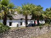
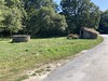
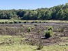
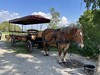
The above images may not be of the site on this page, but were taken nearby. They are loaded from Flickr so please click on them for image credits.
Click here to see more info for this site
Nearby sites
Click here to view sites on an interactive map of the areaKey: Red: member's photo, Blue: 3rd party photo, Yellow: other image, Green: no photo - please go there and take one, Grey: site destroyed
Download sites to:
KML (Google Earth)
GPX (GPS waypoints)
CSV (Garmin/Navman)
CSV (Excel)
To unlock full downloads you need to sign up as a Contributory Member. Otherwise downloads are limited to 50 sites.
Turn off the page maps and other distractions
Nearby sites listing. In the following links * = Image available
415m NNW 330° Kerdanestre Menhir Christianisé* Standing Stone (Menhir)
474m WNW 283° Dolmens de Crugo Burial Chamber or Dolmen
1.3km NNW 346° Keralio Croix Menhir* Standing Stone (Menhir)
1.7km S 176° Menhir de la Grée (Guérande) Standing Stone (Menhir)
1.9km SSW 194° Croix de Sandun Dolmen* Burial Chamber or Dolmen
2.0km W 260° Kerbourg Dolmen 1* Passage Grave
2.0km SSW 205° Tertre de Bretineau* Long Barrow
2.0km WSW 258° Kerbourg Dolmen 2* Burial Chamber or Dolmen
2.0km WNW 290° Pont de Gras* Ancient Trackway
2.3km ENE 69° Dolmens dit les Roches de Baudin Burial Chamber or Dolmen
2.7km W 264° La Pierre Blanche (Kerbourg)* Standing Stone (Menhir)
3.1km SW 226° Dolmen de Lévérac Burial Chamber or Dolmen
3.4km N 358° La Pierre De Len Menhir* Standing Stone (Menhir)
4.0km SW 223° L'Ile de la Chapelle Menhir Standing Stone (Menhir)
5.7km ENE 61° la Butte-aux-Pierres Not Known (by us)
5.9km NE 55° Dolmen de la Roche au Moine Burial Chamber or Dolmen
6.2km SSW 192° La Grée Dolmen Burial Chamber or Dolmen
6.5km S 184° Allée Couverte de Coëtcas Passage Grave
6.5km S 184° Menhir de Couëtcas* Standing Stone (Menhir)
7.1km SW 218° Menhir de Bissin* Standing Stone (Menhir)
7.2km SE 134° Dolmen de la Garenne (St Andre)* Burial Chamber or Dolmen
8.5km SSW 213° Dolmen de Careil Burial Chamber or Dolmen
8.8km WSW 257° Menhir de Keroland* Standing Stone (Menhir)
9.1km SE 134° Dolmen de Cuneix Burial Chamber or Dolmen
9.5km SW 229° La Pierre de Saillé* Standing Stone (Menhir)
View more nearby sites and additional images


 We would like to know more about this location. Please feel free to add a brief description and any relevant information in your own language.
 Wir möchten mehr über diese Stätte erfahren. Bitte zögern Sie nicht, eine kurze Beschreibung und relevante Informationen in Deutsch hinzuzufügen.
 Nous aimerions en savoir encore un peu sur les lieux. S'il vous plaît n'hesitez pas à ajouter une courte description et tous les renseignements pertinents dans votre propre langue.
 Quisieramos informarnos un poco más de las lugares. No dude en añadir una breve descripción y otros datos relevantes en su propio idioma.