

<< Our Photo Pages >> Alignement des Bruyères - Stone Row / Alignment in France in Normandie:Eure (27)
Submitted by TheCaptain on Saturday, 16 April 2005 Page Views: 4828
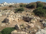
Neolithic and Bronze AgeSite Name: Alignement des Bruyères Alternative Name: Baux-Sainte-Croix AlignementCountry: France Département: Normandie:Eure (27) Type: Stone Row / Alignment
Nearest Town: Evreux Nearest Village: Les Baux-Sainte-Croix
Latitude: 48.946166N Longitude: 1.100598E
Condition:
| 5 | Perfect |
| 4 | Almost Perfect |
| 3 | Reasonable but with some damage |
| 2 | Ruined but still recognisable as an ancient site |
| 1 | Pretty much destroyed, possibly visible as crop marks |
| 0 | No data. |
| -1 | Completely destroyed |
| 5 | Superb |
| 4 | Good |
| 3 | Ordinary |
| 2 | Not Good |
| 1 | Awful |
| 0 | No data. |
| 5 | Can be driven to, probably with disabled access |
| 4 | Short walk on a footpath |
| 3 | Requiring a bit more of a walk |
| 2 | A long walk |
| 1 | In the middle of nowhere, a nightmare to find |
| 0 | No data. |
| 5 | co-ordinates taken by GPS or official recorded co-ordinates |
| 4 | co-ordinates scaled from a detailed map |
| 3 | co-ordinates scaled from a bad map |
| 2 | co-ordinates of the nearest village |
| 1 | co-ordinates of the nearest town |
| 0 | no data |
Internal Links:
External Links:
I have visited· I would like to visit
TheCaptain couldn't find on 3rd May 2005 I carelessly missed this alignment of three menhirs by not looking carefully at all the information I had with me. I looked in the village for details but there were none I could find. It is supposedly in a field down near the hamlet of Les Bruyeres. So much for my thinking that some unknown being was helping me out today !
")
You may be viewing yesterday's version of this page. To see the most up to date information please register for a free account.
")
")
")
Do not use the above information on other web sites or publications without permission of the contributor.
Click here to see more info for this site
Nearby sites
Click here to view sites on an interactive map of the areaKey: Red: member's photo, Blue: 3rd party photo, Yellow: other image, Green: no photo - please go there and take one, Grey: site destroyed
Download sites to:
KML (Google Earth)
GPX (GPS waypoints)
CSV (Garmin/Navman)
CSV (Excel)
To unlock full downloads you need to sign up as a Contributory Member. Otherwise downloads are limited to 50 sites.
Turn off the page maps and other distractions
Nearby sites listing. In the following links * = Image available
53m ENE 70° Fosse funéraire des Bruyères* Passage Grave
2.0km WSW 256° La Pierre Courcoulée (Ventes)* Burial Chamber or Dolmen
3.1km NW 307° Dolmen de l'Hôtel-Dieu* Burial Chamber or Dolmen
6.2km NE 43° Tumulus d'Angerville Round Barrow(s)
6.7km SSW 200° Dolmen dit la Pierre Lée Burial Chamber or Dolmen
9.4km NNE 23° Musée de l'Ancien-Evêché* Museum
17.0km ENE 75° Menhir dit le Caillou de Gargantua Standing Stone (Menhir)
18.3km SSW 213° Pierre de la Goue* Standing Stone (Menhir)
19.3km S 182° Acon burial chamber Burial Chamber or Dolmen
20.2km SSE 168° Dolmen Le Menillet Burial Chamber or Dolmen
20.3km S 180° Nécropole Dolménique des Prés d'Acon Burial Chamber or Dolmen
22.7km S 173° Dolmen dit le Menillet Burial Chamber or Dolmen
22.8km ESE 122° Dolmen dit Gravier de Gargantua 1 Burial Chamber or Dolmen
22.8km ESE 122° Dolmen dit Gravier de Gargantua 2 Burial Chamber or Dolmen
22.9km ENE 57° Houlbec-Cocherel burial chamber Burial Chamber or Dolmen
23.5km SE 126° Fort Harrouard* Ancient Village or Settlement
23.7km SE 127° Dolmen de la Ferme Brûlée* Burial Chamber or Dolmen
24.1km NNE 16° Dolmen de la Croix (Acquigny) Burial Chamber or Dolmen
24.4km E 84° Pierre Frite de Breuilpont Standing Stone (Menhir)
25.0km E 99° Garennes-sur-Eure Menhir* Standing Stone (Menhir)
25.8km S 182° Dolmen de la Grosse-Pierre (Prudemanche) Burial Chamber or Dolmen
27.0km SE 134° Dolmen de Cocherelle Burial Chamber or Dolmen
27.1km NNE 14° Allée Couverte de Pinterville Passage Grave
27.1km N 360° Dolmen de La Croix Blanche (Eure)* Burial Chamber or Dolmen
27.3km W 277° Thevray Menhir Standing Stone (Menhir)
View more nearby sites and additional images


 We would like to know more about this location. Please feel free to add a brief description and any relevant information in your own language.
 Wir möchten mehr über diese Stätte erfahren. Bitte zögern Sie nicht, eine kurze Beschreibung und relevante Informationen in Deutsch hinzuzufügen.
 Nous aimerions en savoir encore un peu sur les lieux. S'il vous plaît n'hesitez pas à ajouter une courte description et tous les renseignements pertinents dans votre propre langue.
 Quisieramos informarnos un poco más de las lugares. No dude en añadir una breve descripción y otros datos relevantes en su propio idioma.