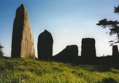
Featured: Ark of Secrets - Neolithic spirit alive in the Middle Ages

Ark of Secrets - Neolithic spirit alive in the Middle Ages

Random Image


Talia's Torque

Circles of Stone - Max Milligan

Circles of Stone - Max Milligan

Who's Online

There are currently, 285 guests and 6 members online.

You are a guest. To join in, please register for free by clicking here

Sponsors

<< Our Photo Pages >> Cashtal-yn-Ard - Chambered Tomb in Channel Islands and Isle of Man in Isle of Man

Submitted by Thorgrim on Saturday, 04 October 2003  Page Views: 16014

Neolithic and Bronze AgeSite Name: Cashtal-yn-Ard Alternative Name: Castle of the Heights
Country: Channel Islands and Isle of Man Island: Isle of Man Type: Chambered Tomb
Nearest Town: Ramsey  Nearest Village: Glen Mona
Map Ref: SC46228923
Map Number: 95
Latitude: 54.275519N  Longitude: 4.363278W
Condition:
5Perfect
4Almost Perfect
3Reasonable but with some damage
2Ruined but still recognisable as an ancient site
1Pretty much destroyed, possibly visible as crop marks
0No data.
-1Completely destroyed
4 Ambience:
5Superb
4Good
3Ordinary
2Not Good
1Awful
0No data.
5 Access:
5Can be driven to, probably with disabled access
4Short walk on a footpath
3Requiring a bit more of a walk
2A long walk
1In the middle of nowhere, a nightmare to find
0No data.
3 Accuracy:
5co-ordinates taken by GPS or official recorded co-ordinates
4co-ordinates scaled from a detailed map
3co-ordinates scaled from a bad map
2co-ordinates of the nearest village
1co-ordinates of the nearest town
0no data
5

Internal Links:
External Links:

Cashtal-yn-Ard
Cashtal-yn-Ard submitted by TimPrevett : A low shot atCashtal yn Ard tomb, 31st July 2014, taking in the flowers and the mountains. Magnificent place. We were here over an hour and had it to ourselves. A very exposed location in hard rain and very lovely in warm sunshine, both of which we had in the time here. (Vote or comment on this photo)
Chambered Tomb in Isle of Man. Cashtal-yn-Ard (The Castle of the Heights) is one of three Manx Neolithic tombs dating from around 2000 BC. It very well preserved and one of the largest of its kind in the British Isles.

It was originally a megalithic chambered cairn holding five chambers and extending for over 130 feet. It was excavated in the 1930's and later in 1999.

Situated on the east coast of the Isle of Man near, Cornaa. There is a footpath to it from Glen Mona.

The Journal of Antiquities also includes an entry for Cashtal-yn-Ard, Near Glen Mona, Isle Of Man, which includes a photograph, directions for finding this site, a description, background information and a list of reference sources for more information.

Also see The Antiquities Journal, Isle of Man, Manx Notebook for a visitor's impression from 1932, including some interesting photographs of the site from this date.
You may be viewing yesterday's version of this page. To see the most up to date information please register for a free account.


Cashtal-yn-Ard
Cashtal-yn-Ard submitted by howe : The monument is a horned chambered cairn 30m long. A deep forecourt of six stones leads to two large portal stones beyond which is a chamber 12m long, divided into five compartments by transverse slabs. Beyond the chamber in the heart of the cairn lay a mound of burnt material, later incorporated in the cairn. The cairn had a kerb of upright slabs describing a trapezoidal shape. Further stones out... (Vote or comment on this photo)

Cashtal-yn-Ard
Cashtal-yn-Ard submitted by howe : View of chamber from the rear (Vote or comment on this photo)

Cashtal-yn-Ard
Cashtal-yn-Ard submitted by howe : The forecourt viewed from the side showing the horned appearance (Vote or comment on this photo)

Cashtal-yn-Ard
Cashtal-yn-Ard submitted by TimPrevett : Cashtal yn Ard tomb, 31st July 2014. Magnificent place. We were here over an hour and had it to ourselves. A very exposed location in hard rain and very lovely in warm sunshine, both of which we had in the time here. (Vote or comment on this photo)

Cashtal-yn-Ard
Cashtal-yn-Ard submitted by Bladup : Cashtal yn Ard chambered cairn with it's amazing forecourt. (Vote or comment on this photo)

Cashtal-yn-Ard
Cashtal-yn-Ard submitted by celticisland : I was brought up on the Isle of Man. I found myself back on the Island in the late 1990s. Feeling I really didn't understand (or like) the modern world, I found myself taking photographs of Celtic Crosses, Angels at Churches, ruins, and ancient sites. That's twice I've typed 'found myself'.. maybe that's what these ancient sites do, help us find ourselves? This photograph received a general art tr... (3 comments)

Cashtal-yn-Ard
Cashtal-yn-Ard submitted by Thorgrim : Cashtal-yn-Ard is a Manx Neolithic tomb dating from around 2000 BC. It was originally a megalithic chambered cairn holding five chambers and extending for over 130 feet. It was excavated in the 1930's and later in 1999. Situated on the east coast of the Isle of Man near, Cornaa. There is a footpath to it from Glen Mona.

Cashtal-yn-Ard
Cashtal-yn-Ard submitted by TimPrevett : From some angles many stone sites can resemble a jumble of stones, which is what I was trying to do here. Cashtal yn Ard tomb, 31st July 2014. Magnificent place. We were here over an hour and had it to ourselves. A very exposed location in hard rain and very lovely in warm sunshine, both of which we had in the time here.

Cashtal-yn-Ard
Cashtal-yn-Ard submitted by ShamrockStone : Cashtal-yn-Ard

Cashtal-yn-Ard Watercolour, Harold Cresswell
Cashtal-yn-Ard Watercolour, Harold Cresswell submitted by cabrio4 : Recently listed on Ebay, re-posted with permission. A fine watercolour of Cashtal yn Ard, the standing stones and burial ground on the Isle of Man. Named and dated by the artist. Harold Cresswell. He is not at all well known, but certainly deserves to be, as his work has a freshness and immediacy which is very appealing. In the 1960s he worked in London and his views of the capital are tremendous... (3 comments)

Cashtal-yn-Ard
Cashtal-yn-Ard submitted by Thorgrim : Cashtal-yn-Ard (The Castle of the Heights) is one of three Manx Neolithic tombs dating from around 2000 BC. (1 comment)

Cashtal-yn-Ard
Cashtal-yn-Ard submitted by TimPrevett : Some of the late summer wild flowers at Cashtal yn Ard tomb, 31st July 2014. Magnificent place. We were here over an hour and had it to ourselves. A very exposed location in hard rain and very lovely in warm sunshine, both of which we had in the time here.

Cashtal-yn-Ard
Cashtal-yn-Ard submitted by TimPrevett : Cashtal yn Ard tomb, 31st July 2014. Magnificent place. We were here over an hour and had it to ourselves. A very exposed location in hard rain and very lovely in warm sunshine, both of which we had in the time here.

Cashtal-yn-Ard
Cashtal-yn-Ard submitted by ShamrockStone : Cashtal-yn-Ard

Cashtal-yn-Ard
Cashtal-yn-Ard submitted by Bladup : Cashtal-yn-Ard.

Cashtal-yn-Ard
Cashtal-yn-Ard submitted by Bladup

Cashtal-yn-Ard
Cashtal-yn-Ard submitted by Bladup

Cashtal-yn-Ard
Cashtal-yn-Ard submitted by Bladup

Cashtal-yn-Ard
Cashtal-yn-Ard submitted by Aerial-Cam : Although the correct evening sunlight conditions are required to see traces of these 5 cup marks, they can be found on the inside of the smaller, left hand stone that forms part of the entrance to the chambers from the fore-court, of Cashtal Yn Ard. There appear to be 4 in an arc with another in the centre of this group roughly forming the point of the arcs radius. Photographed during an Archaeolo...

Cashtal-yn-Ard
Cashtal-yn-Ard submitted by SumDoood : In the modern wall near to the SE corner of the plot. It's a substantial and broad stone the width of which I could not easily assess due to ferocious brambles on the S side of the wall.

Cashtal-yn-Ard
Cashtal-yn-Ard submitted by Bladup : Cashtal-yn-Ard.

Cashtal-yn-Ard
Cashtal-yn-Ard submitted by Bladup

Cashtal-yn-Ard
Cashtal-yn-Ard submitted by Bladup

Cashtal-yn-Ard
Cashtal-yn-Ard submitted by Bladup : The forecourt at Cashtal-yn-Ard.

These are just the first 25 photos of Cashtal-yn-Ard. If you log in with a free user account you will be able to see our entire collection.

Do not use the above information on other web sites or publications without permission of the contributor.
Click here to see more info for this site

Nearby sites

Click here to view sites on an interactive map of the area

Key: Red: member's photo, Blue: 3rd party photo, Yellow: other image, Green: no photo - please go there and take one, Grey: site destroyed

Download sites to:
KML (Google Earth)
GPX (GPS waypoints)
CSV (Garmin/Navman)
CSV (Excel)

To unlock full downloads you need to sign up as a Contributory Member. Otherwise downloads are limited to 50 sites.


Turn off the page maps and other distractions

Nearby sites listing. In the following links * = Image available
 1.8km ENE 58° Ballagory Horned Cairn* Cairn (SC47759012)
 3.7km SSW 194° Spiral stone (Ballaragh)* Rock Art (SC4520085670)
 4.2km NW 309° Glen Auldyn Cist* Cist (SC4392)
 4.3km NE 49° St Maughold's Well Holy Well or Sacred Spring (SC49619193)
 4.6km NNW 345° Killeaba Mound* Natural Stone / Erratic / Other Natural Feature
 5.4km SSW 204° King Orry's Grave* Chambered Tomb (SC43898439)
 7.5km NNW 333° Cronk Aust Cist* Cist (SC4396)
 8.5km SSW 201° Cloven Stones* Chambered Tomb (SC42928141)
 8.5km WNW 303° Cronk Sumark* Vitrified Fort (SC392941)
 9.1km WNW 287° Oaie ny Foawr (Sulby) Round Barrow(s) (SC376922)
 10.4km SSW 198° Lonan Church Crosses Ancient Cross (SC42737937)
 10.5km SSW 198° Glebe Well (Lonan Church) Holy Well or Sacred Spring (SC42577937)
 10.7km W 260° Druidale* Ancient Village or Settlement (SC356878)
 12.0km N 352° Thor Cross, Bride* Ancient Cross (NX449012)
 12.7km SSW 207° St Peter's Church (Onchan) Ancient Cross (SC40057814)
 13.3km WNW 286° Magher ny Clogh Mooar* Standing Stone (Menhir) (SC335933)
 13.7km SSW 212° White Lady Stone* Standing Stone (Menhir) (SC38597783)
 13.7km WNW 296° Runic Cross (Ballaugh Old Church)* Ancient Cross
 14.4km WNW 301° Ballateare Viking burial mound Round Barrow(s)
 14.5km WNW 285° Orrisdale* Cairn (SC323935)
 14.5km NW 308° Kirk Patrick Burial Mound Artificial Mound (SC350985)
 14.9km W 269° Cronk Guckley mounds* Round Barrow(s) (SC31238945)
 15.5km SSW 210° Manx Museum* Museum
 15.7km W 268° Michael Standing Stone and rock art* Standing Stone (Menhir) (SC30468908)
 15.8km SW 233° Keill Vreeshey (Crosby) Sculptured Stone (SC332802)
View more nearby sites and additional images

<< Dennis Knoll

Eyam Moor II >>

Please add your thoughts on this site

Neolithic Britain And Ireland

Neolithic Britain And Ireland

Sponsors

Auto-Translation (Google)

Translate from English into:

"Cashtal-yn-Ard" | Login/Create an Account | 2 News and Comments
  
Go back to top of page    Comments are owned by the poster. We aren't responsible for their content.
Re: Cashtal-yn-Ard by ShamrockStone on Monday, 30 March 2015
(User Info | Send a Message)
Coordinates are: 54.275480N, 4.363300W (taken by GPS) [Updated]
[ Reply to This ]

Re: Cashtal-yn-Ard by glen on Monday, 02 July 2007
(User Info | Send a Message)
There is a natural agglomeration of white quartz at the top of the larger entrance-stone on the right, - you'd pass right under it to squeeze through into the first chamber. There's something similar at the entrance to King Orrey's Grave too, and white quartz pebbles are still used to decorate parts of the much later keills on Man.
Cashtal-yn-Ard is aligned to a valley-notch to the west horizon.
Over the field wall a few yards to the south is a copse of trees visible from Cornaa beach, which seems to obliterate a circle of slabs - perhaps a scattered cyst? or round barrow with fallen stones? seems to be no legal access....
[ Reply to This ]

Your Name: Anonymous [ Register Now ]
Subject:


Add your comment or contribution to this page. Spam or offensive posts are deleted immediately, don't even bother

<<< What is five plus one as a number? (Please type the answer to this question in the little box on the left)
You can also embed videos and other things. For Youtube please copy and paste the 'embed code'.
For Google Street View please include Street View in the text.
Create a web link like this: <a href="https://www.megalithic.co.uk">This is a link</a>  

Allowed HTML is:
<p> <b> <i> <a> <img> <em> <br> <strong> <blockquote> <tt> <li> <ol> <ul> <object> <param> <embed> <iframe>

We would like to know more about this location. Please feel free to add a brief description and any relevant information in your own language.
Wir möchten mehr über diese Stätte erfahren. Bitte zögern Sie nicht, eine kurze Beschreibung und relevante Informationen in Deutsch hinzuzufügen.
Nous aimerions en savoir encore un peu sur les lieux. S'il vous plaît n'hesitez pas à ajouter une courte description et tous les renseignements pertinents dans votre propre langue.
Quisieramos informarnos un poco más de las lugares. No dude en añadir una breve descripción y otros datos relevantes en su propio idioma.