


<< Our Photo Pages >> Mumbles Erratic - Natural Stone / Erratic / Other Natural Feature in Wales in West Glamorgan
Submitted by Andy B on Friday, 11 February 2022 Page Views: 3337
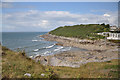
Natural PlacesSite Name: Mumbles Erratic Alternative Name: Limeslade Bay erratic, Purported Stonehenge-style Bluestone (Unspotted Dolerite)?Country: Wales County: West Glamorgan Type: Natural Stone / Erratic / Other Natural Feature
Nearest Village: Mumbles
Map Ref: SS6241986997
Latitude: 51.565017N Longitude: 3.986323W
Condition:
| 5 | Perfect |
| 4 | Almost Perfect |
| 3 | Reasonable but with some damage |
| 2 | Ruined but still recognisable as an ancient site |
| 1 | Pretty much destroyed, possibly visible as crop marks |
| 0 | No data. |
| -1 | Completely destroyed |
| 5 | Superb |
| 4 | Good |
| 3 | Ordinary |
| 2 | Not Good |
| 1 | Awful |
| 0 | No data. |
| 5 | Can be driven to, probably with disabled access |
| 4 | Short walk on a footpath |
| 3 | Requiring a bit more of a walk |
| 2 | A long walk |
| 1 | In the middle of nowhere, a nightmare to find |
| 0 | No data. |
| 5 | co-ordinates taken by GPS or official recorded co-ordinates |
| 4 | co-ordinates scaled from a detailed map |
| 3 | co-ordinates scaled from a bad map |
| 2 | co-ordinates of the nearest village |
| 1 | co-ordinates of the nearest town |
| 0 | no data |
Internal Links:
External Links:
")
Phil wanders this coast very frequently, and says he looked at this erratic several times, on a number of visits, before realising that it was is different indeed from the Carboniferous Limestone bedrock. He was attracted by both the colouring of the rock, and its texture, and realised that it was very similar to a dolerite rock sample he collected many years ago from Foel Eryr, near the western end of Mynydd Preseli.
He took some high definition photos, and asked me to take a look. I was fairly convinced that he was right in assuming the greenish rock to be unspotted dolerite. He also asked Dr Katie Preece, an igneous rock specialist working at the Swansea University Geography Dept, to take a look, and on the basis of visual inspection she confirmed the rock as dolerite or micro-gabbro. It was similar to the Foel Eryr sample, but the crystal sizes were different. Whether that proves significant, time will tell. Further work is in the pipeline, so watch this space.
Last Sunday afternoon there was a low tide, and the weather was dry and calm - so I hopped into the car and drove over to The Mumbles at high speed. Phil and I took a good look at the giant erratic and at some of the nearby coastal exposures. I became even more convinced that the erratic was made of unspotted greenish dolerite, and we compared the boulder surface with a number of unspotted dolerite samples that I just happened to have in my rucksack. In close-up my garden sample looks a bit greener, and the giant erratic looks a bit bluer - but that may be a trick of the light.
Brian John continues: The presence of this erratic (if it identifies as we propose) shows that the glacial transport of the Stonehenge bluestones was not just possible but - to me - probable. Archaeologists and some geologists have previously assumed that it would have been "impossible" for glacier ice to transport large boulders, pillars and slabs of dolerite from North Pembrokeshire, or anywhere else, up the Bristol Channel towards Somerset and Stonehenge.
Many smaller dolerite erratics are known from Gower and other parts of South Wales, but there have been no discoveries to compare with the "giant erratics" that are known from the coasts of Devon and Cornwall. Phil’s very exciting discovery demonstrates that the glacier did indeed transport large blocks of rock south-eastwards from their source areas. There must be other erratics of this size awaiting discovery along the South Wales coast, but unfortunately most of them are likely to be located under the murky waters of the Bristol Channel."
This discovery should force the archaeologists to ask themselves how reliable their evidence really is for the huge narrative they have built around the bluestones, involving quarries, mighty haulage expeditions and lost circles.
But I'm not getting over-excited. This is just the start of a long journey, and clearly samples from this boulder will need to be subjected to a whole range of analytical techniques before we can be sure what the provenance really is.
Brian has more on his blog.
SAFETY NOTE: The boulder is in a very dangerous position around mid-tide mark, and great care is needed especially when the rocks are wet and slippery.
Note: Further updates since this was first announced, more on our page
You may be viewing yesterday's version of this page. To see the most up to date information please register for a free account.
")
")
")
Do not use the above information on other web sites or publications without permission of the contributor.
Nearby Images from Geograph Britain and Ireland:
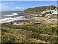
©2019(licence)
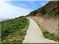
©2019(licence)
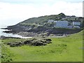
©2018(licence)
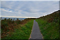
©2017(licence)
©2010(licence)
The above images may not be of the site on this page, they are loaded from Geograph.
Please Submit an Image of this site or go out and take one for us!
Click here to see more info for this site
Nearby sites
Key: Red: member's photo, Blue: 3rd party photo, Yellow: other image, Green: no photo - please go there and take one, Grey: site destroyed
Download sites to:
KML (Google Earth)
GPX (GPS waypoints)
CSV (Garmin/Navman)
CSV (Excel)
To unlock full downloads you need to sign up as a Contributory Member. Otherwise downloads are limited to 50 sites.
Turn off the page maps and other distractions
Nearby sites listing. In the following links * = Image available
509m N 8° Mumbles Hill Cave Cave or Rock Shelter (SS625875)
1.6km WNW 283° Rother's Tor Cave Cave or Rock Shelter (SS609874)
3.6km WNW 283° Caswell Bay Cave Cave or Rock Shelter (SS589879)
3.6km WNW 291° St Peters's Well* Holy Well or Sacred Spring (SS59048837)
3.7km W 277° Caswell Cliff Fort* Hillfort (SS58808756)
5.3km WNW 295° Kittle Hill Cave or Rock Shelter (SS577894)
5.6km W 277° Bishopston Valley* Hillfort (SS569878)
5.7km N 4° Swansea Gorsedd Circle* Modern Stone Circle etc (SS6296392660)
5.7km W 264° High Pennard* Hillfort (SS567866)
6.3km W 267° Bacon Hole* Cave or Rock Shelter (SS561868)
6.6km NW 305° Bishopston Burch Cairn (SS571909)
6.6km W 268° Crow Hole Cave or Rock Shelter (SS558869)
6.9km W 267° Minchin Hole Cave or Rock Shelter (SS555868)
7.5km WNW 288° Trinity Well, Ilston* Holy Well or Sacred Spring (SS55308946)
7.7km W 271° Ravencliffe Cave* Cave or Rock Shelter (SS547873)
7.8km N 359° Cockett Standing Stone Standing Stone (Menhir) (SS6253194791)
8.4km WNW 284° Gower Heritage centre* Museum (SS543892)
8.7km W 278° Pennard Pill Promontory Fort / Cliff Castle (SS53828851)
9.1km WNW 287° Parc le Breos* Chambered Tomb (SS53738984)
9.1km WNW 288° Cat Hole Cave* Cave or Rock Shelter (SS53779002)
9.2km WNW 287° Church Hill Earthwork* Misc. Earthwork (SS53628987)
9.3km W 279° North Hills Lane Barrow Cemetary Barrow Cemetery (SS53248863)
9.3km W 275° Penmaen Burrows* Chambered Tomb (SS53168812)
9.4km W 273° Leather's Hole Cave or Rock Shelter (SS530877)
10.1km WNW 291° Tooth Cave* Cave or Rock Shelter (SS531909)
View more nearby sites and additional images


 We would like to know more about this location. Please feel free to add a brief description and any relevant information in your own language.
 Wir möchten mehr über diese Stätte erfahren. Bitte zögern Sie nicht, eine kurze Beschreibung und relevante Informationen in Deutsch hinzuzufügen.
 Nous aimerions en savoir encore un peu sur les lieux. S'il vous plaît n'hesitez pas à ajouter une courte description et tous les renseignements pertinents dans votre propre langue.
 Quisieramos informarnos un poco más de las lugares. No dude en añadir una breve descripción y otros datos relevantes en su propio idioma.