
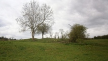

<< Our Photo Pages >> Abergairn Castle Ruins - Stone Fort or Dun in Scotland in Aberdeenshire
Submitted by TheDruid-3X3 on Friday, 14 August 2020 Page Views: 1970
Medieval (High and Late)Site Name: Abergairn Castle Ruins Alternative Name: Gairn CastleCountry: Scotland County: Aberdeenshire Type: Stone Fort or Dun
Nearest Town: Ballater, Scotland Nearest Village: Bridge Of Gairn
Map Ref: NO35869741
Latitude: 57.063248N Longitude: 3.059259W
Condition:
| 5 | Perfect |
| 4 | Almost Perfect |
| 3 | Reasonable but with some damage |
| 2 | Ruined but still recognisable as an ancient site |
| 1 | Pretty much destroyed, possibly visible as crop marks |
| 0 | No data. |
| -1 | Completely destroyed |
| 5 | Superb |
| 4 | Good |
| 3 | Ordinary |
| 2 | Not Good |
| 1 | Awful |
| 0 | No data. |
| 5 | Can be driven to, probably with disabled access |
| 4 | Short walk on a footpath |
| 3 | Requiring a bit more of a walk |
| 2 | A long walk |
| 1 | In the middle of nowhere, a nightmare to find |
| 0 | No data. |
| 5 | co-ordinates taken by GPS or official recorded co-ordinates |
| 4 | co-ordinates scaled from a detailed map |
| 3 | co-ordinates scaled from a bad map |
| 2 | co-ordinates of the nearest village |
| 1 | co-ordinates of the nearest town |
| 0 | no data |
Internal Links:
External Links:
")
More photos on Flickr
You may be viewing yesterday's version of this page. To see the most up to date information please register for a free account.
")
")
Do not use the above information on other web sites or publications without permission of the contributor.
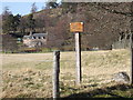
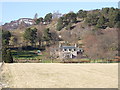
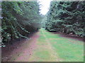
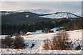
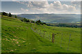
Nearby Images from Geograph Britain and Ireland:
©2007(licence)
©2007(licence)
©2020(licence)
©2014(licence)
©2008(licence)
The above images may not be of the site on this page, they are loaded from Geograph.
Please Submit an Image of this site or go out and take one for us!
Click here to see more info for this site
Nearby sites
Key: Red: member's photo, Blue: 3rd party photo, Yellow: other image, Green: no photo - please go there and take one, Grey: site destroyed
Download sites to:
KML (Google Earth)
GPX (GPS waypoints)
CSV (Garmin/Navman)
CSV (Excel)
To unlock full downloads you need to sign up as a Contributory Member. Otherwise downloads are limited to 50 sites.
Turn off the page maps and other distractions
Nearby sites listing. In the following links * = Image available
2.5km S 183° Scurriestone* Standing Stone (Menhir) (NO357949)
3.1km E 87° Tullich* Class I Pictish Symbol Stone (NO390975)
3.4km E 89° Braehead Farm* Souterrain (Fogou, Earth House) (NO393974)
6.0km WSW 257° Ballater-St.Manire* Standing Stone (Menhir) (NO300962)
8.5km ENE 73° Loch Kinord Cross Slab* Class III Pictish Cross Slab (NO44009978)
8.6km E 80° Kinord earth house* Souterrain (Fogou, Earth House) (NO444988)
8.7km ENE 75° Loch Kinord Crannog* Crannog (NO443995)
8.7km ENE 70° Old Kinord Ancient Village or Settlement (NJ441002)
8.9km NE 40° Milton of Whitehouse* Souterrain (Fogou, Earth House) (NJ417042)
9.0km ENE 71° Hut Circles at Old Kinord* Ancient Village or Settlement (NJ444002)
9.8km ENE 72° Monandavan Ring Cairn (NJ453003)
10.3km NNE 30° Blue Cairn Circle* Stone Circle (NJ411063)
10.9km ENE 75° Knockenzie Ancient Village or Settlement (NJ465000)
12.2km NE 39° Migvie Stone* Class II Pictish Symbol Stone (NJ4364706823)
12.2km NE 39° Migvie Cupmarked Stone* Rock Art (NJ4369606817)
12.4km ENE 73° Balnacraig Cairn Aberdeenshire Chambered Cairn (NJ47830082)
12.6km NE 54° Corrachree* Class I Pictish Symbol Stone (NJ46160470)
12.7km E 84° Ferrar Ancient Village or Settlement (NO485986)
12.7km NE 42° Milton of Migvie* Souterrain (Fogou, Earth House) (NJ44600668)
12.8km NE 34° Tillypronie 1 Class I Pictish Symbol Stone (NJ432079)
12.9km NE 34° Tillypronie 2 Class I Pictish Symbol Stone (NJ43250796)
12.9km NE 50° Logie Coldstone Stone Circle (NJ459055)
13.5km ENE 76° Blue Cairn (Cairn)* Cairn (NJ49070059)
13.6km NE 54° Melgum Centre* Stone Circle (NJ471052)
13.7km NE 54° Melgum NW Stone Circle (NJ471053)
View more nearby sites and additional images


 We would like to know more about this location. Please feel free to add a brief description and any relevant information in your own language.
 Wir möchten mehr über diese Stätte erfahren. Bitte zögern Sie nicht, eine kurze Beschreibung und relevante Informationen in Deutsch hinzuzufügen.
 Nous aimerions en savoir encore un peu sur les lieux. S'il vous plaît n'hesitez pas à ajouter une courte description et tous les renseignements pertinents dans votre propre langue.
 Quisieramos informarnos un poco más de las lugares. No dude en añadir una breve descripción y otros datos relevantes en su propio idioma.